CIVIC PRECINCT PUBLIC DOMAIN PLAN
DRAFT REPORT
CONTENTS
- 1 Introduction
- 1.1 Project Overview
- 1.2 Study Area
- 1.3 Public Domain Strategies
- 2 Site Context & Analysis
- 2.1 Regional Context
- 2.2 Local Context
- 2.3 Strategic Planning Context
- 2.4 Site Analysis Summary
- 3 Key Opportunities
- 3.1 Street Typologies
- 3.2 Natural Environment
- 3.3 Vehicle Access And Movement
- 3.4 Pedestrian And Cycle Movement
- 3.5 Heritage And Built Character
- 4 Public Domain
- 4.1 Street Design Typologies
- 4.2 Overall Public Domain Plan
- 4.3 King Street
- 4.4 Hunter Street
- 4.5 Workshop Way
- 4.6 Union Street
- 4.7 Auckland Street
- 4.8 Darby Street
- 4.9 Merewether Street
- 5 Parks & Plazas
- 5.1 Wheeler Place
- 5.1.1 Key Moves
- 5.1.2 Concept Plan
- 5.1.3 Precedent Images
- 5.1.4 Perspective A - Day
- 5.1.5 Perspective A - Night
- 5.1.6 Perspective B - Day
- 5.1.7 Perspective B - Night
- 5.2 Christie Park
- 5.2.1 Key Moves
- 5.2.2 Concept Plan
- 5.2.3 Precedent Images
- 5.2.4 Perspective C
- 5.3 Civic Park
- 5.3.1 Key Moves
- 5.3.2 Concept Plan
- 5.3.3 Precedent Images - Entry Statement
- 5.3.4 Precedent Images - Picnic Area
- 5.3.5 Precedent Images - Activating Corner Of Darby St & Laman St
- 5.3.6 Precedent Images - Amenities Block
- 5.3.7 Perspective D - Darby St Entry
- 5.3.8 Perspective E - Amenities Block
- 5.3.9 Perspective F - Memorial Grove
- 5.3.10 Perspective G - War Memorial Tree Avenue

Australia
China
South East Asia
Follow us on


|
Report title |
Civic Precinct Public Domain Plan |
|
Document number |
231001 |
|
Prepared for |
City of Newcastle |
|
Authors |
SA, MH |
|
Revision number |
02 |
|
Revision issue date |
MARCH 2025 |
|
Approved |
TF, LI |
|
Reason for revision |
FOR REVIEW |
|
Cover page image |
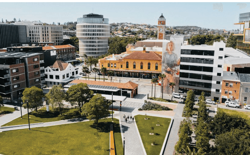
Museum Park, artwork by Fintan Magee Source: www.visitnewcastle.com.au |
Disclaimer: This report has been prepared in accordance with the scope of services described in the contract or agreement between Place Design Group Pty Ltd ACN 082 370063 and the Client. The report relies upon data, surveys, measurements and results taken at or under the particular times and conditions specified herein. Any findings, conclusions or recommendations only apply to the aforementioned circumstances and no greater reliance should be assumed or drawn by the Client. Furthermore, the report has been prepared solely for use by the Client and Place Design Group accepts no responsibility for its use by other parties
ACKNOWLEDGMENT OF COUNTRY
In the spirit of reconciliation, Place Design Group acknowledges the Awabakal and Worimi peoples, the traditional custodians of the land of this project.
We pay our respect to all Aboriginal peoples living in or visiting the City of Newcastle. We extend this respect to First Nations throughout Australia, past, present and future. Acknowledging their resilience, cultural heritage and continuing connection to land, waters, sky and community.
It is internationally recognised that First Nations peoples have managed land and waterways as living entities since time immemorial. As designers, we accept the responsibility of being custodians of the land and strive to design spaces which celebrate and unite individuals from all walks of life.
1 INTRODUCTION
Figure ii. University of Newcastle, Source: Place Design Group
1.1 project overview
project background
The Civic Precinct is a key destination point for Newcastle containing the city’s core civic and cultural attractions and a growing university presence. Whilst there have been a number of major projects recently completed in the precinct which have helped to shape the character, including the most recent renewal of Hunter Street in association with the Newcastle Light Rail Project. The Civic Public Domain Plan (PDP) remains a catalyst project for supporting the vision set out in the City Centre Revitalisation Framework which is focused on promoting Newcastle towards becoming one of the most welcoming cities in Australia. The framework provides for
‘‘Wide multi-modal and tree lined streets, connections to parks, harbour and beaches, including major facilities representative of a regional capital’’
City Centre Revitalisation Framework, 2010
The overall direction is to deliver a great community environment, that people will love to live, visit, play and work in the inner city.
PROJECT OVERVIEW
The scope of the project is to produce concept design for the public domain within the Civic Precinct site area. The project will focus on integrating key City of Newcastle strategic policies and guidelines to guide the shape, character and connectivity throughout the precinct, with logical connections to neighbouring public domain plans.
Furthermore it will explore opportunities to support and celebrate the significance of the Civic Precinct as the City’s key destination for Art, Culture and Heritage,
‘‘Strengthening the precincts significance as the main civic, educational and cultural hub of Newcastle and promoting specific physical improvements and linkages between Civic Park, Wheeler Place and the harbour’’
City Centre Public Domain Manual, 2014
The Civic PDP will strengthen future pedestrian north south links from Civic Park to Honeysuckle and further activate this area to create vibrant public spaces, lanes and through-site links. This will improve way finding and pedestrian friendly connections in the precinct and support a vibrant, attractive, inviting public domain outcome that draws on its local context to reinforce the precincts distinctive role and character.
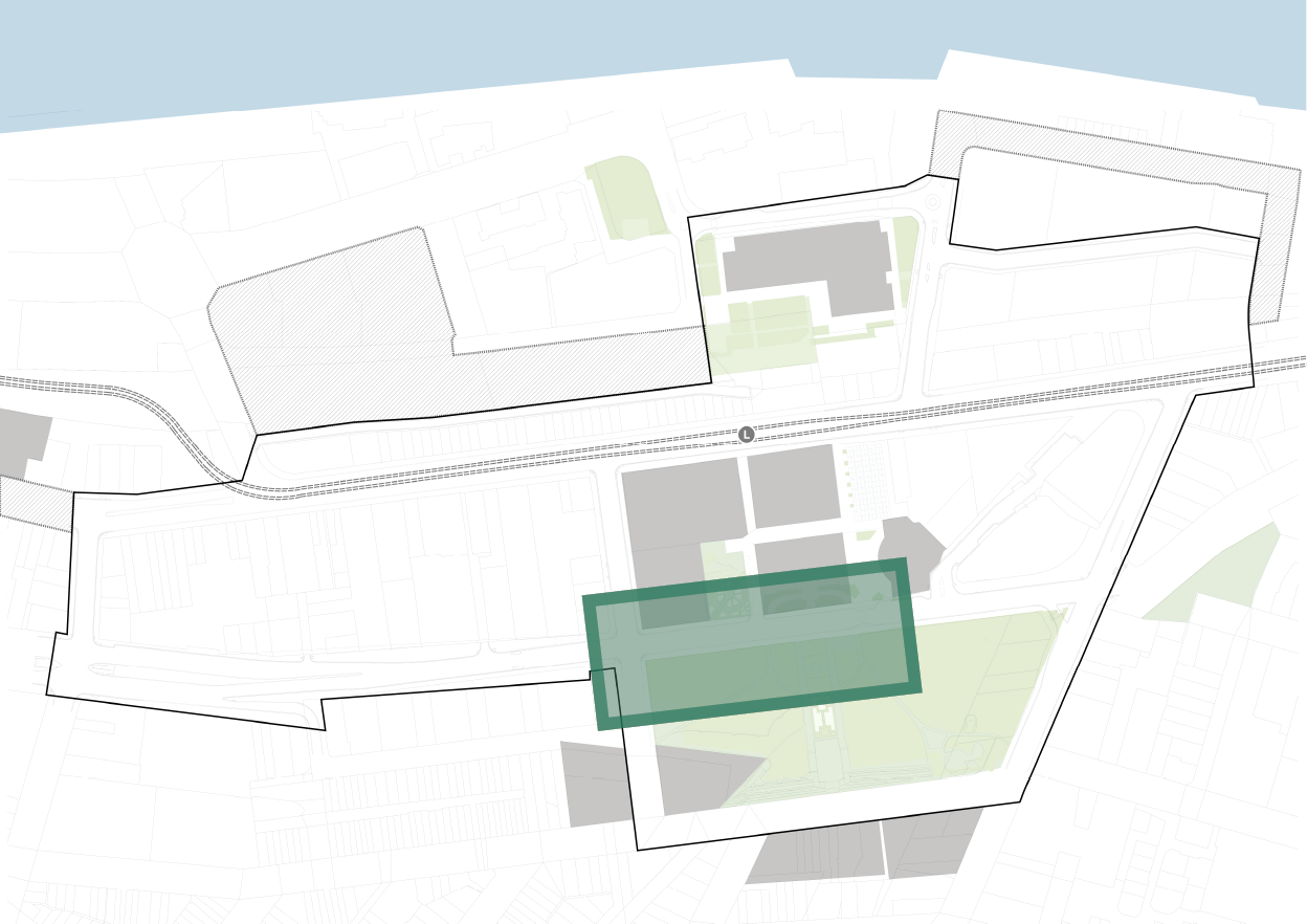
STUDY AREA
The Civic Precinct is bounded by Union Street in the west, King Street and Civic Park to the south, Darby Street to the East. The northern boundary follows an indirect line between Centenary Road, Workshop Way and Civic Lane. The site is approximately 15.6 ha in size.
Purpose Of the CIVIC PRECINCT PUBLIC DOMAIN PLAN (PDP)
The PDP has been commissioned by Newcastle City Council to provide a framework for public domain improvements. It will set out important requirements and recommendations for public space and street design for all professionals engaged in the facilitation, design, approvals and implementation of the public realm. It is a companion document to the City Centre Public Domain Technical Manual which set out the mandatory technical and documentation requirements for all civil, landscape and infrastructure works occurring in the public realm.
There is a high volume of commercial and private development occurring in the Civic Precinct with more forecast to occur in the coming years. The PDP will guide development through a clear and comprehensive approach to the streetscape resulting in a better outcome for the public domain, and co-ordinating requirements to offset future City of Newcastle works to private developers.
PROJECT OBJECTIVES
1. Diversity of use
- Provide a range of public spaces and streets upgrade to support the needs of current and future populations at various times of the day and night and throughout the year.
- Create a diverse choice of experiences, activities, and journeys.
- Provide opportunities for outdoor dining, small business stands and the like.
2. design excellence
- Achieve design excellence and pursue design innovations to optimise the success of the project purpose and objectives.
- Create vibrant and active streets, open spaces and community facilities.
3. movement and place
- Look at the balance of vehicular movements and the facilitation of active transport (walking and cycling), and
- The creation of meaningful spaces that are integrated into the cultural fabric of the precinct. Works to consider the Transport for NSW Movement and Place Framework.
4. heritage
- Recognise and commemorate the rich Indigenous within the public domain throughout the Civic Precinct as outlined by the Aboriginal Heritage Management Report (2018-2021)
- Recognise and protect views & vistas of valued heritage items throughout the precinct, such as the historic relationships between Newcastle City Hall, Civic Park, Wheeler Place & Christie Place
- Prioritising Country at the ‘centre’ of design considerations as aligned to ‘Design with Country’ prinicples.
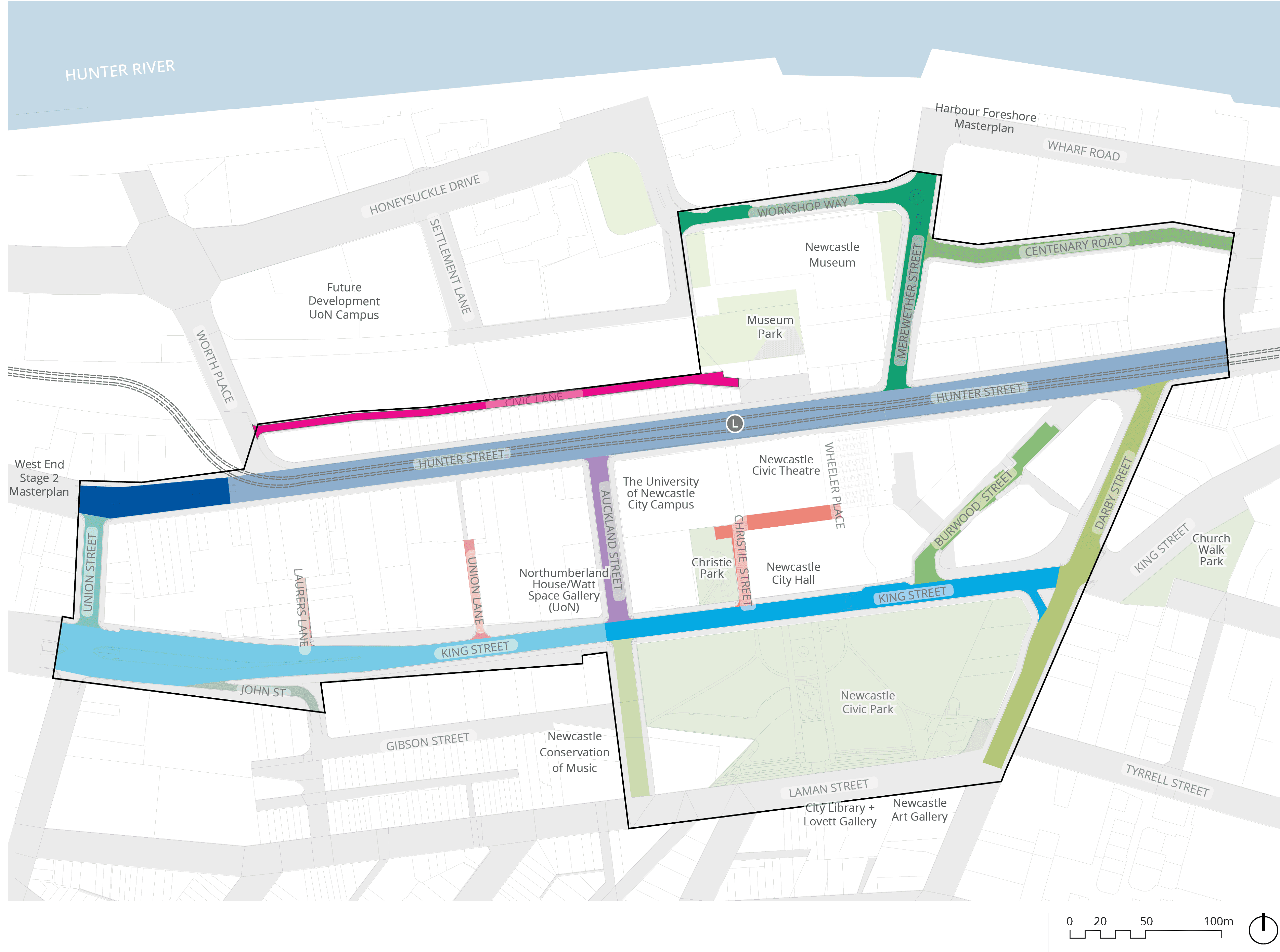
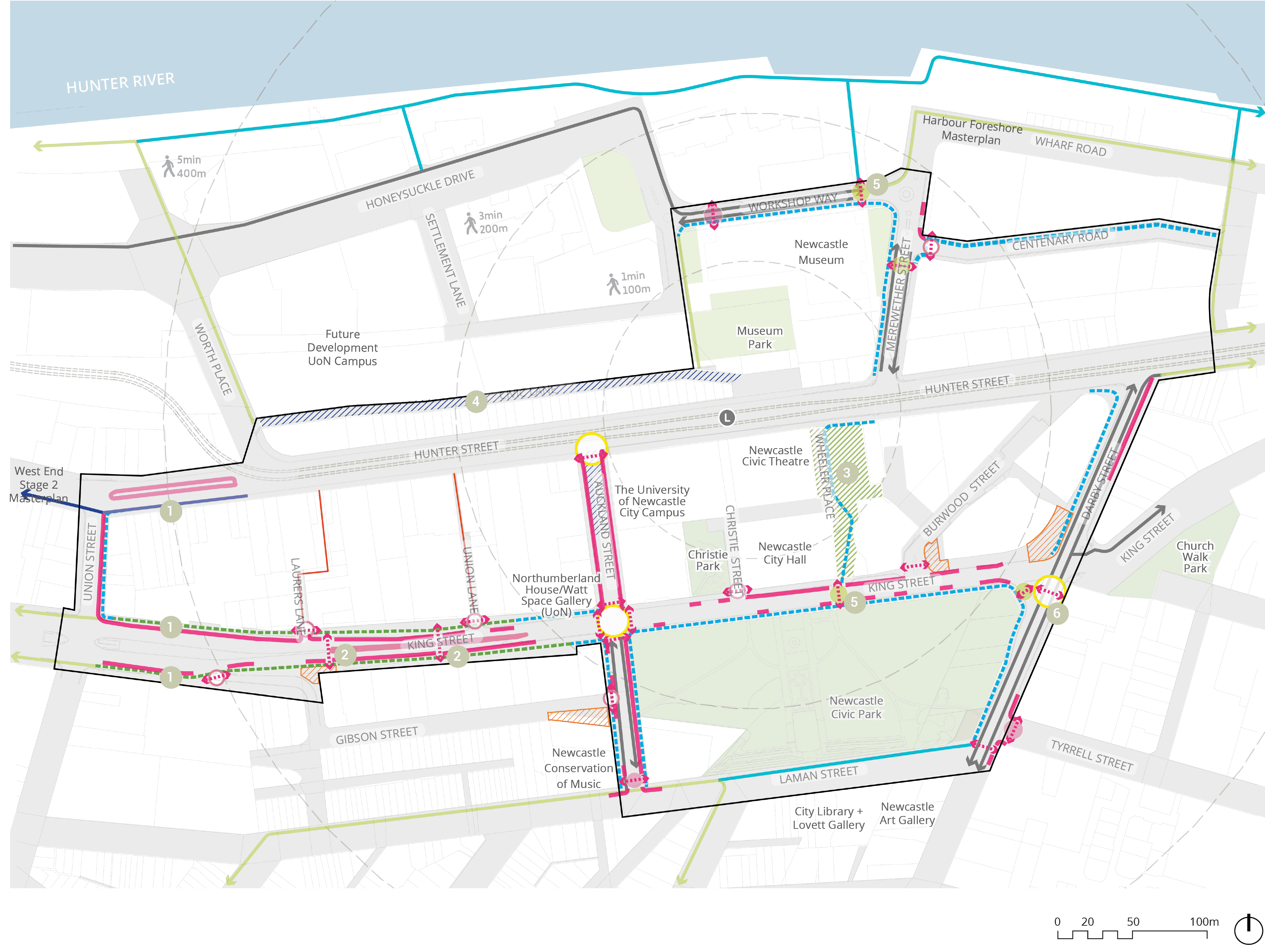
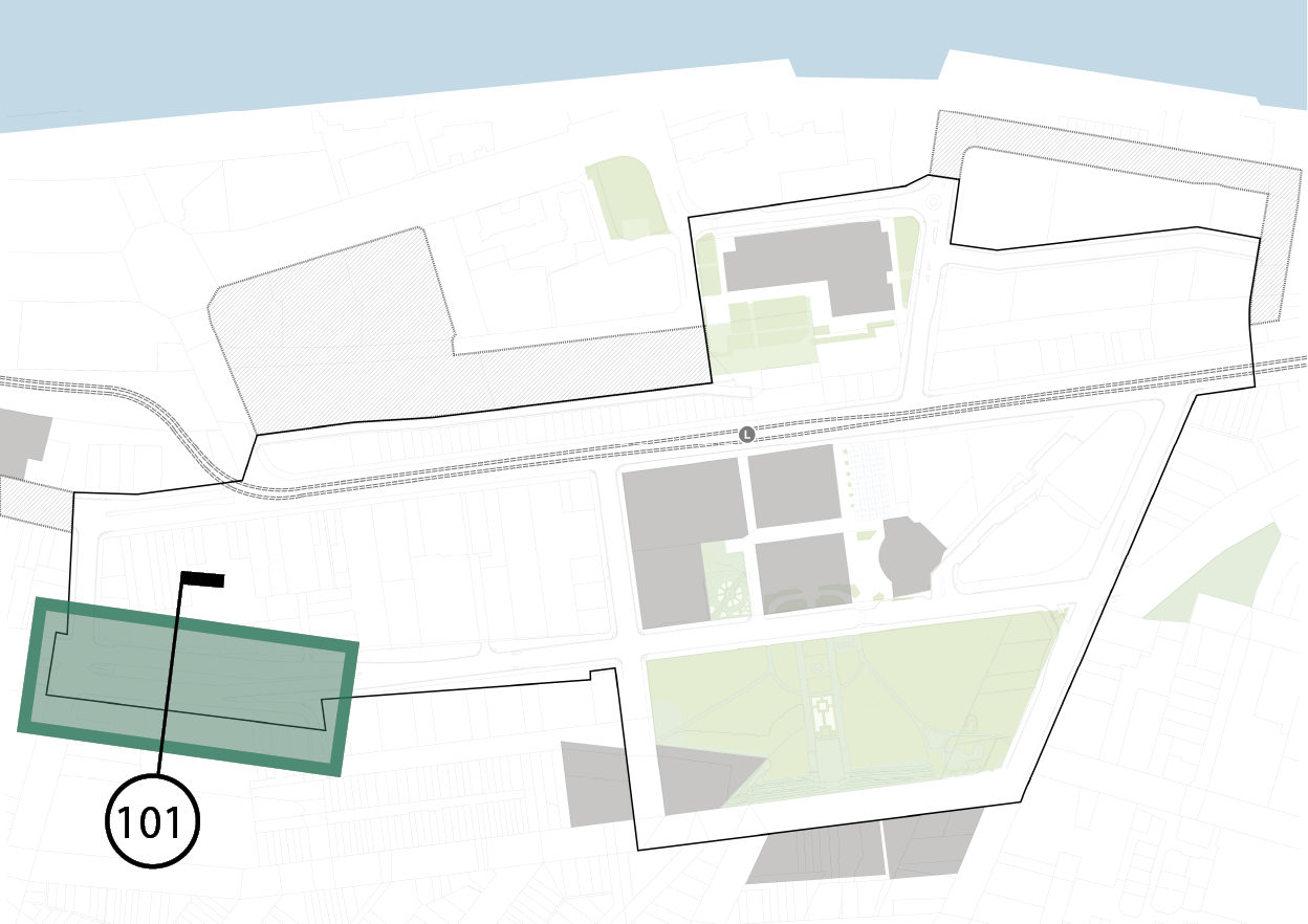
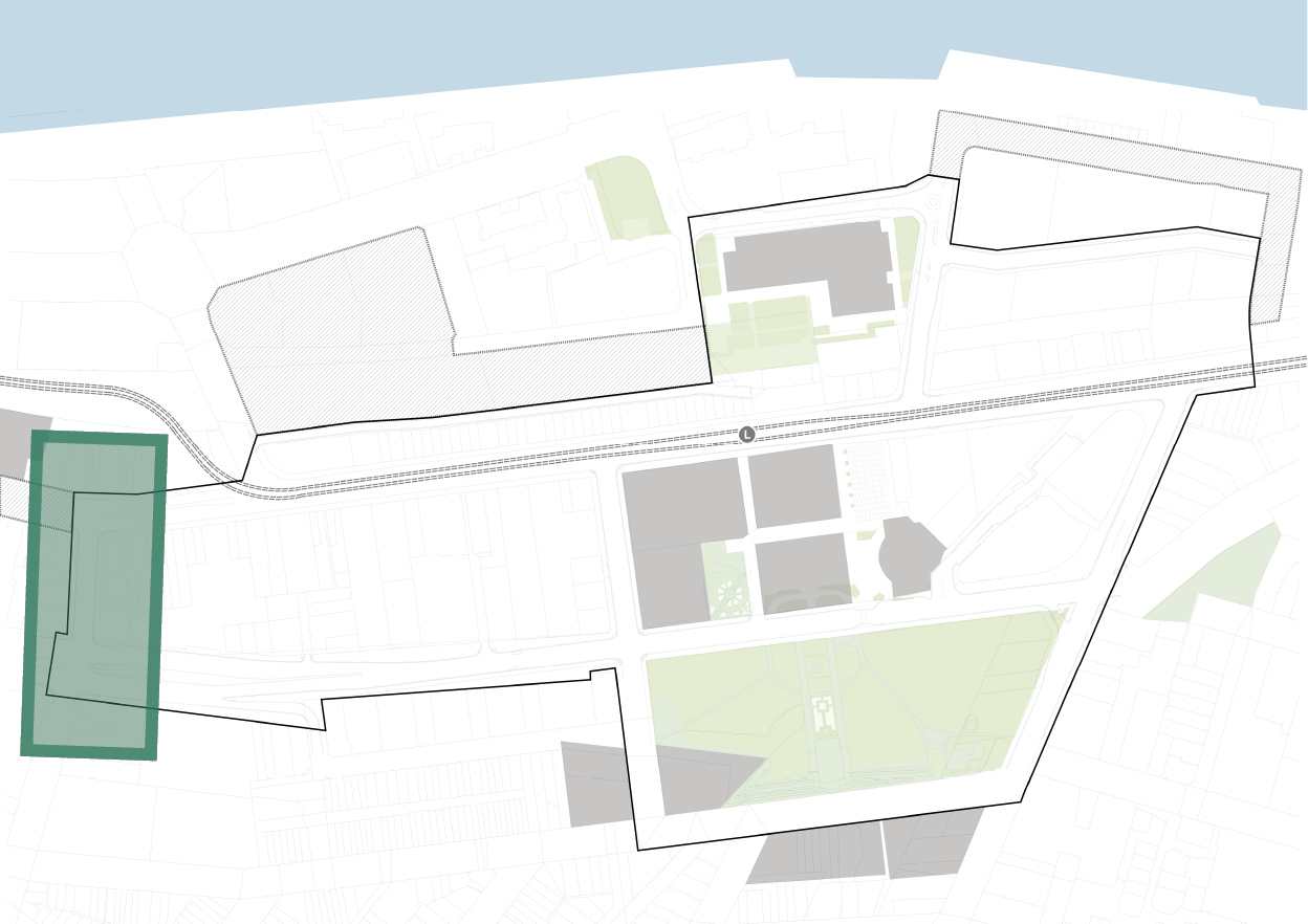
1.2 STUDY AREA
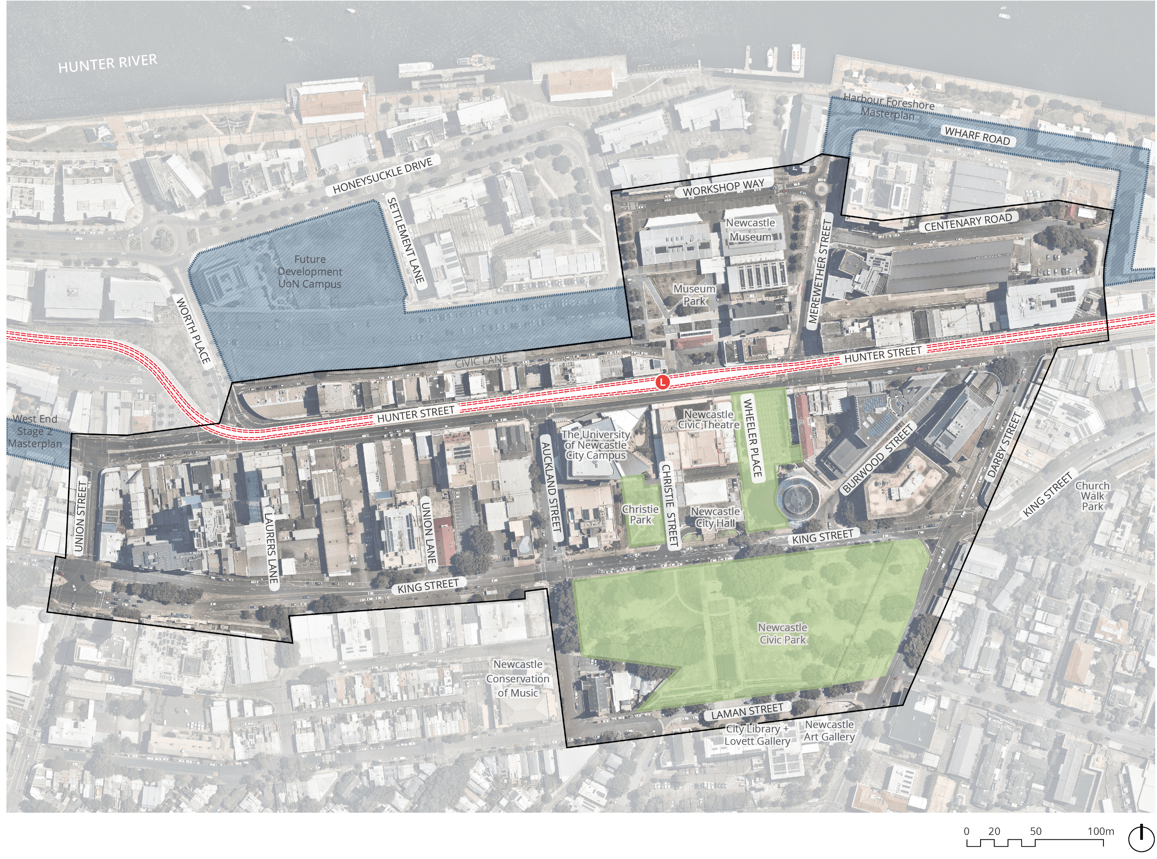
Long text alternative
A map of an area of Newcastle, south of Hunter River within Union Street, Laman Street and Darby Street, highlighting the Study Area and other types of spaces.
The Study Area is outlined with a black solid line. From the corner of Union Street and Hunter Street, it goes south along the west of Union Street, then turns east along south of King Street, then turns south along west of Auckland Street, then turns east along south of Laman Street, then turns north along east of Darby Street, crosses Hunter Street, then turns west along north of Centenary Road, then turns north along east of Merewether Street, then turns west along north of Workshop Way, then turns south along west of Honeysuckle Drive, then turns west along north of Civic lane, crosses Worth Place and the Light rail, and goes along north of Hunter Street, connecting back to the corner of Union Street and Hunter Street.
The Light rail line is highlighted in red, which goes along Hunter Street. The Light rail station is marked, which is north of the Newcastle Civic Theatre.
Three areas are highlighted in blue for recent or future development. (1) An area of Hunter Street that is west of Union Street is labelled ‘West End Stage 2 Masterplan’. (2) An area between Worth Place in the west, Honeysuckle Drive in the north, Settlement Lane in the east and Civic Lane in the south is labelled ‘Future Development UoN Campus’. (3) An area of Wharf Road north of Merewether Street is labelled Harbour Foreshore Masterplan.
Three areas are highlighted in green for Open spaces to be updated as part of this project. (1) An area on the west corner of Christie Street and King Street is labelled Christie Park. (2) An area between King Street and Hunter Street east of Newcastle Civic Theatre and Newcastle City Hall is labelled Wheeler Place. (3) An area between King Street in the north, Auckland Street in the west, Laman Street in the south and Darby Street in the east is labelled Newcastle Civic Park.
Legend
|
|
Study area |
|
|
Light rail line |
|
|
Light rail station |
|
|
Recent/ future development |
|
|
Open spaces to be updated as part of this project |


Figure iii. Project Overview Source: Place Design Group
1.3 PUBLIC DOMAIN STRATEGIES
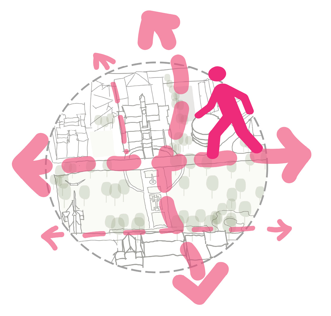
1 PRIORITISE PEDESTRIANS
Improve wayfinding and create pedestrian friendly connections. Particularly strengthening north south linkages from Civic Park to Honeysuckle.
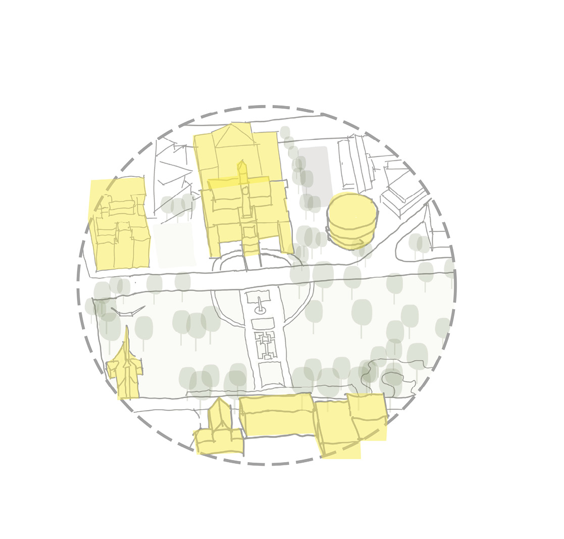
2 REINFORCE PRECINCT AS CULTURAL AND ARTS HUB
Maintain flexible programming and to support temporary activation of streets during events.
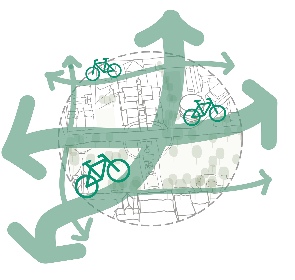
3 INTEGRATE ACTIVE TRANSPORT NETWORK
Provide a well connected active transport network which links to Newcastle’s broader transport system.
1.3 PUBLIC DOMAIN STRATEGIES
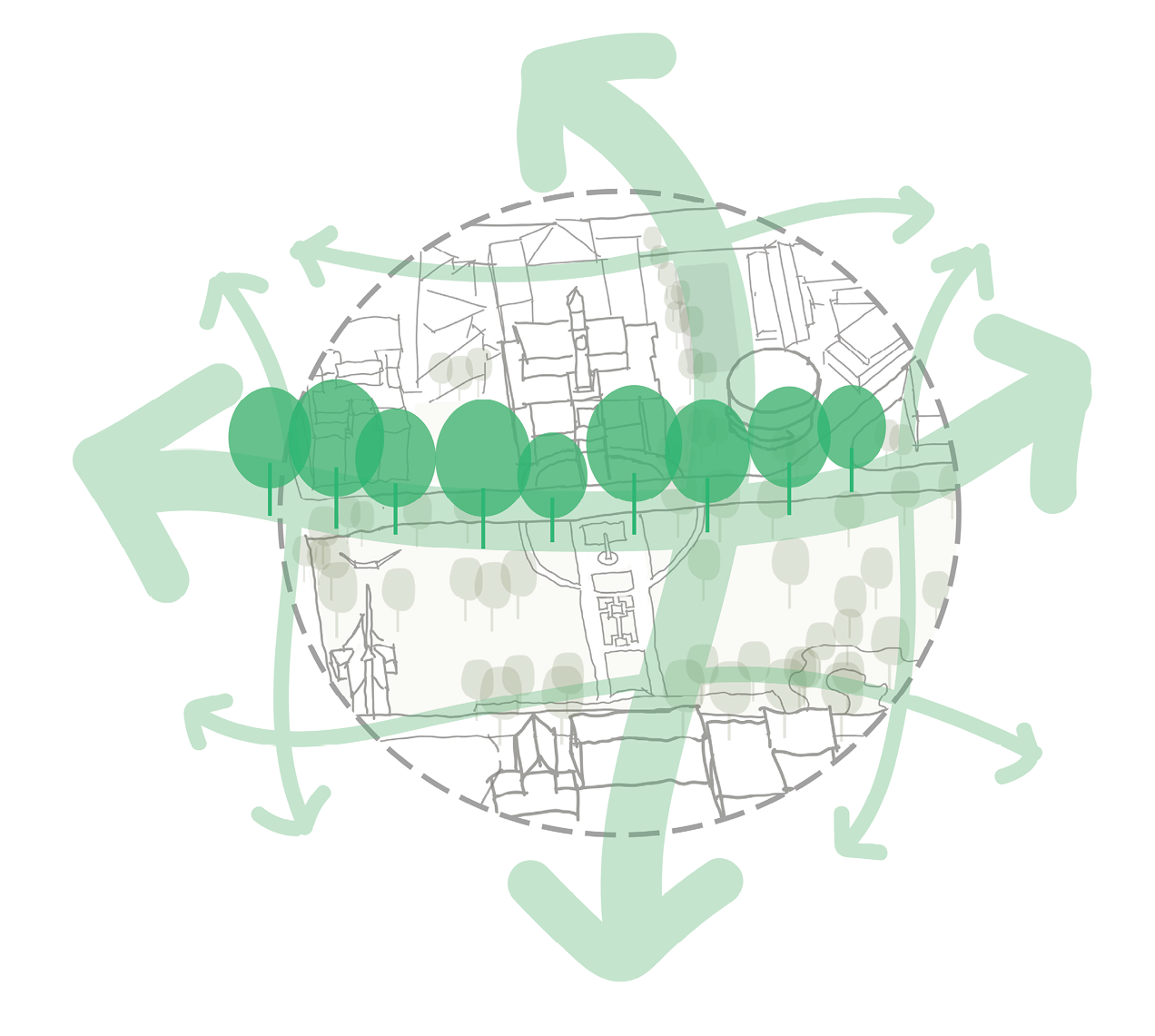
4 the PUBLIC DOMAIN
Maximise planting and street tree planting opportunities to increase canopy coverage and mitigate urban heat island effect.
5 CELEBRATE and enhance site HERITAGE
Enhancing sight-lines to iconic historic buildings and monuments throughout the precinct. Seek opportunities to sensitively and creatively express past uses in the built form of the public domain.
6 INTRODUCE ENVIRONMENTAL STRATEGIES
Identify infrastructure upgrade requirements and WSUD opportunities to mitigate catchment wide flooding and provide positive environmental outcomes.
2 SITE CONTEXT & ANALYSIS

Figure iv. University of Newcastle, Source: Place Design Group
2.1 REGIONAL CONTEXT
CITY CENTRE PRECINcTS
The Civic Precinct study area identified as part of this project, sits within a larger Civic Precinct area as identified in the City Centre Development Control Plan, 2014. The precinct sits between two other City Centre Precincts - East End and West End Precincts, each of which require place-specific outcomes to reinforce their distinctive character.
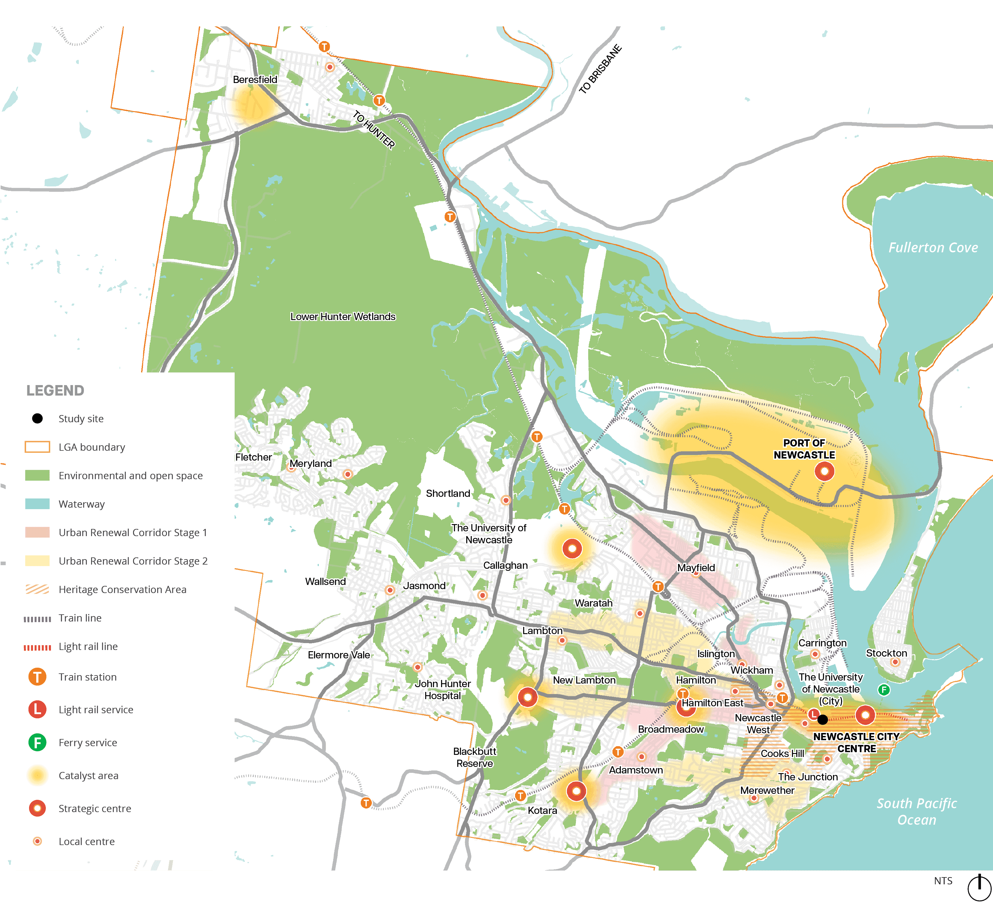
Long text alternative
A map that outlines a part of Newcastle and marks various areas. Environment and open spaces are highlighted in green, and Waterways are highlighted in blue. Train lines are in a grey dotted line and Light rail lines are in a red dotted line.
A boundary is outlined in a solid orange line and is labelled as ‘LGA boundary’ in the legend. It goes around west of Lower Hunter Wetlands, west and south of Elermore Vale, west of Blackbutt Reserve, south of Kotara, along of the coast of the South Pacific Ocean, around Fullerton Cove, north of Port of Newcastle and around Beresfield.
Some areas are covered in red highlight to indicate ‘Urban Renewal Corridor Stage 1’. These areas cover Mayfield, Wickham, Hamilton East, Broadmeadow and Adamstown.
Some areas are covered in light yellow highlight to indicate ‘Urban Renewal Corridor Stage 2’. These areas cover an area between Waratah, Lambton and Hamilton, an area south of New Lambton, and an area between The Junction, Merewether and Adamstown.
Some areas are covered in light orange lines to indicate ‘Heritage Conservation Area’. These areas cover areas around Hamilton East, Newcastle West, Cooks Hill and the Newcastle City Centre.
Some spots area highlighted in yellow to indicate a ‘Catalyst area’, and an orange circle to indicate a ‘Strategic centre’. These spots include The Port of Newcastle, an area north of Waratah, a spot southwest of New Lambton, a spot northeast of Kotara and southwest of Adamstown, a spot between Hamilton, Hamilton East and Broadmeadow and a spot in the Newcastle City Centre.
A black spot is in the Newcastle City Centre which indicates the ‘Study site’.
Various spots scattered on the map are marked with a small orange dot to indicate a Local centre.
Figure viii. Regional Context Source: Place Design Group
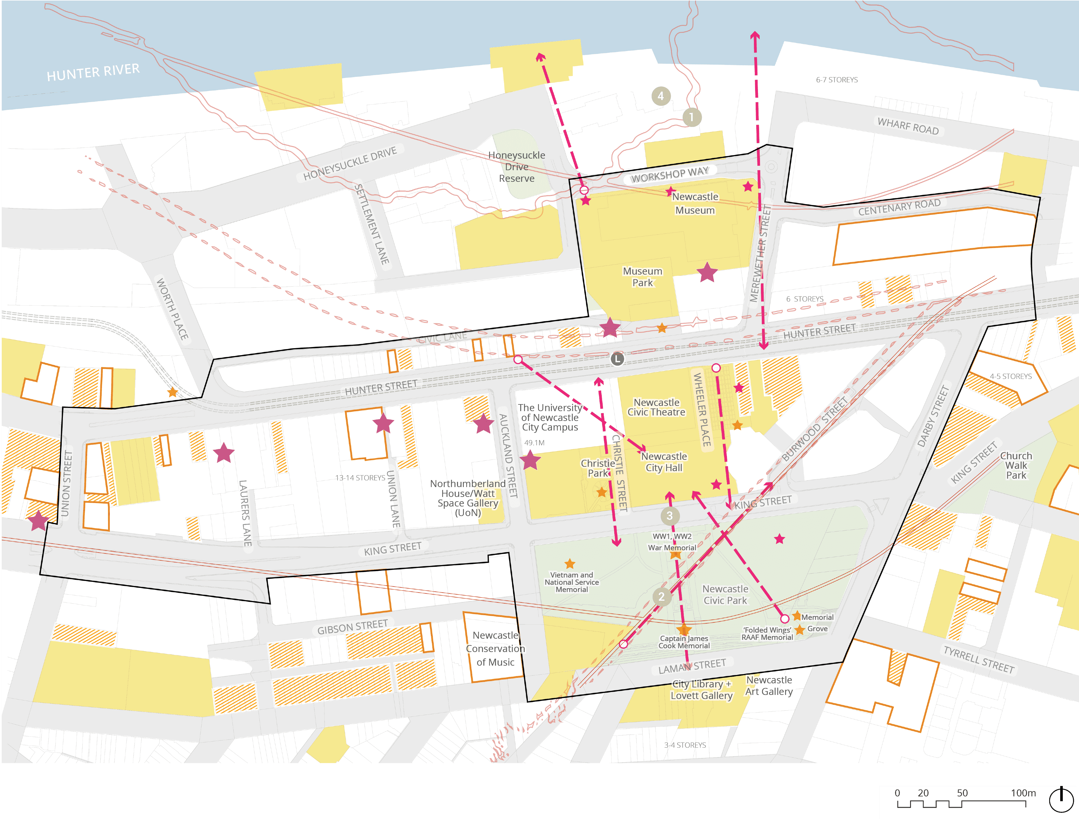
2.2 LOCAL CONTEXT
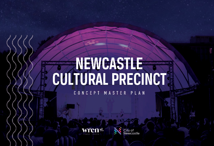
NEWCASTLE CULTURAL PRECINCT
The Newcastle Cultural Precinct Concept Masterplan (NCPCM) defines a precinct area for Newcastle’s Civic cultural institutions and the streets and public spaces that connect them, for cultural and economic development and protection of heritage within the area. In parallel, the Hunter Street Revitalisation Masterplan (HSRM) identifies actions to achieve tangible “on the ground” outcomes in order to deliver a community inspired vision for a revitalised Hunter Street.
Both documents recognise that the heart of city centre is defined by Hunter Street. The NCPCM explores how Greater Newcastle may be revitalised in becoming a nationally significant platform for arts, culture, festivals and expression. Its states that urban renewal will be catalyised by...
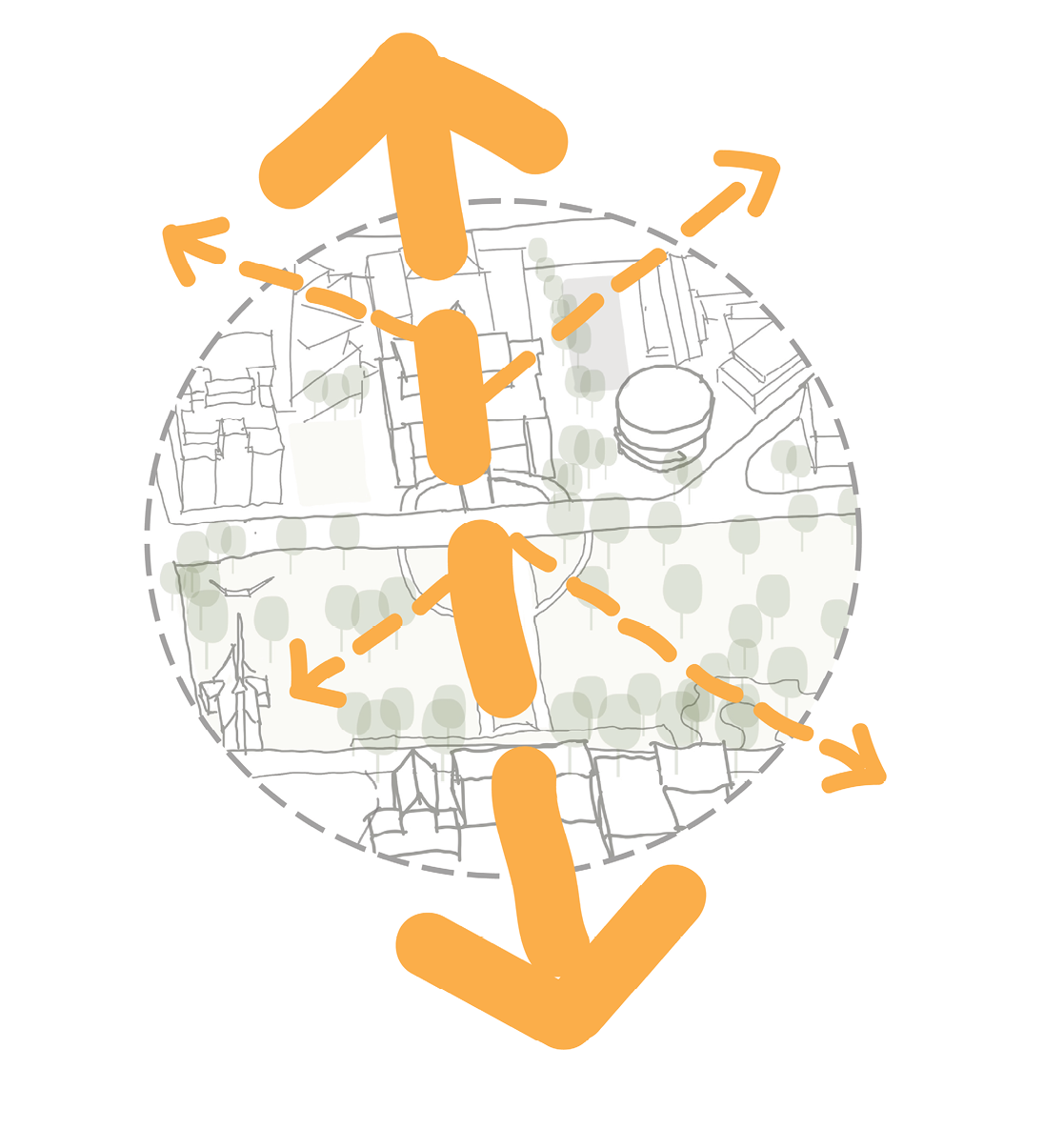
Unifying the strengths and ambitions of existing cultural institutions, and then connecting these institutions along corridors of complementary economic activity (a north-south axis and an east-west axis).
The North-South Activity Corridor flows from the harbourfront, where Honeysuckle Drive turns right, across Workshop Way, through existing green space, across the light rail stop (Civic).
The NCPCM identifies five big moves, four of which apply directly to the Civic Precinct. They are:
- Create an ‘Academic Corridor’ to knit the Cultural Precinct and University of Newcastle’s City Campus helping to integrate the Cultural Precinct with the University’s City Campus
- Create a legible east-west journey through public art, lighting and way finding strengthening the corridor between Perkins and Auckland Streets via King
- Exploring opportunities to expand and enhance Museum Park to create a unique interface between the Museum and City Campus and improve north-south permeability between Wheeler Place and the harbour and enable performance and events to more easily ‘plug and play’
- Activate Wheeler Place with seasonal and/or semi permanent tenancies and as part of a larger ‘performing arts Centre’ that includes City Hall, Civic Theatre and Civic Playhouse.
- Invite the community to identify new cultural infrastructure for the Boat Harbour site.
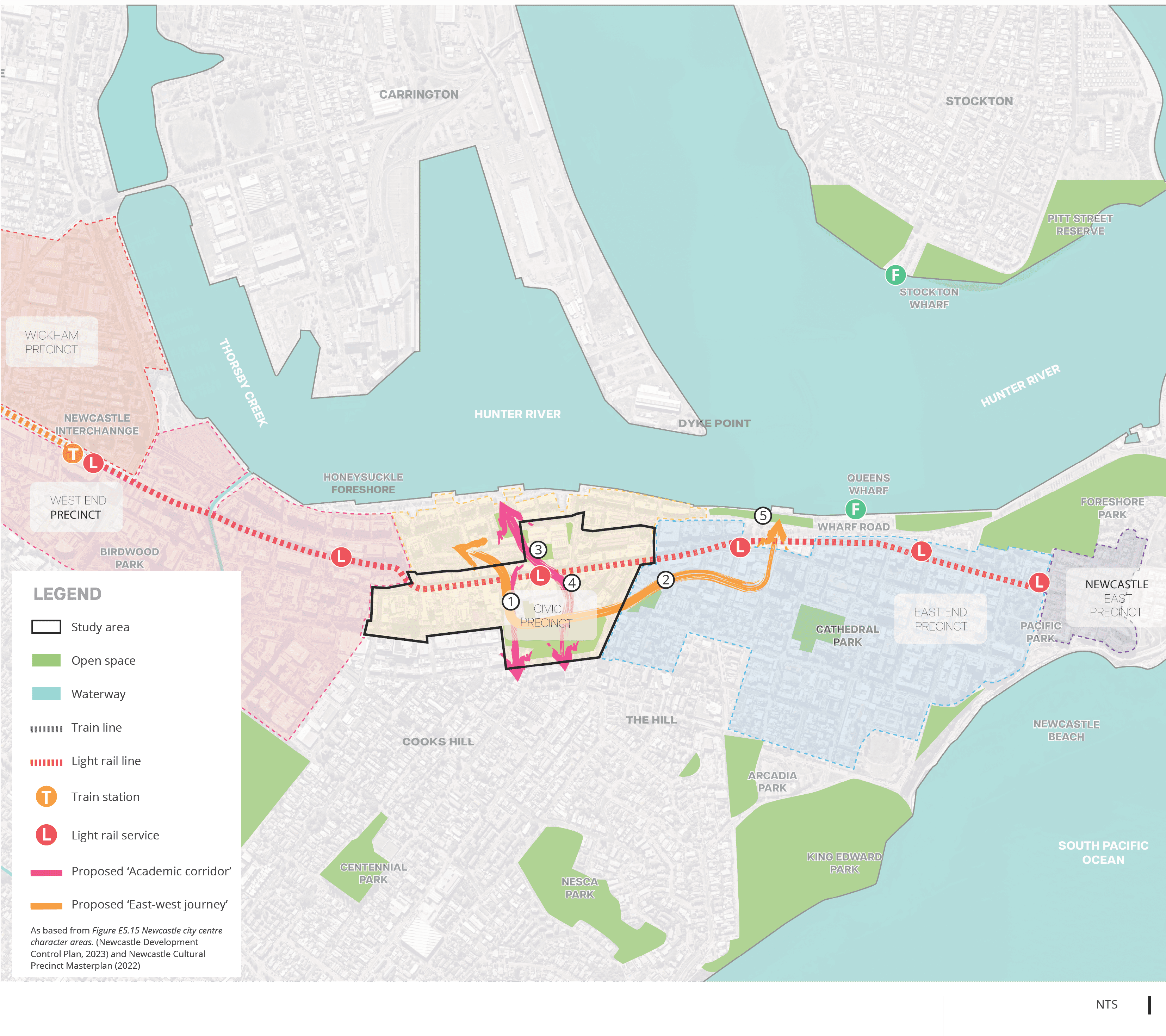
Long text alternative
A map of the Study area highlighted within the wider context of Newcastle. Other areas showing around the Study area are Hunter River, which is north of the Study area, the West End Precinct (including Birdwood Park) and Wickham Precinct, which are west of the Study area, the East End Precinct (including Cathedral Park) and Newcastle East Precinct, which are east of the Study area.
There are 5 areas labelled from 1 to 5 which are associated with the five big moves described in the accompanying text. 1 is in the middle of the Study area. 2 is outside, east of the study area within the East End Precinct. 3 is slightly northeast of 1, north of the Light rail service. 4 is slightly southeast of 3 and east of 1, south of the Light rail line. 5 is outside, east of the study area, north of the East End Precinct and south of Hunter River.
Two pink arrows are drawn within the Study area indicating the ‘Proposed Academic corridor’. One arrow goes from the middle of the Study area and points south of it. Another two-way arrow points both north and south of the Study area and is slightly east of the middle of the Study area.
An orange, two-way arrow is drawn from outside, north of the middle of the Study area. It goes south into the Study area and then east to outside the Study area into the East End Precinct. It then points north of the East End Precinct towards the Hunter River.
Figure ix. Local Context Source: Place Design Group
2.3 STRATEGIC PLANNING CONTEXT
RELATED DOCUMENTS
An extensive range of documents have been reviewed and analysed to understand the strategic planning context of the Civic Precinct and the key objectives and priorities that have been developed to date, and to draw on the extensive thought and knowledge gathered through previous studies within the precinct. These documents encapsulate the key social, cultural, environmental, political, economic drivers that are shaping the revitalisation of Newcastle City Centre and the Civic Precinct. Civic Precinct PDP is already identified as a catalyst for is the Hunter Street Revitalisation Strategic Framework (HSRSF) which was endorsed by Council 2010. The NSW State Government’s document, Newcastle Renewal Strategy (NURS) 2014, stated that a public domain plan should be completed for this important catalyst site.
A comprehensive list of Councils strategies, plans, guidelines and community engagement summaries formed part of the desktop analysis. The key government, strategies, plans and master planning studies include the following.
- Hunter Street Revitalisation Strategic Framework, 2010
- Practitioners Guide to Movement and Place, 2020
- Greater Newcastle Metropolitan Plan, 2036
- Newcastle, 2040
- Local Social Strategy, 2030
- On Our Bikes Cycling Plan, 2021-2030
- On the Street Parking Plan, 2021-2030
- Newcastle Draft Social Infrastructure Strategy, 2022
- Disability Inclusion Action Plan, 2022
- Heritage Strategy, 2020
- Local Strategic Planning Statement, 2021
- Economic Development Strategy, 2021
- Aboriginal Heritage Management Strategy, 2018
- Newcastle After Dark 2018-2022, 2018
- Connecting Newcastle - Our urban renewal vision, 2016 Smart City Strategy 2017
- Civic Park Conservation Management Plan, 2016
- Social Strategy, 2016
- Newcastle Transport Strategy, 2014
- Newcastle Environmental Management Strategy, 2013
- Newcastle City-wide Floodplain Risk Management Study and Plan, 2012
- Newcastle City Hall Conservation Management Plan, 2008
nsw government strategies
The Hunter Regional Plan sets a vision that Greater Newcastle is to become Australia’s emerging economic and lifestyle city. This is achieved through the work of this PDP, to support in the revitalisation of Newcastle City Centre.
The Greater Newcastle Metropolitan Plan states the key opportunity for the Civic Precinct is to reinforce the cultural axis from Civic Park to the Waterfront. Thus, this have become a guiding principle throughout this PDP.
The Connecting with Country Framework has been a guide on how to take a Country-centred approach through the formation and design of the public domain within the Civic Precinct.
This document explains how collaboration on strategies, plans and projects across all stages of design and delivery is vital to achieve a better built environment. Informing how this PDP can maximise its role in providing guidance in the delivery of future projects.

Provides clear objects to achieve good design in and effective design processes for the built environment, informing the rigorous design development within this PDP.
Design tools and best practise for cycleways which have been applied and tailored to the Civic Precinct.
supporting documents and master plans
The production of this PDP is also direct outcome of the actions set by this framework. It also highlights key opportunities within the Civic Precinct, including the priority of creating a major North-South green spine via Auckland Street & Wheeler Place to connect Civic Park to the Waterfront.
This plan provides clear guidance on how to manage development of the City Hall so that heritage significance is conserved and enhanced.
The CMP for Civic Park manages future work and changes to the site to ensure continued conservation of it’s heritage value.
The PDP develops concurrently to the Harbour Foreshore Masterplan, its important to ensure the proposals are coordinated and aligned in principles.
Provides city-wide direction on flood management initiatives to be integrated into the design of the public domain.
A framework for long-term protection of City’s cultural institutions and advises the impact of activating the public domain in contributing to the social fabric, liveability and local character within the precinct.
A set of guidelines, specifications and material palettes for all public domain works in the City Centre to promote a cohesive character and sense of identity for the city.
Newcastle council strategies and principles

The PDP directly supports a number of the priorities set out by the LSPS, including, 1. Prioritising active transport, 4. Green our neighbourhoods and 11. Protect and celebrate our heritage.

Outlines the shared community vision, that Newcastle is to be a liveable, sustainable and inclusive global city. The PDP also shares Newcastle City’s commitment to this vision .
Strategic vision for a connected city. This document has lead the key objectives for the Hunter Street Revitalisation Strategic Framework and Newcastle Urban Renewal Strategy and in turn, the direction of this PDP.
The Heritage Strategy has driven the PDP’s approach to the management of heritage matters. One measure includes: Ensuring consistent and sympathetic uses, physical and aesthetic treatments and outstanding interpretations.

This PDP has adopted the actions set out by this Strategy to ensure the proposal respects Aboriginal Heritage.
Newcastle Transport Strategy is to guide Council’s transport related decisions and actions to achieving the objectives of the Newcastle Community Strategic Plan.
This document nominates existing and proposed cycle connections to build an overall cycle network throughout the LGA of Newcastle. The PDP works to plug into this proposed network.
This document is a guide for parking management to improve amenity of streets. The PDP enables the implementation of the plan to encourage the mode shift to active and public transport.

The Economic Development Strategy highlights the impact of precinct activation and improved amenity towards economic success and high quality of life. The PDP aims to deliver high-value public domain to support economic opportunities.

This report outlines the major opportunities in the Civic Precinct relating to improving pedestrian connections, and leveraging off the big activity generators like the Theatre and University.

The PDP supports the Smart City Strategy in the development and delivery infrastructure to enable integration of future transport modes, prioritising walking and cycling.
.png)
The Social Strategy reinforces the importance of providing linked networks of shared paths and public places that provide diverse activity, along with a built environment that maintains and enhances Newcastle’s sense of identity.

The Local Social Strategy shares a framework on how to achieve the vision of a socially just and inclusive place for all. It advises the PDP on how supporting public spaces can encourage an active, healthy and social lifestyle.
The Draft Social Infrastructure Strategy particularly informs the PDP in how public facilities, public parks and open spaces may work harder to be multipurpose in their use.
This plan advises the PDP on the importance of providing opportunities for people of all ages, ability levels and backgrounds to engage fully in civic, economic and social life.
The PDP looks to implement initiatives to support Newcastle’s commitment to build resilience to Climate change and prioritise nature-based solutions.
2.4 SITE ANALYSIS SUMMARY
Refer to associated document ‘Civic Precinct Public Domain Plan - Site Analysis Report’ for comprehensive site analysis of study area.
ENVIRONMENT
- While there are several established, significant and healthy trees to be retained and protected, overall there is a lack of sufficient street trees and shade cover to mitigate heat island effects
- Overall, the streetscape lacks bio-diversity plantings and native endemic species
- Open spaces offer little shade amenity, bio-diverse planting and richness in ecological habitat
- Different street and verge widths limit potential for street tree planting throughout the precinct
- Overhead and underground services, street and traffic signs and awnings limit tree planting potential
- Number of underutilised open space areas largely due to lack of amenity, aging infrastructure and issues with legibility
- Civic Park requires significant hardstand surfaces and minimum 20-30m diameter spaces to cater for existing and future temporary large events, markets and ceremonial services
pedestrian movement & access
- High traffic speed and volumes of King and Hunter Street impact pedestrian/cycle safety
- Limited pedestrian crossings along King Street limit north-south connection
- Existing path widths don’t provide sufficient capacity for pedestrians and cyclists
- Incomplete pedestrian links at signalised crossing on corner of Darby Street and King Street
- Limited legibility and wayfinding between Civic Park, harbour and key civic spaces and places
- High traffic volumes on Hunter Street results in bikes, scooters, skateboarders utilising footpaths causing conflicts with pedestrians
VEHICLE movement & access
- Existing bus shelters are limited in associated infrastructure and signage
- Existing road hierarchy of main and local streets to be enhanced
- Bus parking for event times on King Street along Civic Park to be retained
- Existing loading zones, accessible parking, taxi zones to be retained
2.4 SITE ANALYSIS
cycleways
- On road bike paths along Auckland Street, Union Street, Darby Road, Hunter Street, Workshop Way and Merewether Street are fragmented
- Limited safety and efficiency of overall cycle network
- Overall disconnect to regional cycle network
- Lack of dedicated and separated cycle connections
STORMWATER & FLOODING
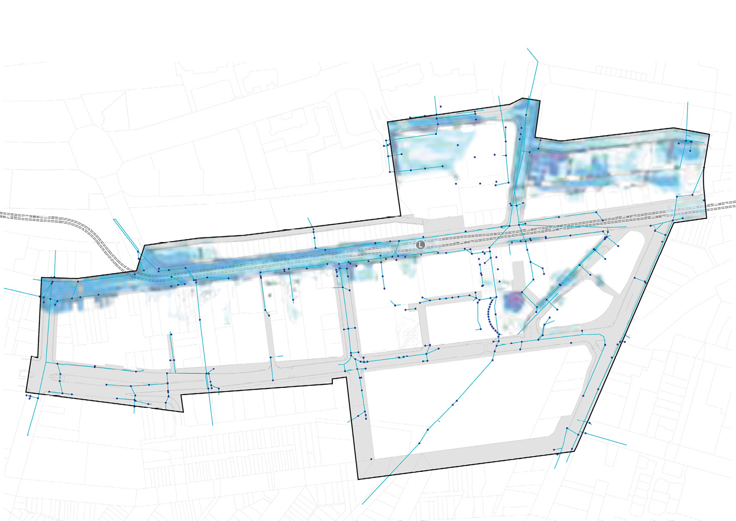
- Existing drainage currently inadequate to manage stormwater flows
- Several areas in the precinct experience flooding notably Hunter Street west, Merewether Street, Workshop Way and Centenary Road
HERITAGE & CHARACTER
- Key physical and visual axis, movement corridors linking Civic to the harbour are underutilised
- Existing memorials and plaques are dispersed across the parkland in an unstructured manner devaluing their significance and resulting in visual clutter within the open space areas
- Formal structure planting of the park has been eroded over time with the addition of unplanned plantings in the park
- Rich heritage and distinctive character to be enhanced and strengthened through the treatment of the public domain i.e Opportunity for interpretation of the historic rail line route and shoreline edge pre-colonisation
3 KEY OPPORTUNITIES
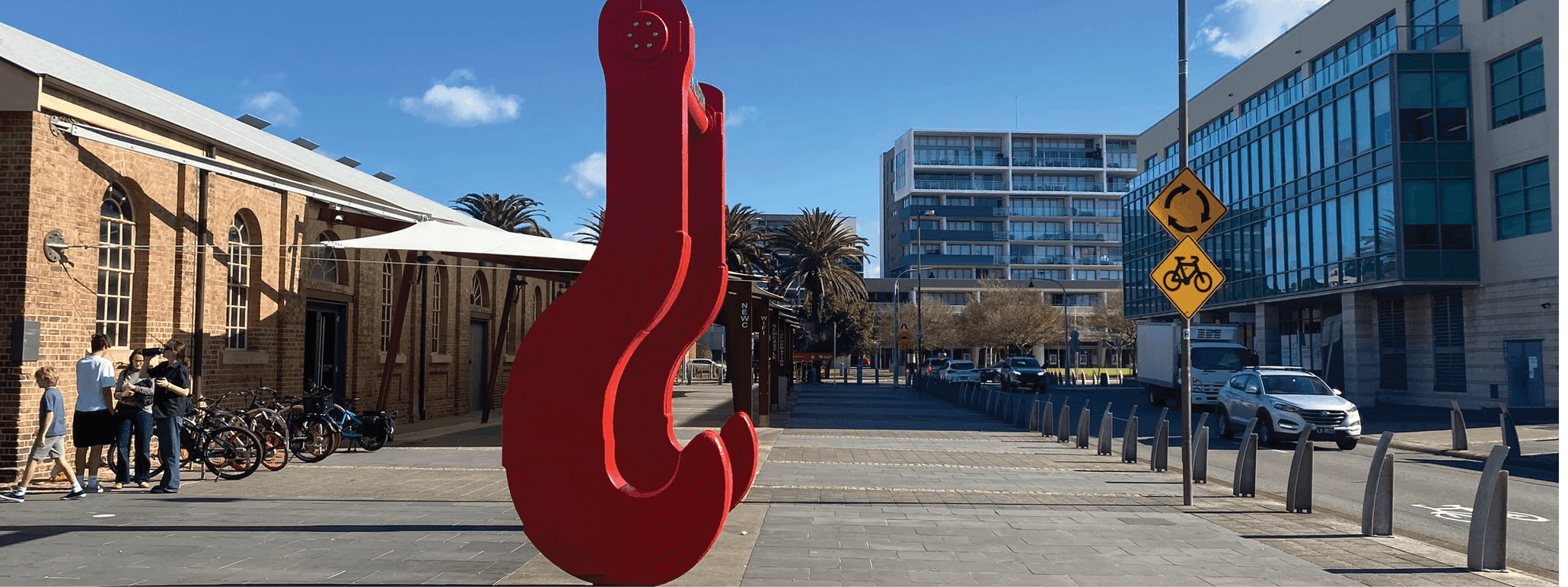
Figure vi. Newcastle Museum, Source: Place Design Group
3.1 STREET typologies
Legend
|
|
Study Area |
|
|
Light Rail Line |
|
|
Light Rail Station |
|
|
Existing Park and Open Space |
|
Main Streets |
|
|
Destination High Streets |
|
|
|
King St (East) |
|
|
Hunter St (East) |
|
Transit Streets |
|
|
|
King St (West) |
|
|
Hunter St (West) |
|
Connector Avenues |
|
|
|
Auckland St (South) |
|
|
Centenary St |
|
|
Burwood St |
|
|
John St |
|
|
Merewhether St |
|
|
Workshop Wy |
|
|
Union St |
|
Arterial High Street |
|
|
|
Darby St |
|
Civic Spaces |
|
|
Civic Lane |
|
|
|
Civic Ln |
|
Service Lane |
|
|
|
Union Ln |
|
|
Lauers Ln |
|
|
Christie St |
|
Transit Mall |
|
|
|
Auckland St (North) |


Figure 1 Street Hierarchy Map
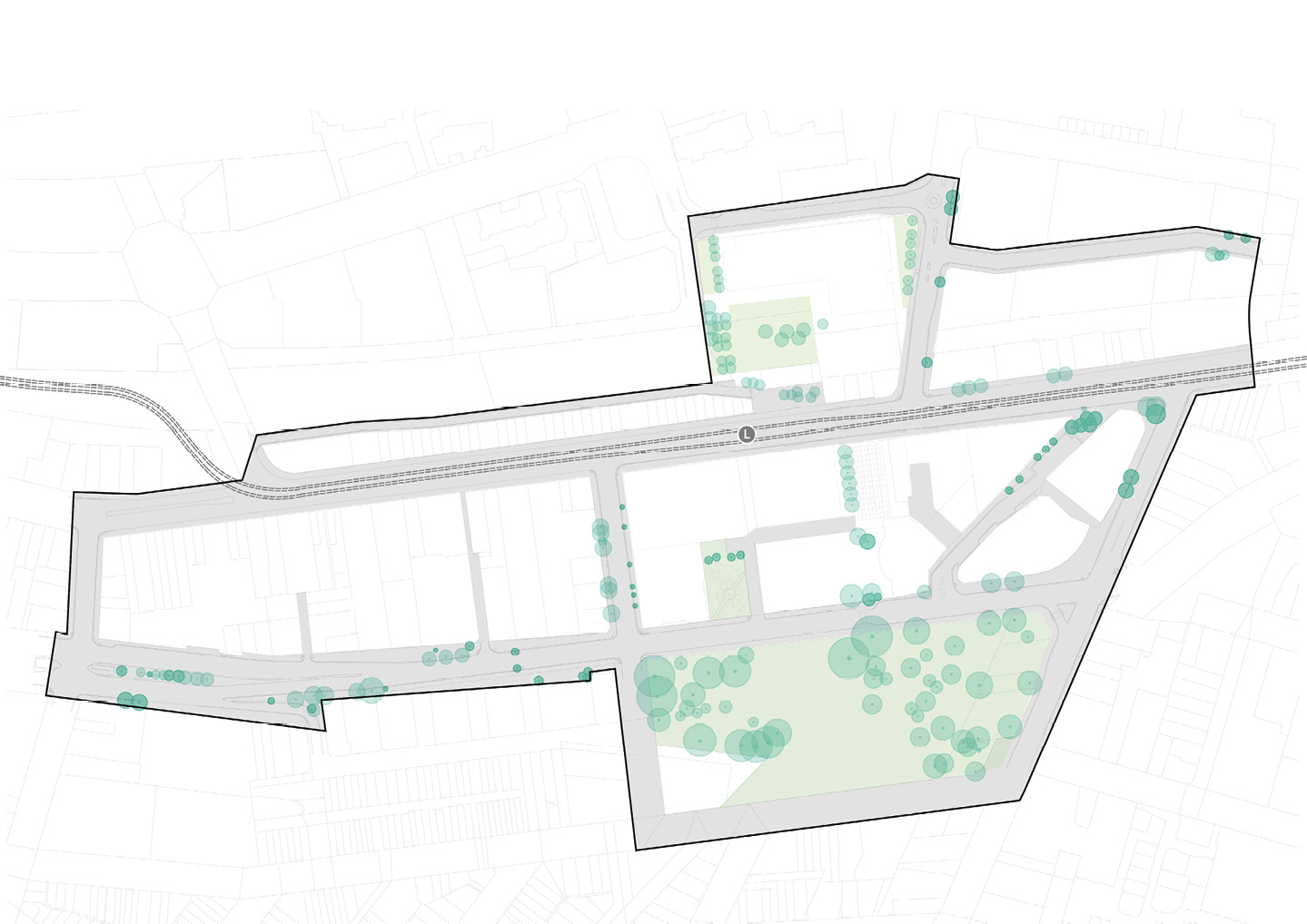
3.2 NATURAL ENVIRONMENT
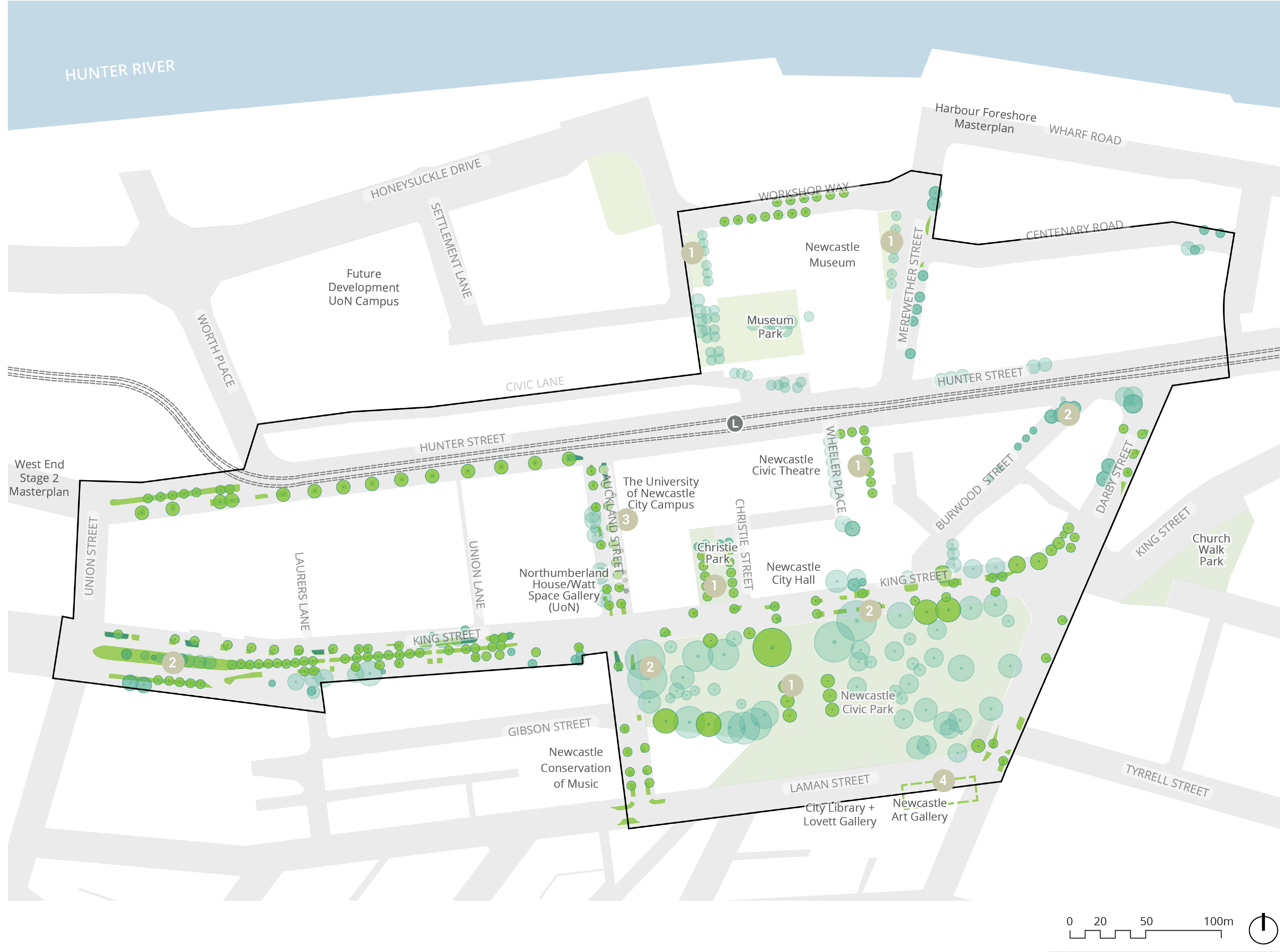
Long text alternative
A map that marks natural environments within the Study Area.
Green circles and rectangles are scattered throughout the streets and Newcastle Civic Park indicating Proposed Trees and Proposed Street Planting.
Teal circles are also scattered throughout the streets and Newcastle Civic Park indicating Existing trees to be retained.
There are 5 spots marked with the number 1 that indicates ‘Enhance Open spaces to Support Biodiversity, Mitigate Climate Change and Maximise Recreational Opportunities’. These spots are (1) the middle of Newcastle Civic Park, (2) Christie Park, (3) east of Wheeler Place, (4) west of Merewether Street east of Newcastle Museum, and (5) east of Honeysuckle Drive and north of Museum Park.
There are 4 spots marked with the number 2 that indicates ‘Prioritise Retention of Existing Mature Trees’. Theses spots are (1) northwest corner of Newcastle Civic Park, (2) North of Newcastle Civic Park, (3) along the westside of King Street, and (4) northside of Burwood Street.
There is a spot marked with the number 3 that is East of Aukland Street North, which indicate ‘Trees to be Replaced (Due to Failure)’.
There is a spot marked with the number 4 that is south of Laman Street, north of the Newcastle Art Gallery, which indicate an ‘Area to Investigate Additional Tree Planting’.
Legend
|
|
Study Area |
|
|
Light Rail Line |
|
|
Light Rail Station |
|
|
Existing Park and Open Space |
|
|
Existing Tree to be Retained |
|
|
Proposed Tree |
|
|
Tree to be Removed |
|
|
Proposed Street Planting |
|
|
Proposed Street Raingarden |
|
|
Enhance Open spaces to Support Biodiversity, Mitigate Climate Change and Maximise Recreational Opportunities |
|
|
Prioritise Retention of Existing Mature Trees |
|
|
Trees Along East of Auckland St North to be Replaced (Due to Failure) |
|
|
Area to Investigate Additional Tree Planting |


Figure 2 Natural Environment Map
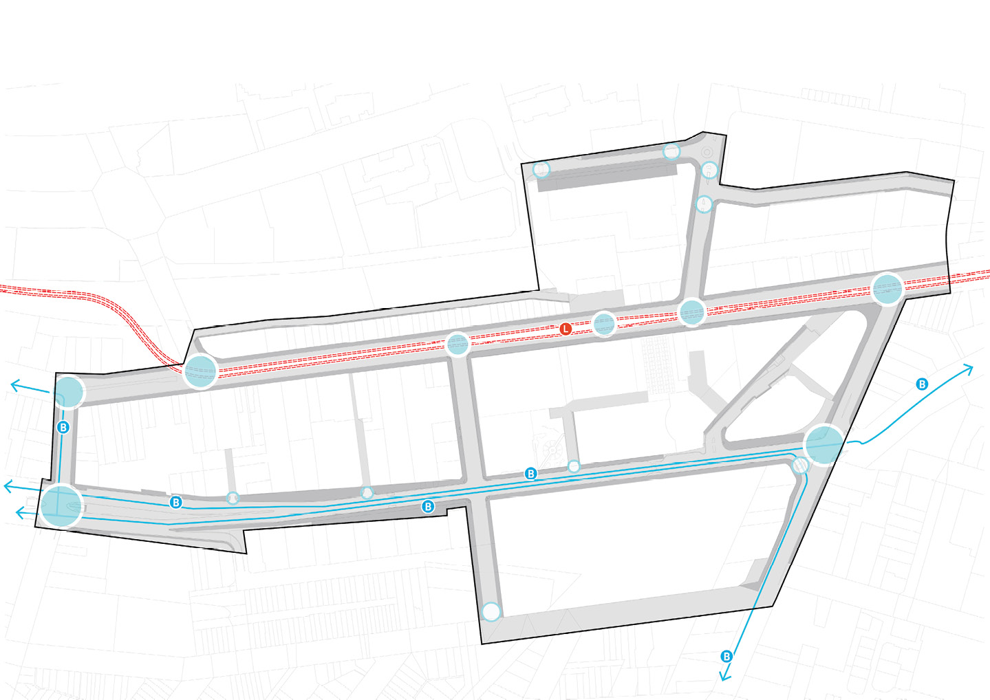
3.3 VEHICLE ACCESS AND MOVEMENT
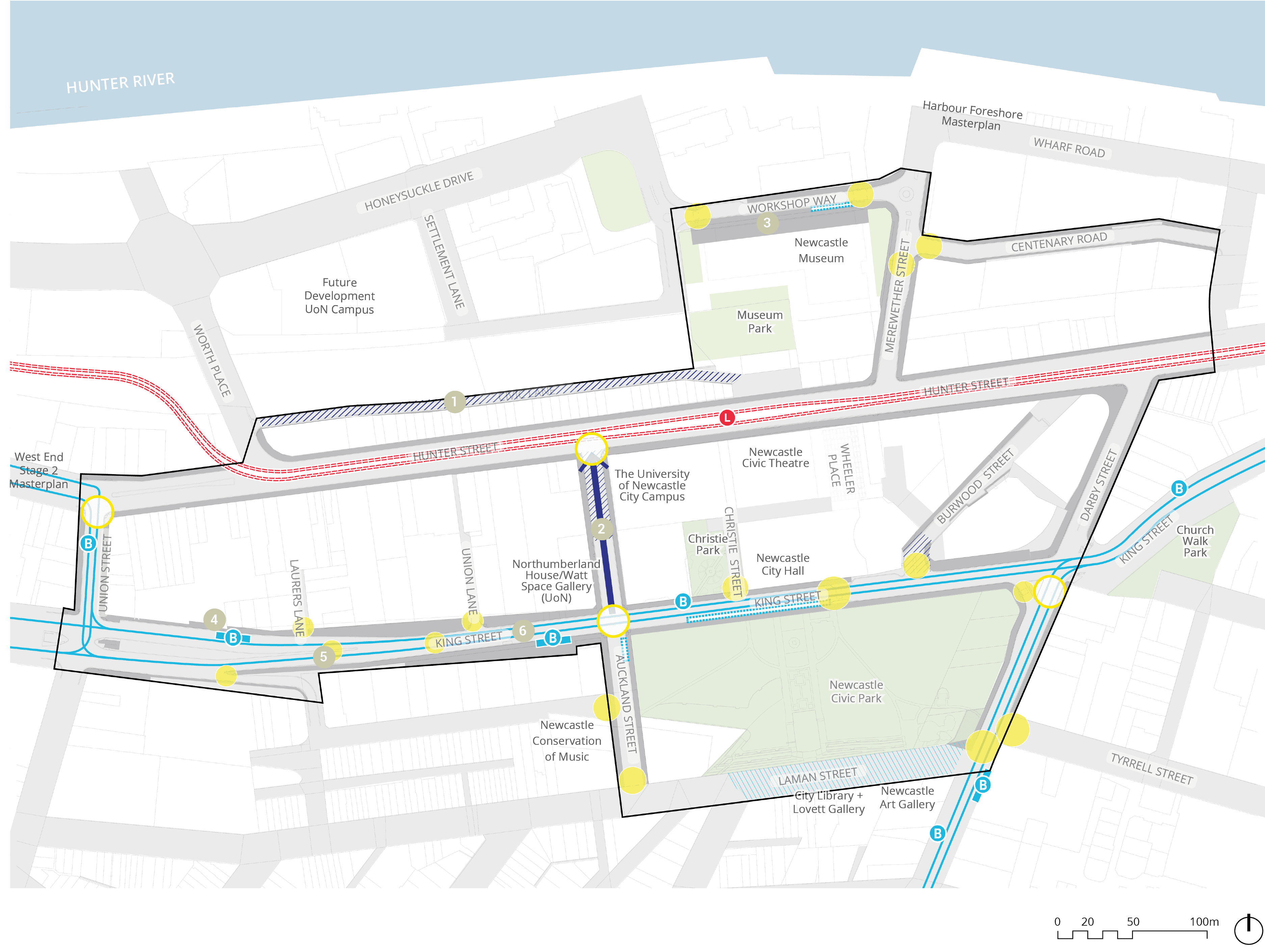
Long text alternative
A map of the Study Area showing vehicle access and movement.
Part of Laman Street is shaded light blue to indicate that it’s an ‘Existing shared zone’.
Civic lane and northside Aukland Street are shaded dark blue indicating ‘Proposed shared zones’.
A dark blue arrow goes along Auckland Street starting from King Street and points north to indicate that it is a ‘Proposed one-way link (two-way during events)’.
Light blue lines go along King Street, Union Street and south of Darby Street to indicate they are ‘Existing bus routes to be retained’.
Light blue marks with the letter B are scattered throughout the existing bus routes indicating they are ‘Existing bus route stops to be retained’.
Two light blue rectangles are marked along King Street and one south along Darby Street indicate ‘Proposed bus stop platforms/shelters’.
A light blue dotted rectangle is marked along King Street, north of Newcastle Civic Park, and one south of King Street along Auckland Street, indicating a ‘Proposed bus/coach drop off’.
Four yellow outlined circles indicate ‘Proposed signalised crossing upgrades’. They are (1) at the junction of Union Street and Hunter Street, (2) at the junction of Hunter Street and Auckland Street, (3) at the intersection of King Street and Auckland Street, and (4) at the junction of of Darby Street and King Street.
Yellow solid circles are scattered throughout King Street, some on Auckland Street and Darby Street, two on Workshop Way, one on Merewether Street, and one on Centenary Road. These indicate ‘Proposed unsignalised crossing upgrades’.
There are 6 markers numbered from 1 to 6 which are associated with descriptions in the legend. Number 1 is located on Civic Lane. Number 2 is along Auckland Street in between Hunter Street and King Street. Number 3 is south of Workshop Way on the Newcastle Museum. Number 4 is on the west side of King Street close to Union Street. Number 5 is slightly east of 4 along King Street close to Lauers Lane. Number 6 is further east of 5 close to Union Lane.
Legend
|
|
Study area |
|
|
Light rail line |
|
|
Light rail station |
|
|
Existing park and open space |
|
|
Existing shared zone |
|
|
Proposed shared zone |
|
|
Proposed one-way link (two-way during events) |
|
|
Existing bus route to be retained |
|
|
Existing bus route stop to be retained |
|
|
Proposed bus stop platform/shelter |
|
|
Proposed bus/coach drop off |
|
|
Proposed signalised crossing upgrade |
|
|
Proposed unsignalised crossing upgrade |
|
|
Partner with university to ensure development set backs allow for proposed contraflow cycle movement along laneway |
|
|
Maintain capacity within parking lanes for special event south bound traffic flows |
|
|
Improve experience for pedestrians at museum entry |
|
|
Explore opportunities to provide new bus shelters and associated signage throughout precinct |
|
|
Proposed refuge island crossing to improve link to Lauers Ln |
|
|
Proposed refuge island crossing to improve link to Union Ln |


Figure 3 Vehicle Access and Movement Map
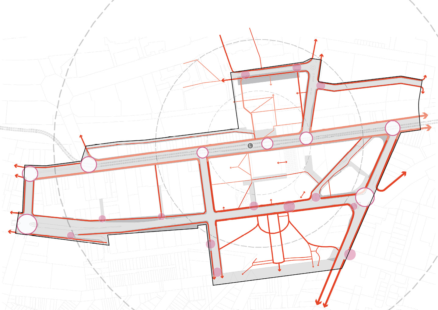
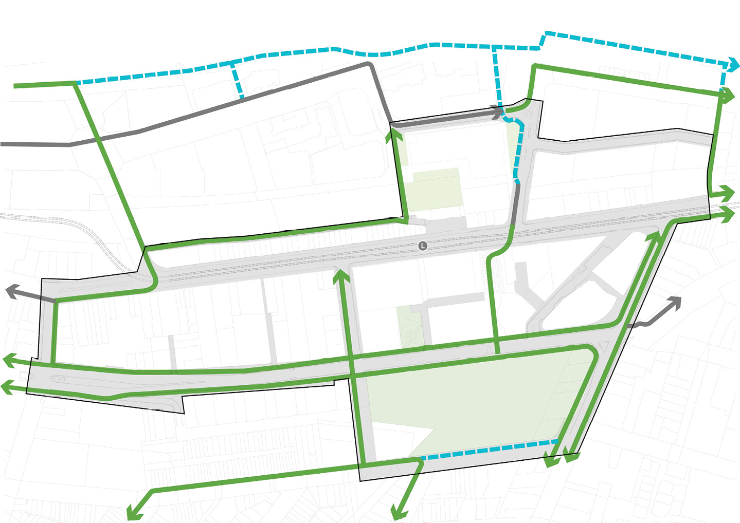
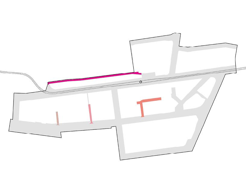
3.4 PEDESTRIAN AND CYCLE MOVEMENT
Long text alternative
A map showing pedestrian and cyclist movements.
Four areas are marked with orange shading to indicate ‘Space identified as potential future plaza’. They are (1) west of Auckland Street, outside the Study area, (2) the corner of Burwood Street and King Street, (3) the corner of King Street and Darby Street, and (4) south of King Street, opposite of Lauers Lane.
An area around Wheeler Place is shaded green to indicate an ‘Existing Plaza to be upgraded’.
Civic Lane and a north part of Auckland Street are shaded dark blue to indicate a ‘Proposed shared zone’.
Three spots are marked with a yellow outline circle to indicate a ‘Proposed signalised Pedestrian crossing’. They are (1) the junction of Hunter Street and Auckland Street, (2) the intersection of Auckland Street and King Street, (3) the corner of Darby Street and King Street.
Four spots are marked with a yellow solid circle to indicate a ‘Proposed priority pedestrian crossing’. They are (1) on King Street south of Wheeler Place, (2) the corner of Darby Street and King Street, (3) near the junction of Centenary Road and Merewether Street, and (4) near the junction between Workshop Way and Wharf Road.
Three spots are marked with a solid pink circle to indicate a ‘Proposed unsignalised crossing upgrade (raised threshold)’. They are (1) north of the intersection of Laman Street and Auckland Street, (2) the intersection of Darby Street and Tyrrell Street, (3) east of the junction between Workshop Way and Honeysuckle Drive.
Eight spots are marked with a dotted pink arrow to indicate a ‘Proposed pedestrian median or zebra crossing upgrade (flush to road)’. They are (1) near the intersection of Lauers Lane and King Street, (2) in the middle of King Street, (3) near the intersection of Laman Street and Tyrrell Street, (4) the junction of King Street and Burwood Street, and four spots at the intersection of King Street and Auckland Street.
Six spots are marked with a pink outline circle to indicate a ‘Proposed continuous footpath’. They are (1) south of the west side of King Street, (2) the junction of King Street and Lauers Lane, (3) the junction of King Street and Union Lane, (4) the junction of King Street and Christie Lane, (5) the junction of Auckland Street and Gibson Street, and (6) the junction of Centenary Road and Merewether Street.
Two areas are circled with a solid pink line to indicate a ‘Proposed median’. They are (1) on the west side of Hunter Street and (2) the middle of King Street.
Solid pink lines are drawn in various areas along Union Street, King Street, Auckland Street, Darby Street and Merewether Street indicating a ‘Proposed kerb extension’.
Solid grey lines are drawn along Honeysuckle Drive, Workshop Way, Merewether Street, Darby Street and Auckland Street to indicate an ‘Existing on-road cycleway’.
A solid blue line is drawn on the west side of Hunter Street, west of Union Street, indicating an ‘Existing separated on-road cycleway’.
Solid purple line is drawn on the west side of Hunter Street, east of Union Street, indicating an ‘Existing separate on-road cycleway to be upgraded’.
Solid light blue line is drawn along Laman Street and along the bank of Hunter River, indicating an ‘Existing off-road cycleway / shared path’.
Dashed light blue lines are drawn along Union Street, King Street, Auckland Street, Darby Street, Wheeler Place, Workshop Way, Merewether Street and Centenary Road, indicating a ‘Proposed shared path’.
Dark green dashed lines are drawn along both sides of King Street indicated a ‘Proposed on-verge separated cycleway’.
Light green solid lines are drawn along King Street, Laman Street, Wharf Road, Honeysuckle Drive, and the east side of Hunter Street, indicating a ‘Proposed new cycleway (out of scope of project).
There are markers numbered from 1 to 6 which are associated with descriptions in the legend. There are three markers labelled as number 1. Two are on King Street and one on Hunter Street. There are two markers labelled as number 2 on King Street. There is one marker labelled as number 3 at Wheeler Place. There is one marker labelled as number 4 on Civic Lane. There are two markers labelled as number 5 on Workshop Way and King Street. There is one marker labelled as number 6 on Darby Street.
Legend
|
|
Study area |
|
|
Light rail line |
|
|
Light rail station |
|
|
Walking catchment |
|
|
Existing park and open space |
|
|
Space identified as potential future plaza |
|
|
Existing plaza to be upgraded |
|
|
Proposed shared zone |
|
|
Proposed signalised pedestrian crossing upgrade |
|
|
Proposed priority pedestrian crossing |
|
|
Proposed un-signalised crossing upgrade (raised threshold) |
|
|
Proposed pedestrian median or zebra crossing upgrade (flush to road) |
|
|
Proposed continuous footpath |
|
|
Proposed median |
|
|
Proposed kerb extension |
|
|
Existing on - road cycleway |
|
|
Existing separated on - road cycleway |
|
|
Existing separated on - road cycleway to be upgraded |
|
|
Existing off - road cycleway / shared path |
|
|
Proposed shared path |
|
|
Proposed on - road cycleway |
|
|
Proposed on - verge separated cycleway |
|
|
Proposed new cycleway (out of scope of project) |
|
|
Proposed separated cycleways as part of regional cycle network to be coordinated with existing signals and bus turning movements |
|
|
Mid-block crossing to improve connectivity to Union Ln & Lauers Ln |
|
|
Proposed shared zone across Wheeler Place linking King Street and Hunter Street |
|
|
Prioritise pedestrian / cycling movement to Civic Ln as part of future Development works of UoN campus |
|
|
Introduce priority pedestrian crossing to existing raised pedestrian crossing |
|
|
Provide southern signalised pedestrian crossing |


Figure 4 Pedestrian and Cycle Movement Map
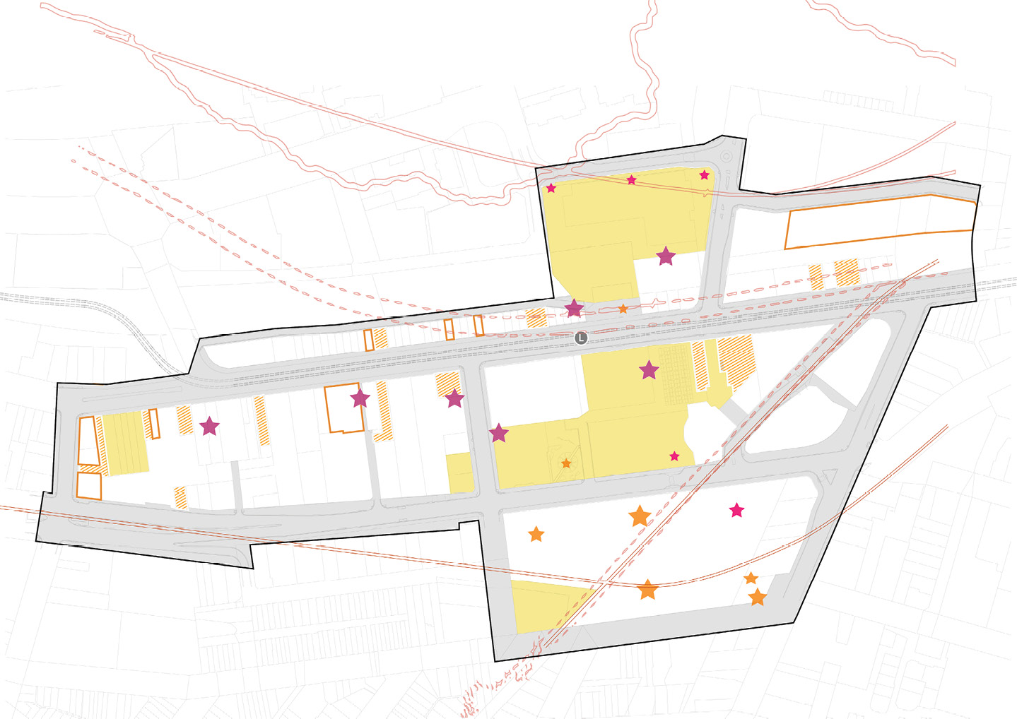
3.5 HERITAGE AND BUILT CHARACTER
Long text alternative
A map of the Study Area showing Heritage and Built Character.
There are 7 dark pink stars marking ‘Murals to be retained’. They are (1) west of Union Street, (2) south of Hunter Street north of Lauers Lane, (3) south of Hunter Street north of Union Lane, (4) southwest of the corner of Hunter Street and Auckland Street, (5) east of Auckland Street, (6) north of Hunter Street southwest of Museum Park, and (7) east of Museum Park.
There are 9 orange stars marking the ‘Monuments / memorials to be retained’. They are (1) near the northwest corner of Hunter Street and Worth Place, (2) North of Hunter Street south of Museum Park, (3) near the northwest corner of Christie Street and King Street, (4) at Wheeler Place, and 5 are within the area between King Street, Darby Street, Laman Street and Auckland Street. They are labelled, (5) WW1, WW2 War Memorial, (6) Vietnam and National Service Memorial, (7) Captain James Cook Memorial, (8) ‘Folded Wings’ RAAF Memorial, and (9) Memorial Grove.
There are 6 small pink stars marking the ‘Public art/ sculpture to be retained’. There are three near Newcastle Museum, one near Wheeler Place, one south of Wheeler Place, and one in Newcastle Civic Park.
There are several areas highlighted in yellow both within and outside the Study Area, which indicate a ‘Heritage item’.
There are several areas highlighted in orange both within and outside the Study Area, which indicate ‘Contributory 1’.
There are several areas outlined in a solid orange line both within and outside the Study Area, which indicate ‘Contributory 2’.
There are orange outlines that go from Hunter River, through Honeysuckle Drive, Workshop Way and Centenary Road that show the ‘Indicative original foreshore – 1858’.
There are orange outlines that go through the area between Honeysuckle Drive and Worth Place, through Civic Lane, and along Hunter Street. There is another outline that goes along Burwood Street and through Newcastle Civic Park. They show the ‘Indicative former paths / road alignment – 1858’.
There is an orange outline that goes along King Street and through Newcastle Civic Park and stops at Church Walk Park, which shows the ‘Former rail alignment – 1896’.
There are several dashed pink arrows through Newcastle Civic Park, through Christie Park and Wheeler Place, one through Merewether Street, and one from Workshop Way to Hunter River. These show ‘Key views’.
There are 4 markers labelled from 1 to 4 which are associated with descriptions in the legend. Number 1 and 4 are both north of Workshop Way, south of Hunter River. Number 2 is within Newcastle Civic Park, and number 3 is on King Street north of Newcastle Civic Park.
Legend
|
|
Study area |
|
|
Light rail line |
|
|
Light rail station |
|
|
Existing park and open space |
|
|
Murals to be retained |
|
|
Monuments / memorials to be retained |
|
|
Public art/ sculpture to be retained |
|
|
Heritage item |
|
|
Contributory 1 |
|
|
Contributory 2 |
|
|
Indicative original foreshore - 1858 |
|
Indicative former paths / road alignment -1858 |
|
|
|
|
|
|
Former rail alignment - 1896 |
|
|
Key views |
|
|
Opportunity to interpret and reinforce narrative of former shoreline |
|
|
Opportunity to interpret and reinforce narrative of former rail alignment |
|
|
Reinforce key historic axis from Newcastle City Hall to City Library |
|
|
Reinforce key visual axis from Hunter St/Workshop St to the harbour |


Figure 5 Heritage and Built Character Map
Figure vii. Wheeler Place, Source: Place Design Group
4 PUBLIC DOMAIN
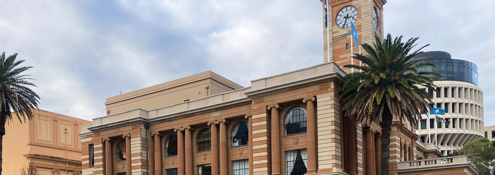
Figure viii. Newcastle City Hall, Source: Place Design Group
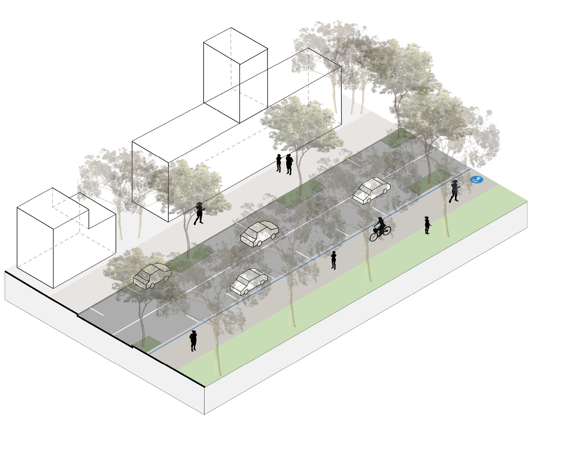
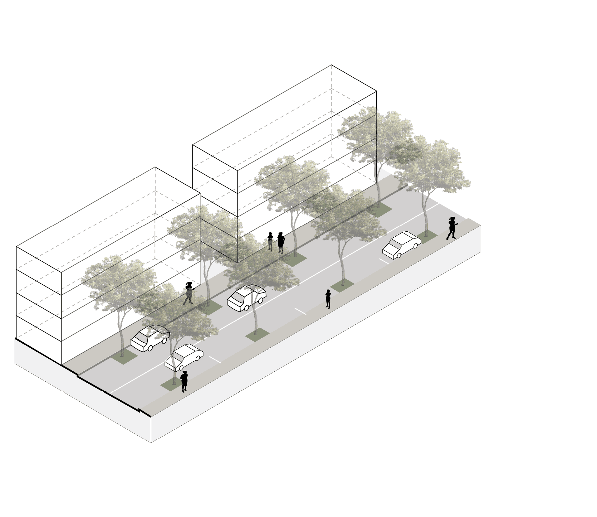
4.1 street DESIGN typologies
MAIN STREETS
destination high street
King St (East)
- Plant additional street trees to enhance biodiversity, shade amenity and frame views of the iconic civic buildings
- Retain parallel parking and bus parking for events times
- Provide shared path along Civic Park
Hunter St (East)
- Plant additional street trees to enhance biodiversity, shade amenity
- Retain parallel parking
transit street
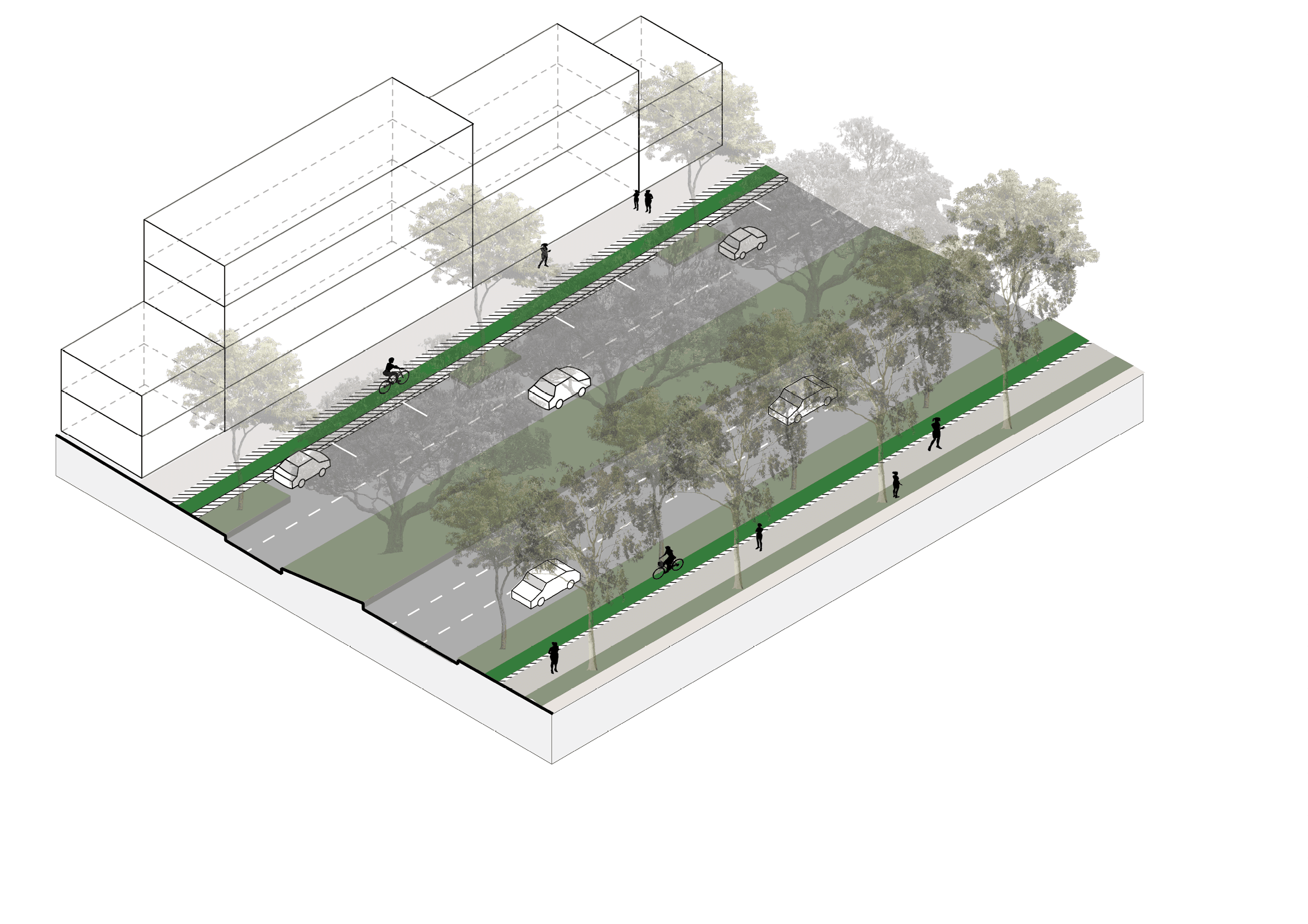
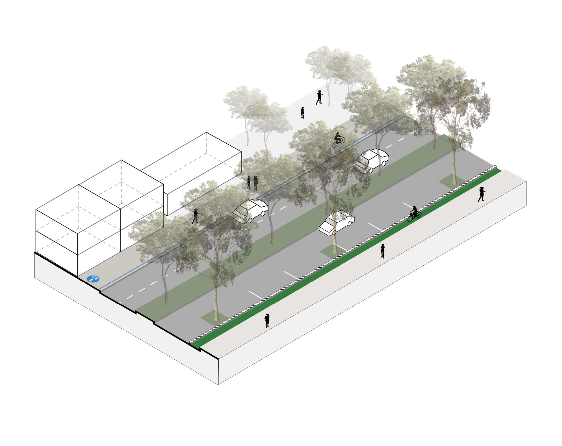
King St (West)
- Retain existing trees and plant additional street trees to provide green boulevard experience upon entry to the precinct
- Retain parallel parking, loading zones, accessible parking
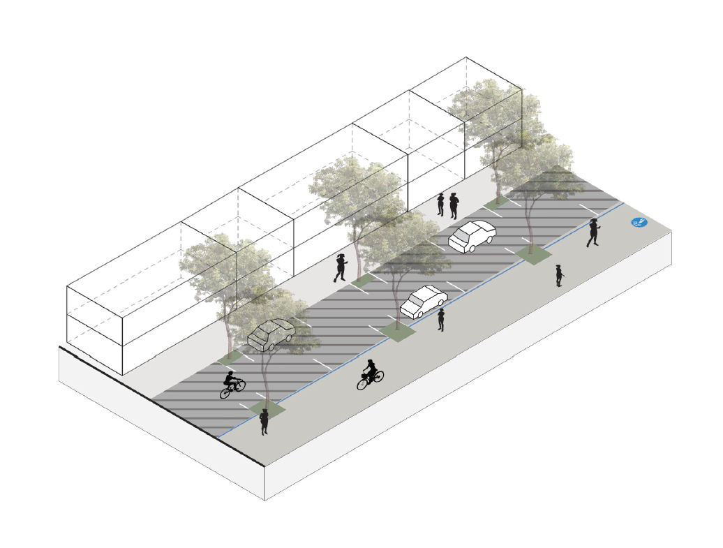
- Provide ‘on-verge’ separated cycleway
- Widen the footpath to enhance pedestrian access
Hunter St (West)
- Plant additional street trees to enhance biodiversity and shade amenity
- Retain parallel parking
- Existing ‘on-road’ separated cycleway to be upgraded
- Widen the footpath to increase buffer to the vehicular carriageway and enhance pedestrian experience
connector avenues
Auckland St (South)
Centenary St
Burwood St
John St
Merewhether St
Union St
Workshop Wy
- Plant additional street trees to enhance biodiversity, shade amenity and frame views of the iconic civic buildings
- Retain parallel parking, accessible parking, loading zones and driveway access
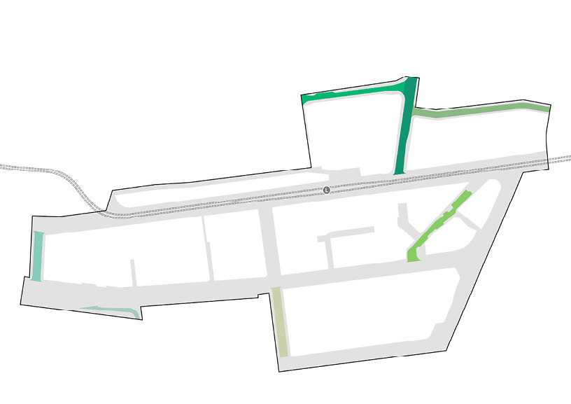
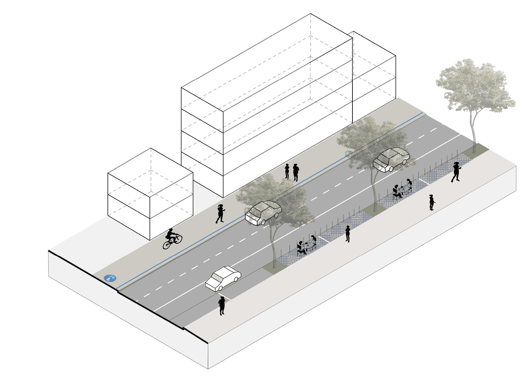
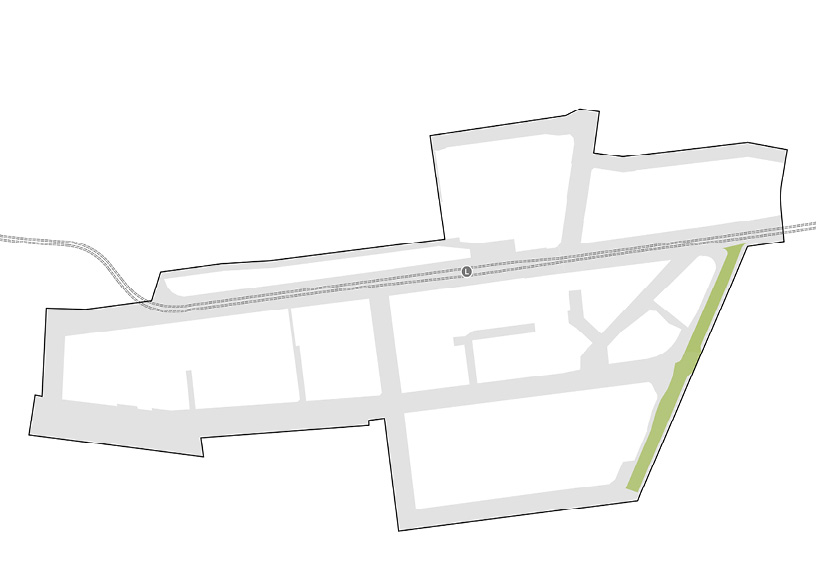
arterial high street
Darby St
- Plant additional street trees to enhance biodiversity and shade amenity
- Retain parallel parking, loading zones and driveway access
- Provide shared path
- Introduce flexible bollard system to allow for outdoor dining
CIVIC SPACES
transit mall
Auckland St (North)
- Plant additional street trees to replace failing trees, enhance biodiversity and shade amenity
- Introduce bio-filtration tree pits to manage flooding
- Retain parallel parking, accessible parking and access to driveways
- Provide one way traffic and shared zone to prioritise pedestrian movement. Two direction travel for event times.
service lane
Christie St
Lauers Ln
Union Ln
CIVIC LANE
Civic Ln
- Provide shared zone to prioritise pedestrian movement
- Contraflow cycle movements permitted
*As part of future development of University of Newcastle campus
4.2 OVERALL PUBLIC DOMAIN PLAN
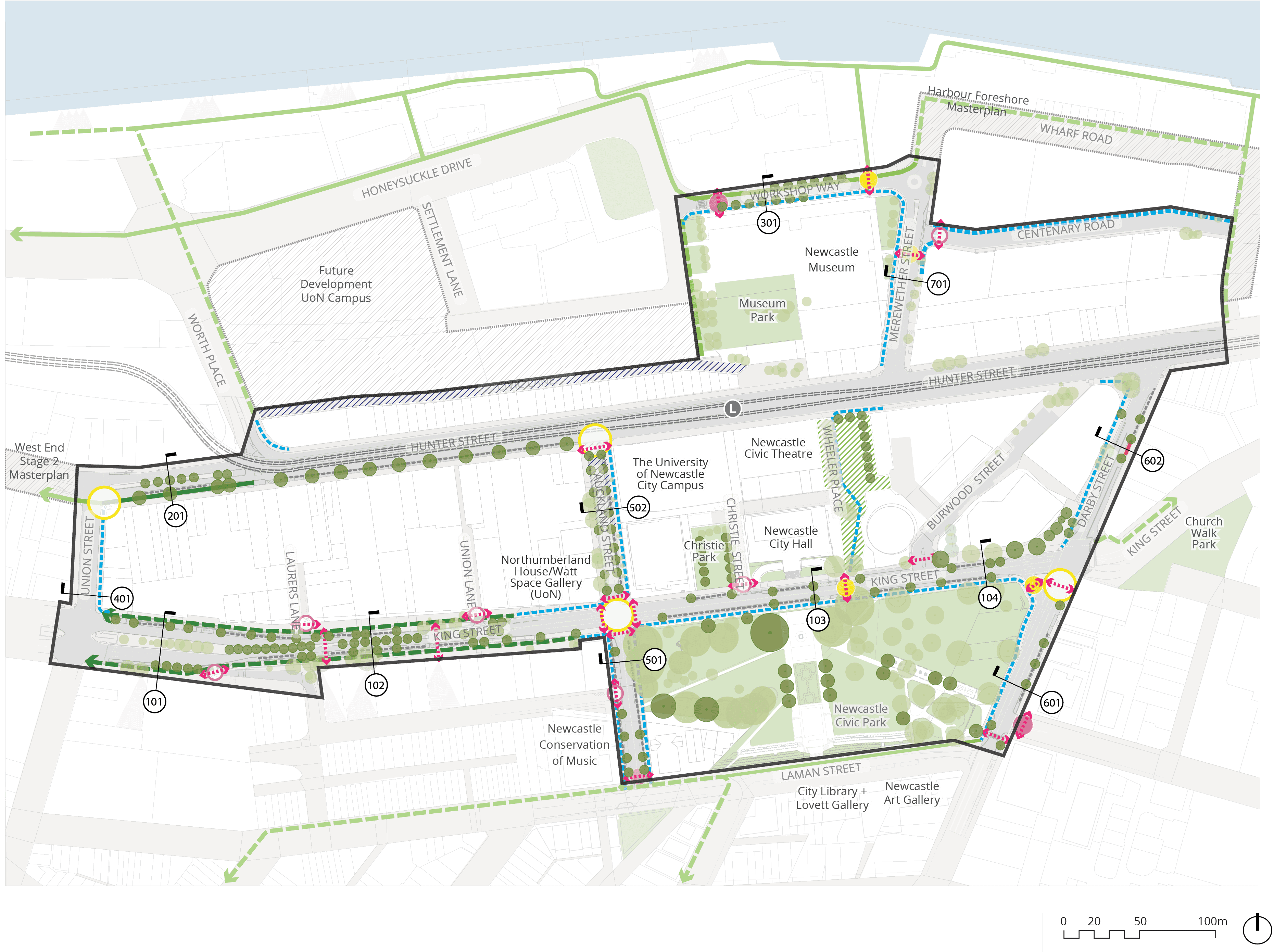
Long text alternative
A map of the Study Area showing the overall public domain plan.
There are four areas highlighted green that mark ‘Existing park / open space to be updated’. They are (1) Museum Park north of Hunter Street, east of Honeysuckle Drive, (2) Newcastle Civic Park that is between King Street, Laman Street, Auckland Street and Darby Street, (3) Christie Park which is north of King Street, across from Newcastle Civic Park, and (4) the corner of Merewether Street.
Three areas are highlighted in grey showing ‘Recent/ proposed development’. They are all outside the Study Area. They are (1) between Hunter Street, Honeysuckle Drive and Worth Place, labelled ‘Future Development UoN Campus, (2) west side of Hunter Street, west of Union Street, labelled ‘West End Stage 2 Masterplan’ and (3) Wharf Road north of Merewether Street, labelled ‘Harbour Foreshore Masterplan’.
Wheeler Place is marked as ‘Existing plaza to be upgraded’. It is located between Hunter Street and King Street, east of Newcastle Civic Theatre and Newcastle City Hall.
Light and dark green circles are marked mainly along Hunter Street, King Street, Darby Street, Workshop Way, Merewether Street and throughout the existing parks, indicating an ‘Existing tree to be retained’ or a ‘Proposed tree’.
Three spots are marked with a yellow outline circle indicating a ‘Proposed pedestrian signalised crossing upgrade’. They are (1) the junction of Hunter Street and Auckland Street, (2) the intersection of Auckland Street and King Street, (3) the corner of Darby Street and King Street.
Four spots are marked with a yellow solid circle to indicate a ‘Proposed priority pedestrian crossing’. They are (1) on King Street south of Wheeler Place, (2) the corner of Darby Street and King Street, (3) near the junction of Centenary Road and Merewether Street, and (4) near the junction between Workshop Way and Wharf Road.
Three spots are marked with a solid pink circle to indicate a ‘Proposed un-signalised crossing upgrade (raised threshold). They are (1) north of the intersection of Laman Street and Auckland Street, (2) the intersection of Darby Street and Tyrrell Street, (3) east of the junction between Workshop Way and Honeysuckle Drive.
Eight spots are marked with a dotted pink arrow to indicate a ‘Proposed pedestrian median or zebra crossing upgrade (flush to road)’. They are (1) near the intersection of Lauers Lane and King Street, (2) in the middle of King Street, (3) near the intersection of Laman Street and Tyrrell Street, (4) the junction of King Street and Burwood Street, and four spots at the intersection of King Street and Auckland Street.
Six spots are marked with a pink outline circle indicating a ‘Proposed continuous footpath’. They are (1) south of the west side of King Street, (2) the junction of King Street and Lauers Lane, (3) the junction of King Street and Union Lane, (4) the junction of King Street and Christie Lane, (5) the junction of Auckland Street and Gibson Street, and (6) the junction of Centenary Road and Merewether Street.
Green solid and dashed lines are drawn along Honeysuckle Drive, Worth Place, Wharf Road, along the bank of Hunter River, along Laman Street and King Street (which are outside of the Study Area), to indicate ‘Existing cycle routes (Outside project extent of works)’ and ‘Proposed cycle routes (Outside project extent of works)’.
Dark green dashed lines are drawn along King Street indicating a ‘Proposed on-verge separated cycleway’.
Dark green solid lines are drawn on the west side of Hunter Street, east of Union Street, indicating an ‘Existing separate on-road cycleway to be upgraded’.
Dashed light blue lines are drawn along Union Street, King Street, Auckland Street, Darby Street, Wheeler Place, Workshop Way, Merewether Street and Centenary Road, indicating a ‘Proposed shared path’.
Grey dashed lines are drawn along Hunter Street, King Street, and Darby Street to indicate ‘Proposed parallel parking’.
A solid red line is drawn on the north side of Darby Street, south of Hunter Street to indicate ‘Proposed alfresco dining’.
Legend
|
|
Study area |
|
|
Light rail line |
|
|
Light rail station |
|
|
Existing park / open space to be updated |
|
|
Recent/ proposed development |
|
|
Existing plaza to be upgraded |
|
|
Proposed shared zone |
|
|
Existing tree to be retained |
|
|
Proposed tree |
|
|
Proposed pedestrian signalised crossing upgrade |
|
|
Proposed priority pedestrian crossing |

|
Proposed un-signalised crossing upgrade (raised threshold) |

|
Proposed pedestrian median or zebra crossing upgrade (flush to road) |
|
|
Proposed continuous footpath |
|
|
Existing cycle route (Outside project extent of works) Source: On our bikes: A plan for safe and connected cycling in the Newcastle LGA (2021) |
|
|
Proposed cycle route (Outside project extent of works) Source: On our bikes: A plan for safe and connected cycling in the Newcastle LGA (2021) |
|
|
Proposed separated cycleway (on verge) |
|
|
Existing separated cycleway to be upgraded (on road) |
|
|
Proposed shared path |
|
|
Proposed parallel parking |
|
|
Proposed alfresco dining |


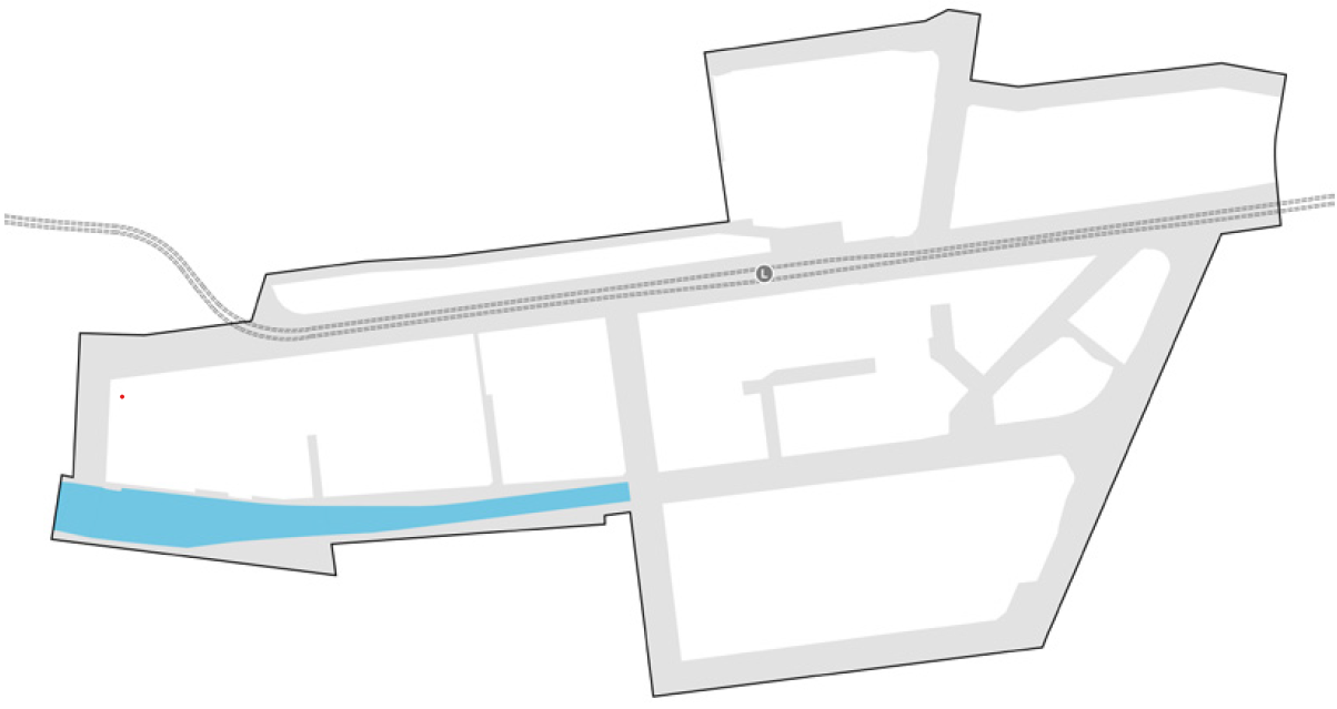
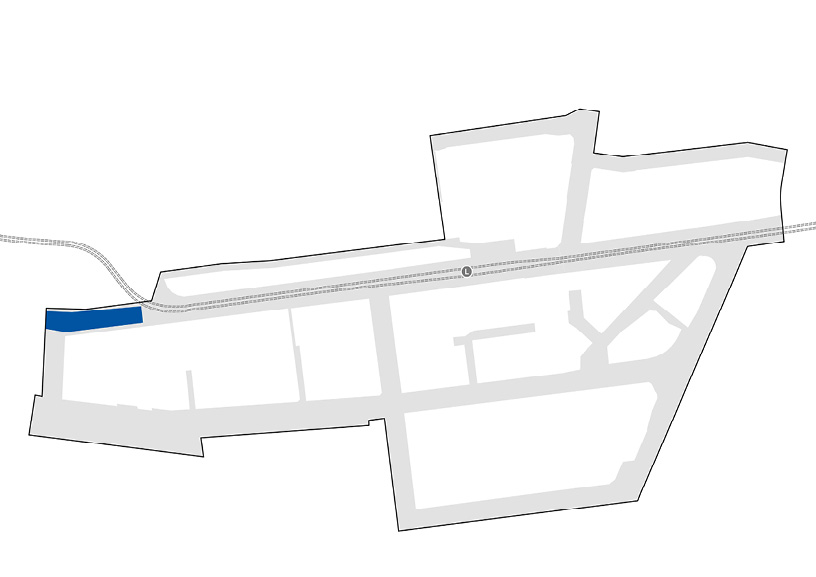
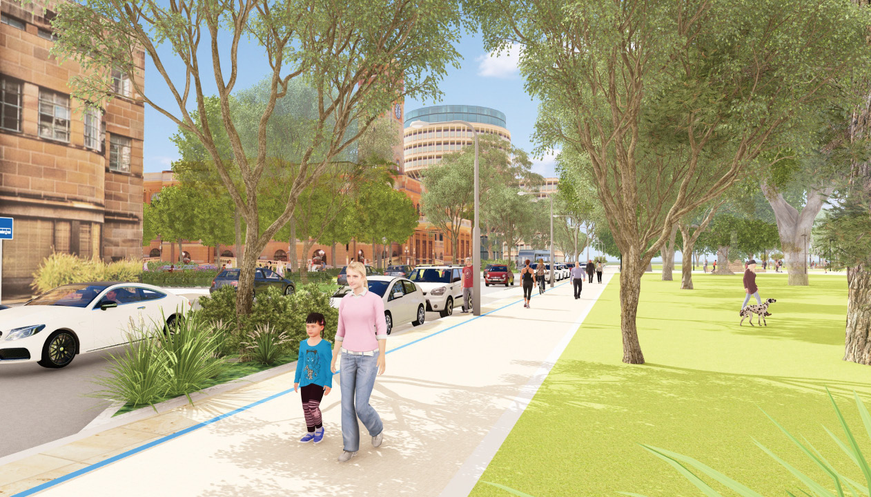
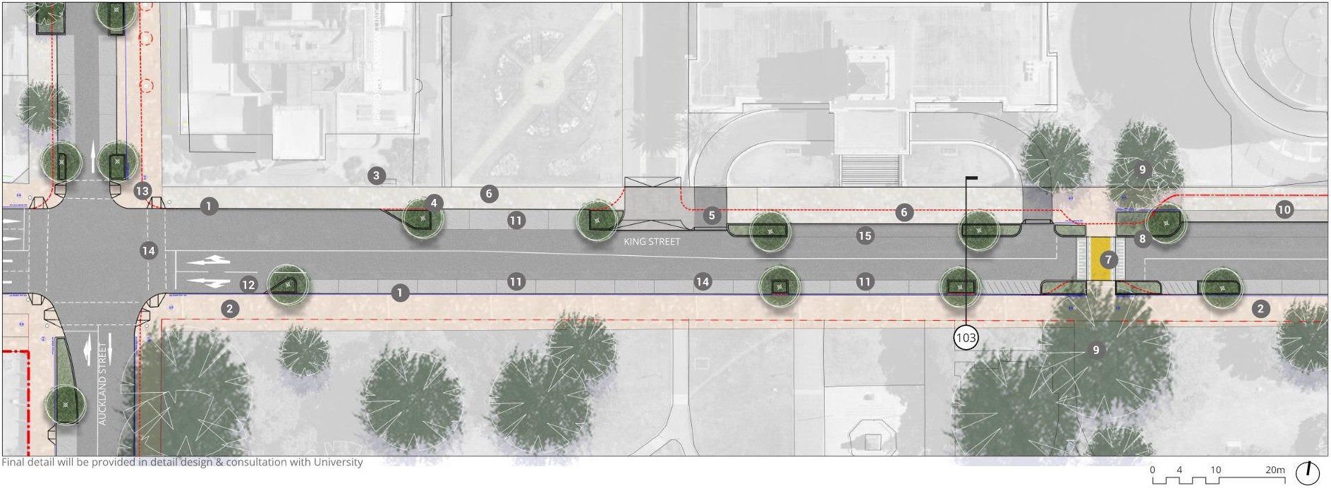
4.3.0 KING STREET perspective
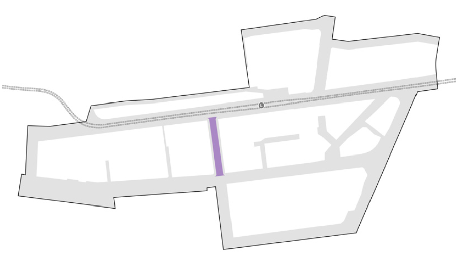
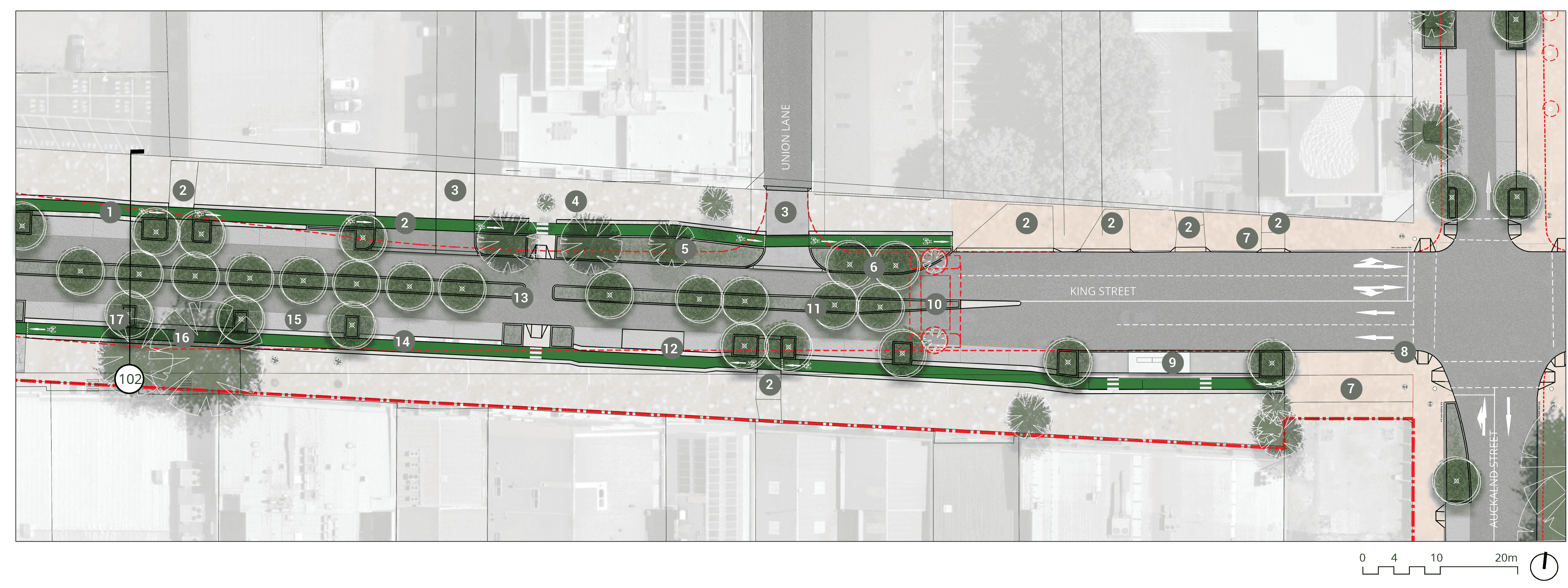
4.3.1 KING STREET plan
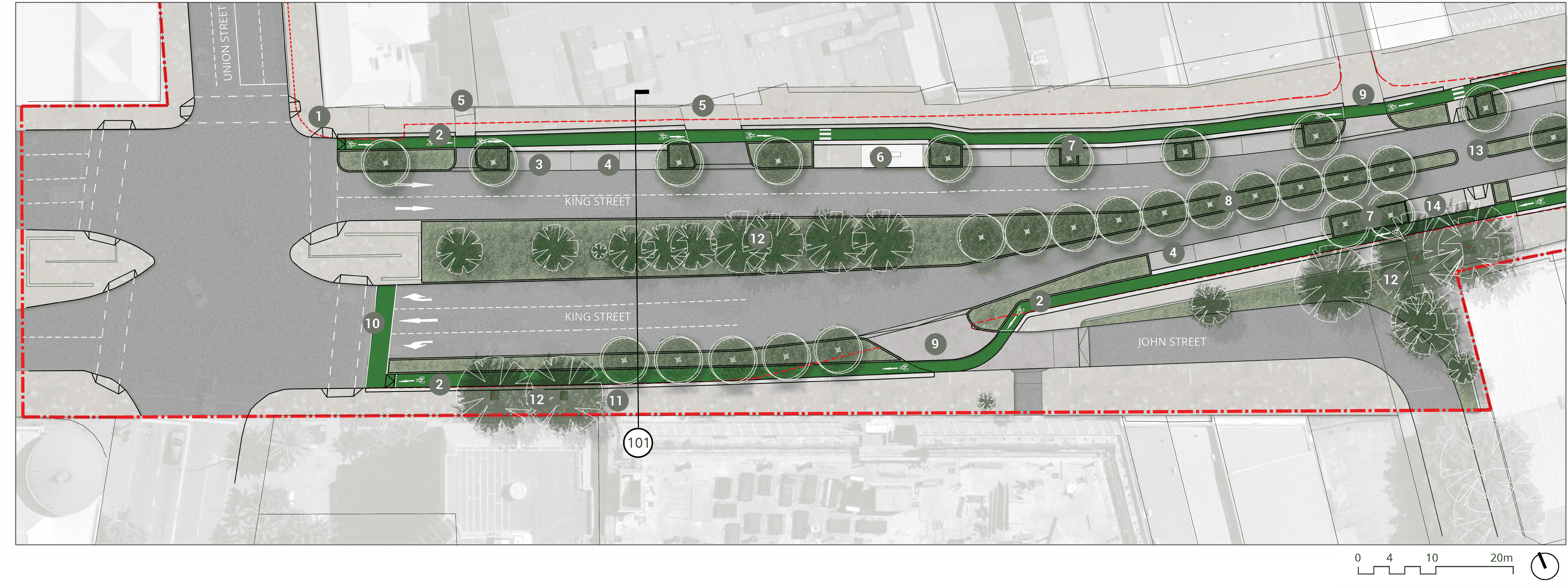
Long text alternative
A map of King Street that shows the proposed plan for how the street will look when it’s been upgraded.
There are numbers marked from 1 to 14 which are associated with the descriptions in the legend.
The corner of Union Street and King Street (1) will have an upgrade to the signalised intersection to include a cycle phase. From this intersection heading east (2) there will be a 2.1m wide uni-directional on-road separated cycleway including a 600mm buffer. This will also be on the southern side of King Street.
On the northern side of King Street to the east of the intersection with Union Street (3) there is a loading zone which will be retained. There are car parks east of this (4) that will be retained, and 2 existing driveway access points (5) to the east of those which will also be retained.
About halfway between Union Street and Lauers Lane along King Street (6) there is an existing bus stop that will be reconfigured to accommodate the cycleway. This will become an in-lane bus stop with a platform to a parking bay. There will be fencing and a pedestrian crossing along the cycleway. East of this (7) there are some parking spaces that will need to be removed to accommodate a 2.5m wide planter for a tree.
In the middle of the road close to John Street (8) the central median planting zone will be extended to 2 metres.
At the entrances to Lauers Lane and John Street (9) there is a proposed shared zone with a raised threshold and a continuous shared path across the intersection.
For traffic traveling west on King Street (10) there will be a 2.5m cycle storage at the front of the traffic lights for people who need to turn right at the intersection with Union Street.
The existing footpath on the south side of King Street (11) is to be retained.
There are existing trees (12) that will be retained as part of a planter zone in the median strip of King Street.
There will be a refuge island (13) linked by a crossing to Lauers Lane.
Just below Lauers Lane on the southern side of King Street (14) there is room for new accessible parking spaces.
Legend
|
|
Study area |

|
Existing kerb to be removed |
|
|
Carriageway / driveway |
|
|
Walkway |
|
|
Planting zone |
|
|
Cycleway |
|
|
Level threshold /continuous shared zone at driveway/road intersection |
|
|
Street parking |
|
|
Existing tree |
|
|
Proposed tree |
|
|
Upgrade to signalised intersection to include cycle-phase |
|
|
2.1m wide uni-directional on-road separated cycleway including 600mm buffer |
|
|
Retain existing loading zone |
|
|
Retain existing car parking |
|
|
Retain existing driveway access |
|
|
Existing bus stop to be reconfigured to accommodate cycleway - in-lane bus stop with platform to parking bay. Fencing and pedestrian crossing along cycleway. |
|
|
Remove parking to accommodate 2.5m wide planter/ street tree |
|
|
Extend central median planting zone to 2m |
|
|
Proposed shared zone/ raised threshold/ continuous shared path across intersection |
|
|
2.5m cycle storage at the front of traffic for right turn at lights |
|
|
Existing footpath to be retained |
|
|
Retain existing trees/ planting zone |
|
|
Refuge island crossing to link to Lauers Lane |
|
|
New accessible parking spaces |


key plan
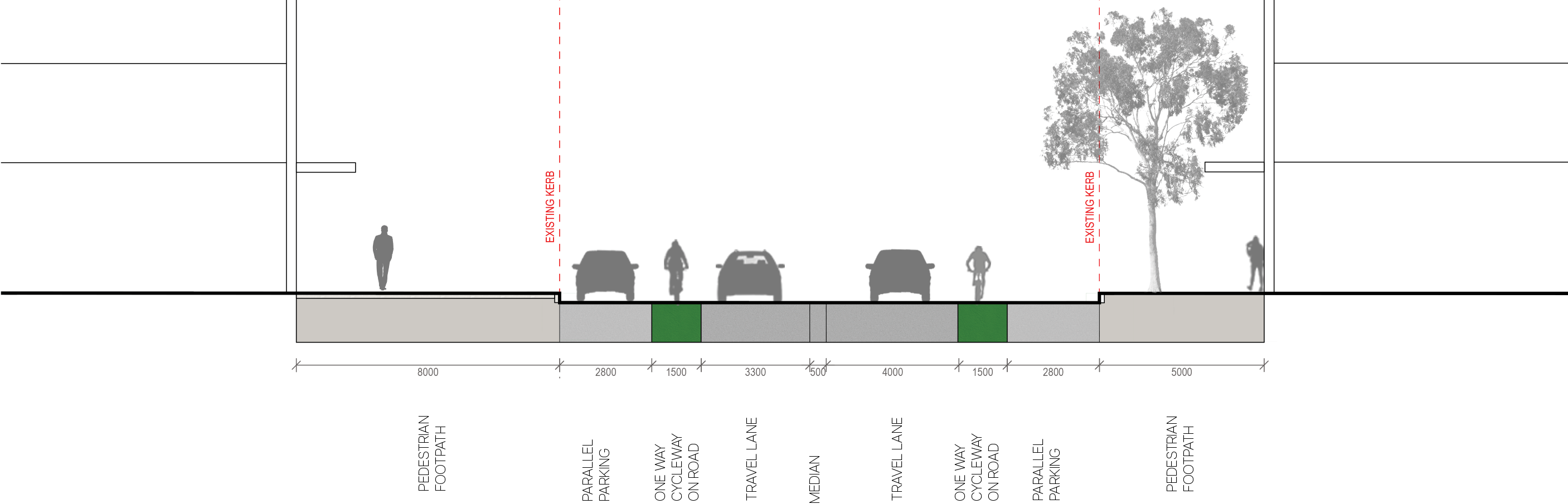
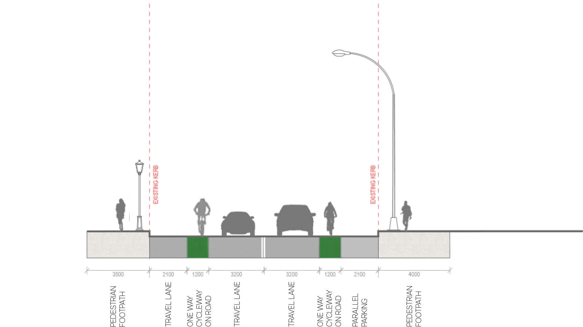
4.3.1 KING STREET section - 101
Existing
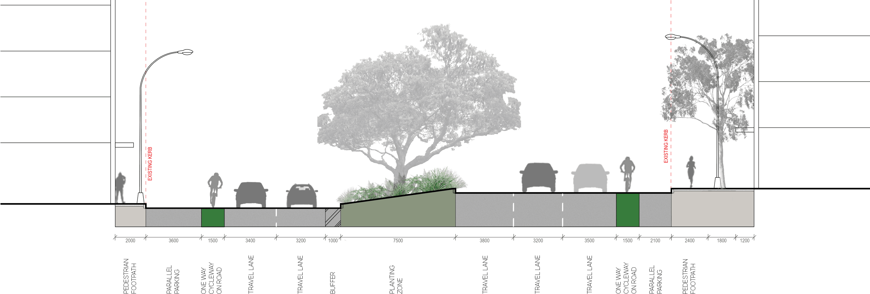
proposed
key plan
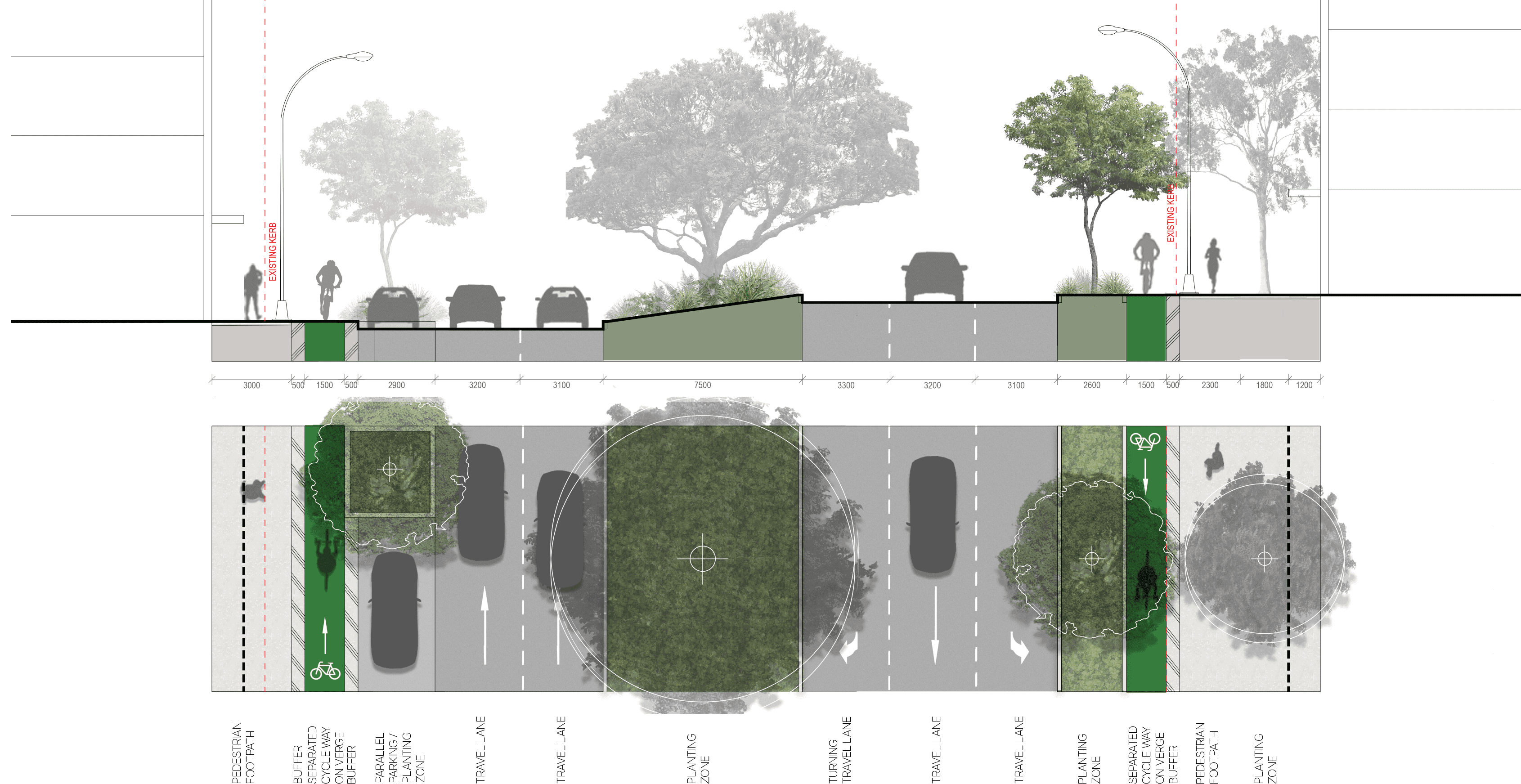
4.3.2 KING STREET plan
Long text alternative
A map of King Street that shows the proposed plan for how the street will look when it’s been upgraded.
There are numbers marked from 1 to 17 which are associated with the descriptions in the legend.
On the north-west end of King Street (1) there is an ‘existing kerb to be realigned to accommodate cycleway’. There are also existing driveways to be retained (2), 6 on the north of King Street and 1 on the south opposite Union Lane. On the northern side of King Street (3) there are 2 proposed shared zones with a raised threshold and a continuous shared path across the intersection at Union Lane and another spot to the west. There is existing seating to be removed (4) west of Union Lane. There are some existing trees to be retained (5) west of Union Lane also.
East of Union Lane on King Street (6) there is a proposal to build the kerb out to accommodate existing and future planting. The eastern side of the path between Auckland Street and Union Lane (7) will be a shared pedestrian and cycle path on both sides of King Street.
At the intersection of King Street and Auckland Street on the southern side (8) the existing kerb is to remain. On the south of King Street west of Aukland Street (9) there is an existing bus stop to be reconfigured to an ‘in-lane bus stop with 3m wide platform and shelter’ to accommodate a cycleway.
Across King Street east of Union Lane (10) there is an existing speed bump to be removed. There is a proposed refuge island with tree planting (11) in the middle of King Street opposite Union Lane. On the south of King Street west of Union Lane (12) there is an existing loading zone to be retained. Across King Street west of Union Lane (13) there is a ‘proposed refuge island crossing to link to pedestrian laneway link and Union Lane’. The south of King Street (14) is an ‘existing kerb to be realigned to accommodate cycleway’. Existing car parking spaces (2.3 metre wide) (15) are to be retained along the south side of King Street to the west. There will be a ‘2.1 metre wide uni-directional on-verge separated cycleway including a 600mm buffer’ (16) west of retained car parking on the south of King Street. At the west end of King Street (17) we will remove parking ‘to accommodate a 2.5 metre wide planter / street tree’.
Legend
|
|
Study area |
|
|
Existing kerb to be removed |
|
|
Carriageway / driveway |
|
|
Walkway |
|
|
Planting zone |
|
|
Cycleway |
|
|
Level threshold /continuous shared zone at driveway/road intersection |
|
|
Shared path |
|
|
Street parking |
|
|
Existing tree |
|
|
Proposed tree |
|
|
Existing kerb to be realigned to accommodate cycleway |
|
|
Existing driveway to be retained |
|
|
Proposed shared zone/ raised threshold/ continuous shared path across intersection |
|
|
Existing seat to be removed |
|
|
Existing trees to be retained |
|
|
Proposed kerb build out to accommodate existing and future planting |
|
|
Shared pedestrian / cycle path |
|
|
Existing kerb to remain |
|
|
Existing bus stop to be reconfigured to accommodate cycleway - in-lane bus stop with 3m wide platform and shelter |
|
|
Existing speed bump to be removed |
|
|
Proposed refuge island with tree planting |
|
|
Existing loading zone to be retained |
|
|
Proposed refuge island crossing to link to pedestrian laneway link and union lane |
|
|
Existing kerb to be realigned to accommodate cycleway |
|
|
Retain existing car parking (2.3m wide) |
|
|
2.1m wide uni-directional on-verge separated cycleway including 600mm buffer |
|
|
Remove parking to accommodate 2.5m wide planter / street tree |


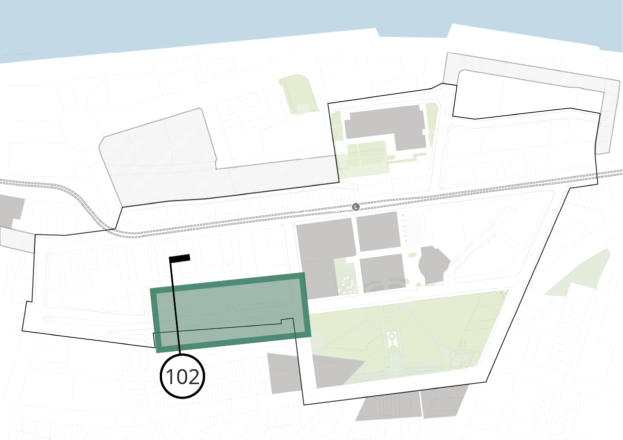
key plan
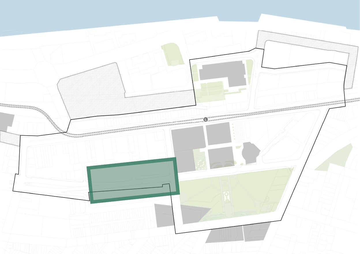
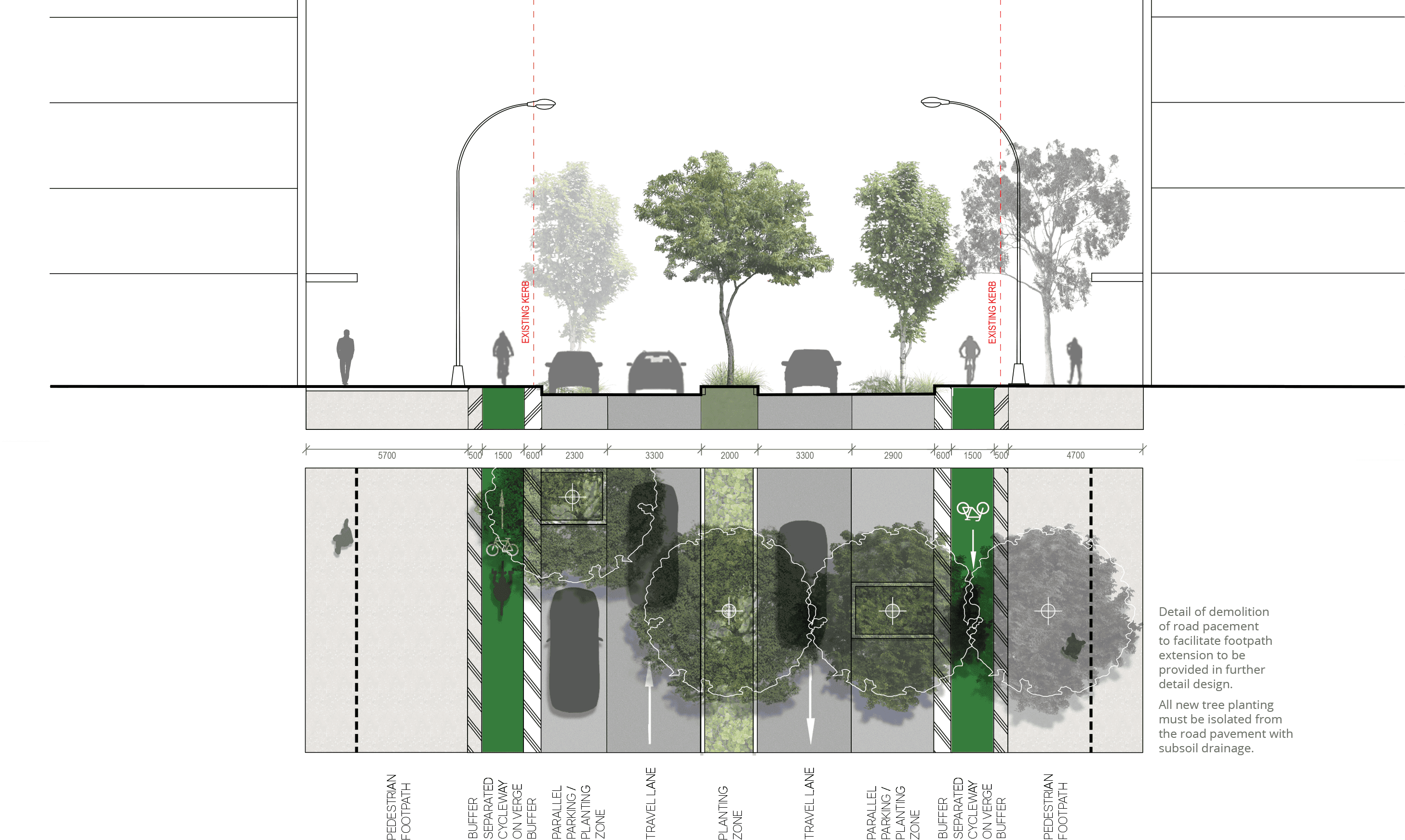
4.3.2 KING STREET section - 102
Existing
proposed
key plan
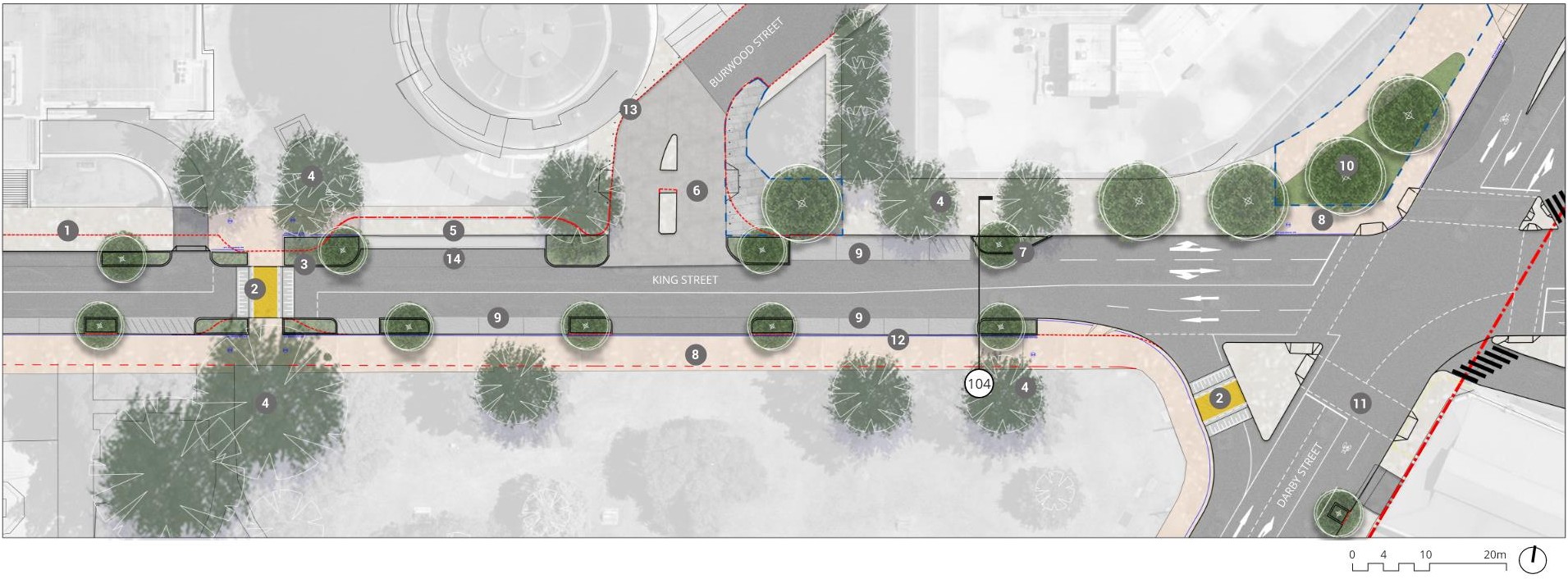
4.3.3 KING STREET plan
Long text alternative
A map of King Street that shows the proposed plan for how the street will look when it’s been upgraded. This map shows the area just east of Auckland Street.
There are numbers marked from 1 to 14 which are associated with the descriptions in the legend.
The kerb in front of University House and Christie Park (1) is to retain the existing kerb. The south side of King Street (2) is a proposed pedestrian and cycle shared path. In front of University House (3) the bus stop seating is to be moved to the back of the path to increase footpath connectivity. This is to be coordinated with the University of Newcastle.
On the north of King Street near Christie Park (4) the kerb is to be built out to accommodate a planting zone. East of Christie Street (5) there is a ‘proposed level raised threshold continuous shared path across intersection and driveway’.
In front of Christie Park and City Hall (6) the existing heritage light poles are to be retained.
We will upgrade the existing crossing on King Street between Wheeler Plaza and Civic Park (7) to a raised priority path crossing. To the east of the crossing (8) we will extend the kerb to provide a larger shared zone to ‘improve pedestrian, cycle amenity & safety’. At 2 points north and south of the crossing (9) we will narrow the footpath and use permeable paving as required to protect the existing trees. We will build out the kerb between Wheeler Plaza and Burwood Street on the north of King Street(10) to accommodate a pedestrian waiting zone.
From University House in the west to City Hall in the east (11) the existing 2.6 metre wide car spaces will be retained on both sides of the street. At the southern side of the intersection between Auckland Street and King Street (12) the existing turning lane will be retained. On the north-east corner of King Street and Aukland Street (13) We will relocate the pedestrian button and or relocate traffic post. The traffic lights at Kings Street and Aukland Street (14) will be upgraded to a scramble crossing.
Legend
|
|
Study area |
|
|
Existing kerb to be removed |
|
|
Existing footpath edge |
|
|
Carriageway / driveway |
|
|
Walkway |
|
|
Planting zone |
|
|
Proposed priority pedestrian crossing (raised) |
|
|
Level threshold /continuous shared zone at driveway/road intersection |
|
|
Shared path |
|
|
Street parking |
|
|
Existing tree |
|
|
Proposed tree |
|
|
Retain existing kerb |
|
|
Proposed pedestrian / cycle shared path |
|
|
Bus stop seating moved to back of path to increase footpath connectivity. To be coordinated with University of Newcastle |
|
|
Kerb build out to accommodate planting zone |
|
|
Proposed level raised threshold continuous shared path across intersection & driveway |
|
|
Retain existing heritage light poles |
|
|
Upgrade existing crossing to become raised priority path crossing |
|
|
Extend kerb at crossing to provide larger shared zone to improve pedestrian, cycle amenity & safety |
|
|
Narrow footpath / use permeable paving as required to protect existing trees. |
|
|
Kerb build out to accommodate pedestrian waiting zone |
|
|
Retain existing car space (2.6m wide) |
|
|
Existing turning lane retained |
|
|
Relocation of pedestrian button and\or relocation of traffic post |
|
|
Upgrade traffic lights to a scramble crossing |


key plan
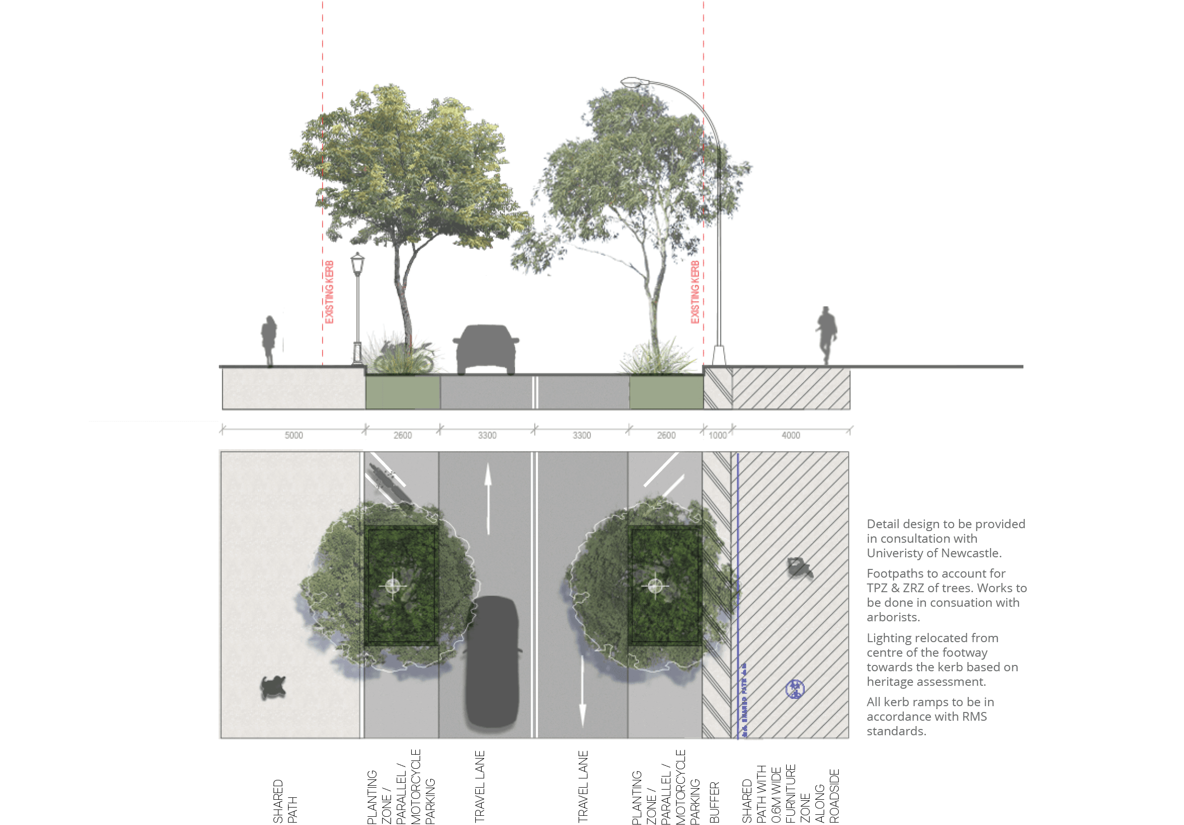
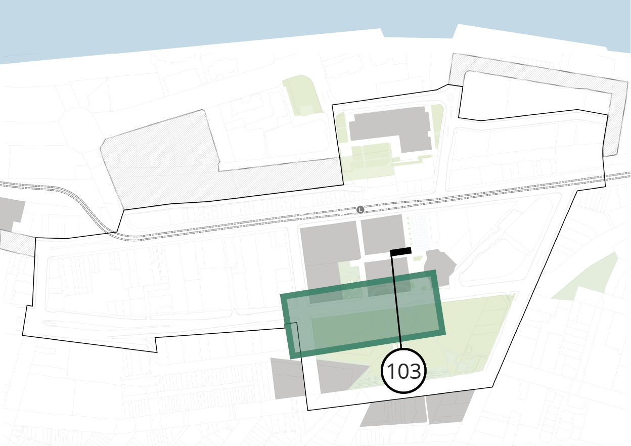
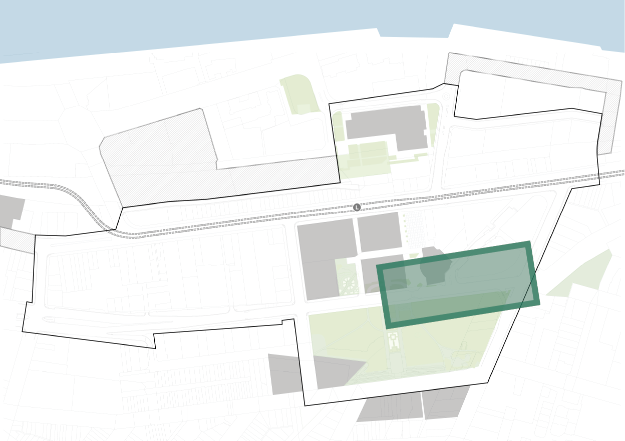
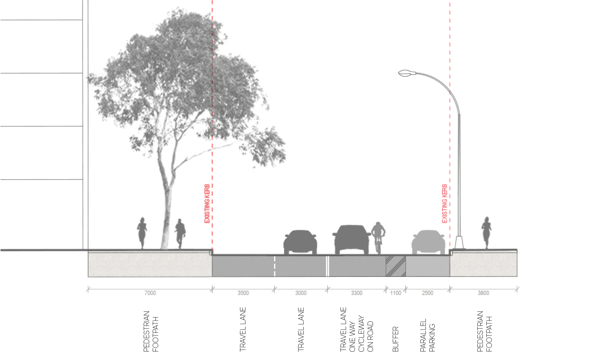
4.3.3 KING STREET section - 103
Existing
proposed
key plan
4.3.4 KING STREET plan
Long text alternative
A map of King Street that shows the proposed plan for how the street will look when it’s been upgraded. This map shows the area east of City Hall up until the intersection between King Street and Darby Street.
There are numbers marked from 1 to 14 which are associated with the descriptions in the legend.
In front of City Hall (1) there are heritage light poles to be retained.
At the pedestrian crossing between Wheeler Plaza and Civic Park, and Civic Park to the island at the intersection of Darby Street and King Street (2) the existing crossing will be upgraded to a raised priority path crossing. East of the crossing from Civic Park to Wheeler Plaza (3) the kerb will be extended to provide a larger shared zone to ‘improve pedestrian, cycle amenity & safety’.
There are 2 spots north and south of King Street near Wheeler Plaza (4) where some existing trees will be retained and protected. North of King Street between Wheeler Plaza and Burwood Street (5) the kerb is to be built out to accommodate a pedestrian waiting zone. At the entrance to Burwood Street (6) there is a ‘proposed on-road threshold/ shared zone with 3 metre wide refuge’.
On the north of King Street east of Burwood Street (7) the kerb is to be built out to accommodate trees and the cycleway.
On the south of King Street (8) is a proposed shared path. The existing 2.1 metre wide car parking spaces on the south of King Street east and west of Burwood Street (9) are to be retained.
(10) a Plaza to future detail have been identified for the large open space to the north west corner of the King Street and Darby Street intersection. The traffic lights at the crossing over Darby Street from the island at the intersection with King Street (11) will be updated to include an additional signalised pedestrian crossing.
On the south of King Street between Burwood Street and Darby Street (12) there will be a 1 metre buffer zone for street furniture.
There are proposed bollards on the west of Burwood Street near the hotel (13).
On the north of King Street west of Burwood Street (14) there is an existing dish drain to be retained.
Legend
|
|
Study area |
|
|
Existing kerb to be removed |
|
|
Existing footpath edge |
|
|
Plaza to future detail |
|
|
Carriageway / driveway |
|
|
Walkway |
|
|
Planting zone |
|
|
Proposed priority pedestrian crossing (raised) |
|
|
Level threshold /continuous shared zone at driveway/road intersection |
|
|
Shared path |
|
|
Street parking |
|
|
Existing tree |
|
|
Proposed tree |
|
|
Retain existing heritage light poles |
|
|
Upgrade existing crossing to become raised priority path crossing |
|
|
Extend kerb to provide larger shared zone to improve pedestrian, cycle amenity and safety |
|
|
Retain and protect existing trees |
|
|
Kerb build-out to accommodate pedestrian waiting zone |
|
|
Proposed on-road threshold/shared zone with 3m wide refuge |
|
|
Kerb build-out to accommodate trees and cycleway |
|
|
Proposed shared path |
|
|
Retain existing car parking space (2.1m wide) |
|
|
Plaza to future detail |
|
|
Update traffic lights to include additional signalised pedestrian crossing |
|
|
1m buffer zone for street furniture |
|
|
Proposed bollards |
|
|
Retain existing dish drain |


key plan
4.3.4 KING STREET section - 104
Existing
proposed
key plan
4.4 HUNTER STREET plan
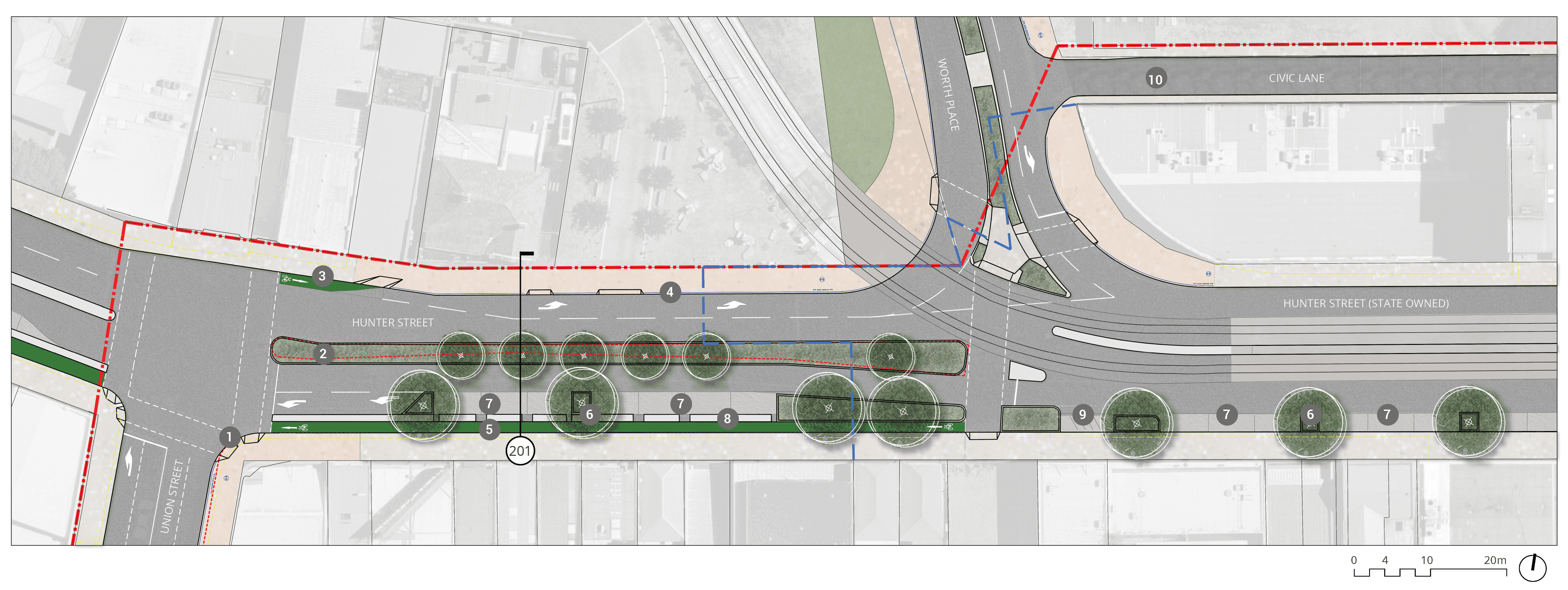
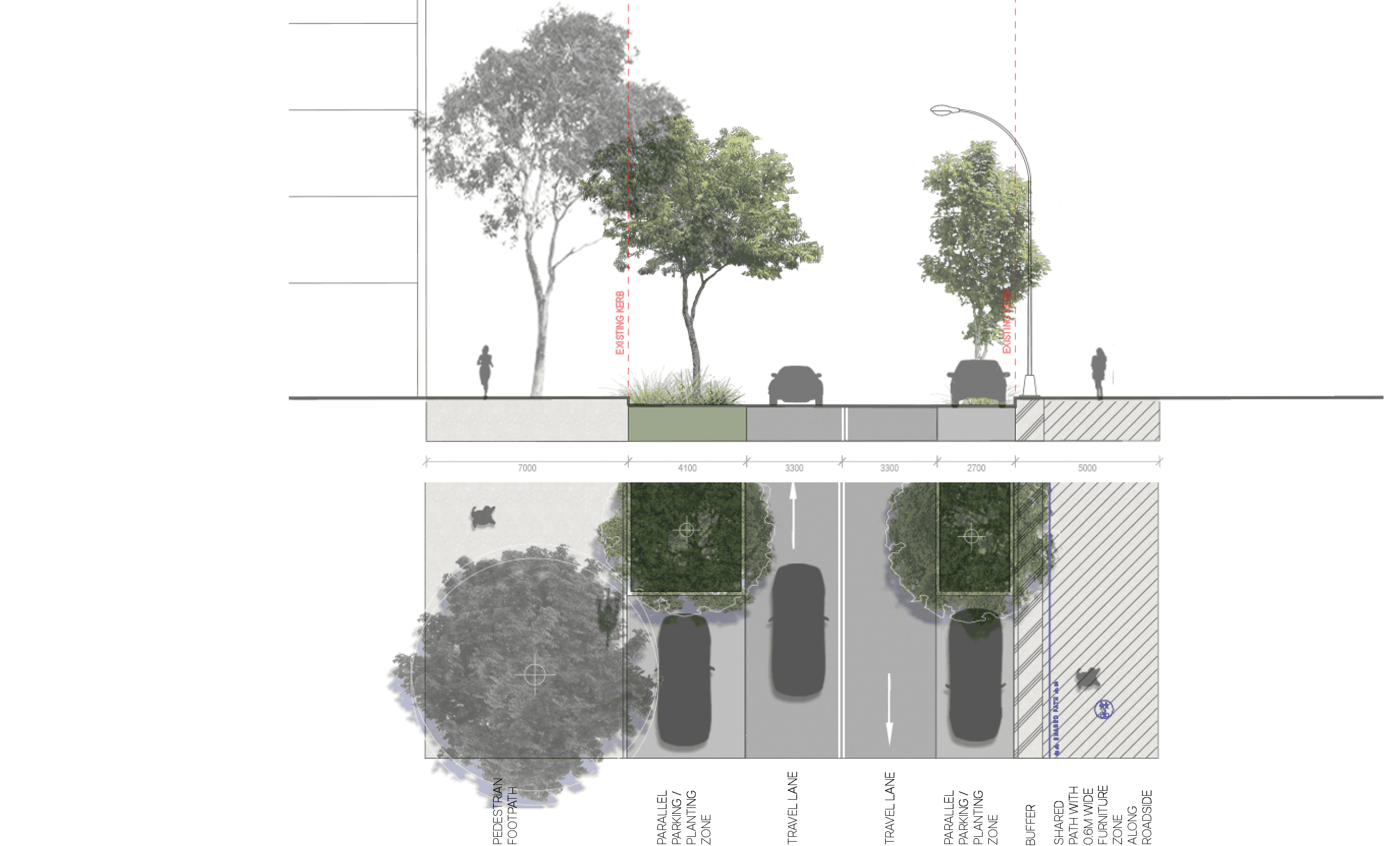
Long text alternative
A map of Hunter Street that shows the proposed plan for how the street will look when it’s been upgraded. This map shows the area east of Union Street and south of Worth Place. A red dashed line marks the boundary of the Study Area.
A dashed light blue line is drawn through the middle of the area of Hunter Street shown, going north through Worth Place and connects to Civic Lane. The east side of the line is the Extent of State-owned land.
A planting zone goes along the middle of Hunter Road from the edge of Union Street to the junction with Worth Place.
There are numbers marked from 1 to 10 which are associated with the descriptions in the legend.
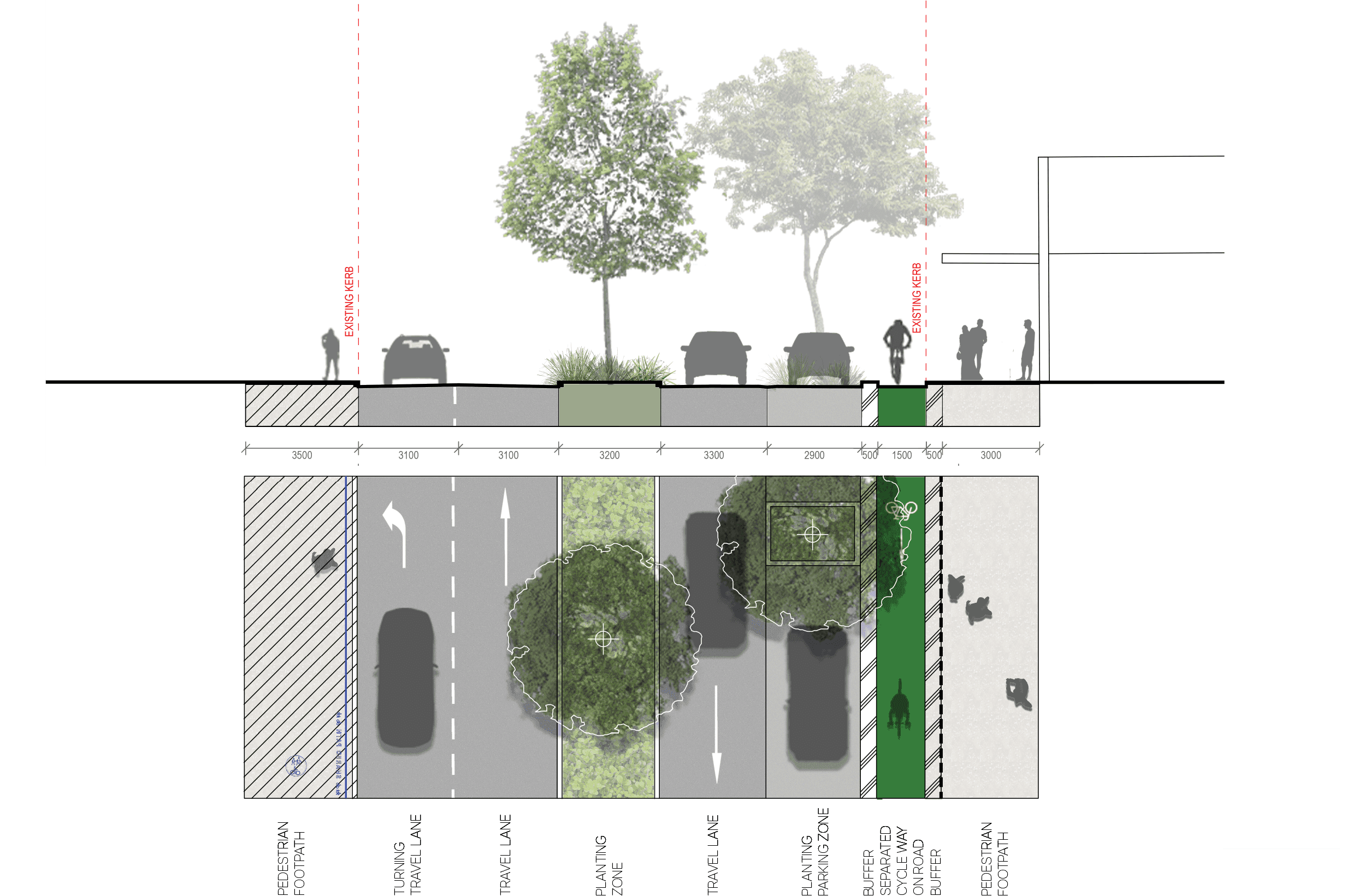
On the southeast corner of Union Street and Hunter Street there is to be an (1) upgrade to signalised intersection to include cycle phase. In the middle of Hunter Street near Union Street there is a (2) Kerb build-out to accommodate planting zone with tree planting. On the north of Hunter Street is an (3) existing on-road one-way cycleway. On the north of Hunter Street between Union Street and Worth Place is (4) retain existing kerb. On the south of Hunter Street is (5) existing cycleway to be retained, provide 0.5 metre wide buffer alongside footpath edge. On the south side of Hunter Street there are 4 spots (7) to retain existing car parking space (2.3 metres wide). Between the 2 westernmost (7) spots there is (6) remove parking to accommodate 2.5 metre wide street tree planting. There is another (6) between the 2 easternmost (7) spots. On the south of Hunter Street west of Worth Place is (8) indicating broken separators to allow for opening of car doors when parked. On the south of Hunter Street across from Worth Place is (9) existing motor bike parking to be retained. East of the intersection between Worth Place and Civic Lane is (10) a Contraflow cycle movement permitted as part of future development of University of Newcastle Campus.
Legend
|
|
Study area |
|
|
Existing kerb to be removed |
|
|
Extent of State owned land |
|
|
Carriageway / driveway |
|
|
Walkway |
|
|
Planting zone |
|
|
Cycleway |
|
|
Level threshold /continuous shared zone at driveway/road intersection |
|
|
Shared path |
|
|
Street parking |
|
|
Existing tree |
|
|
Proposed tree |
|
|
Upgrade to signalized intersection to include cycle phase |
|
|
Kerb build-out to accommodate planting zone with tree planting |
|
|
Existing on-road one-way cycleway |
|
|
Retain existing kerb |
|
|
Existing cycleway to be retained provide 0.5m wide buffer alongside footpath edge |
|
|
Remove parking to accommodate 2.5m wide street tree planting |
|
|
Retain existing car parking space (2.3m wide) |
|
|
Brocken separators to allow for opening of car door when parked |
|
|
Existing motor bike parking to be retained |
|
|
Contraflow cycle movement permitted as part of future development of University of Newcastle Campus |


key plan
4.4 HUNTER STREET section - 201
Existing
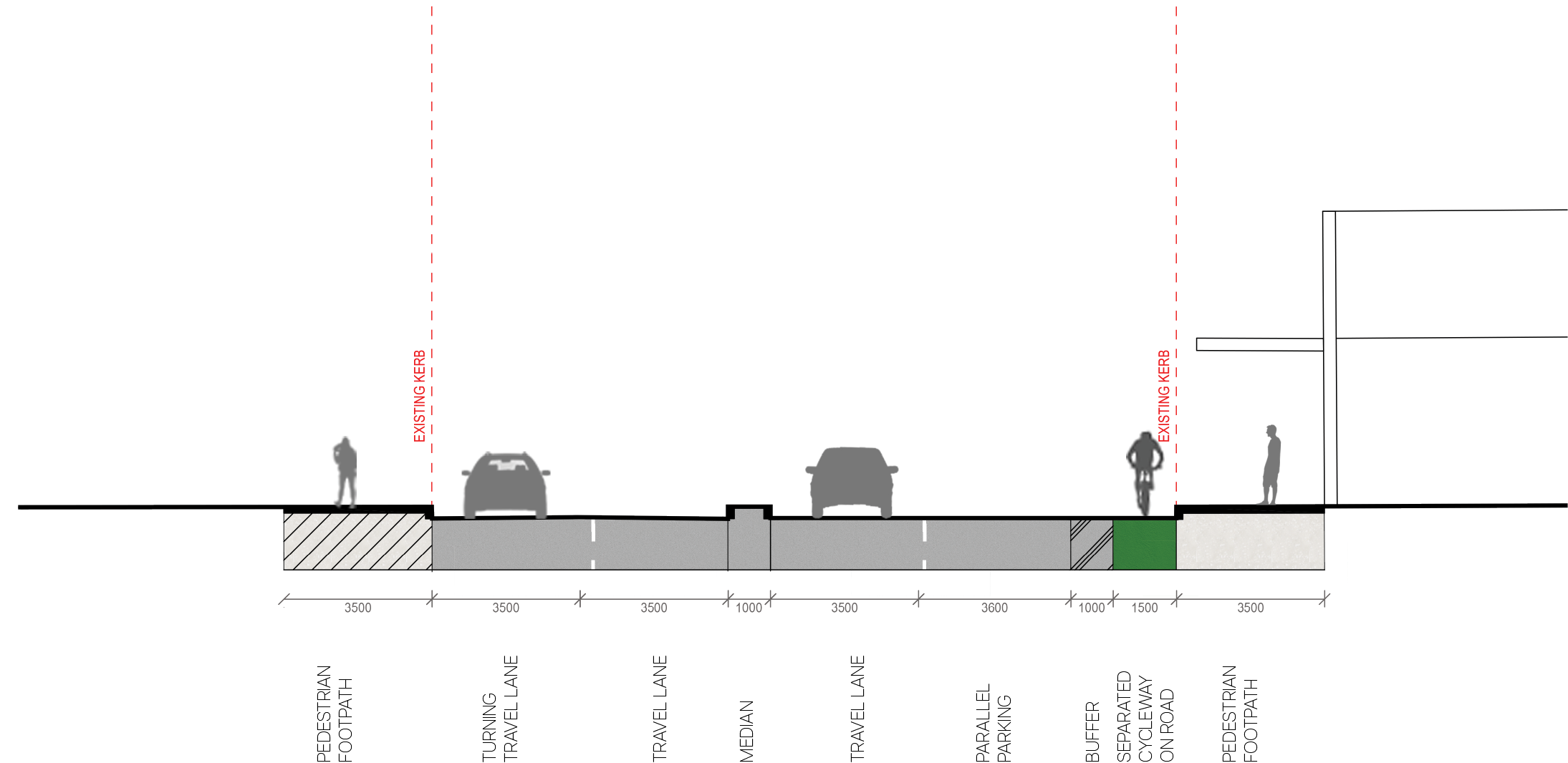
proposed
key plan
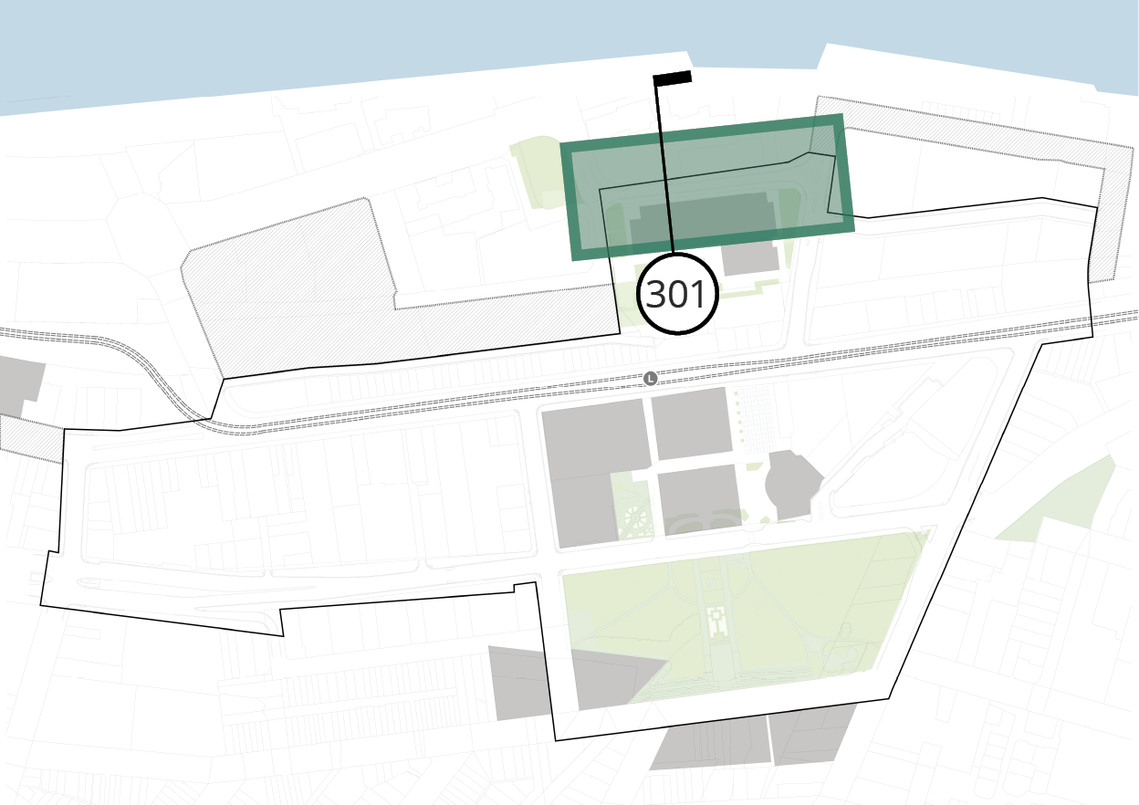
4.5 WORKSHOP WAY plan
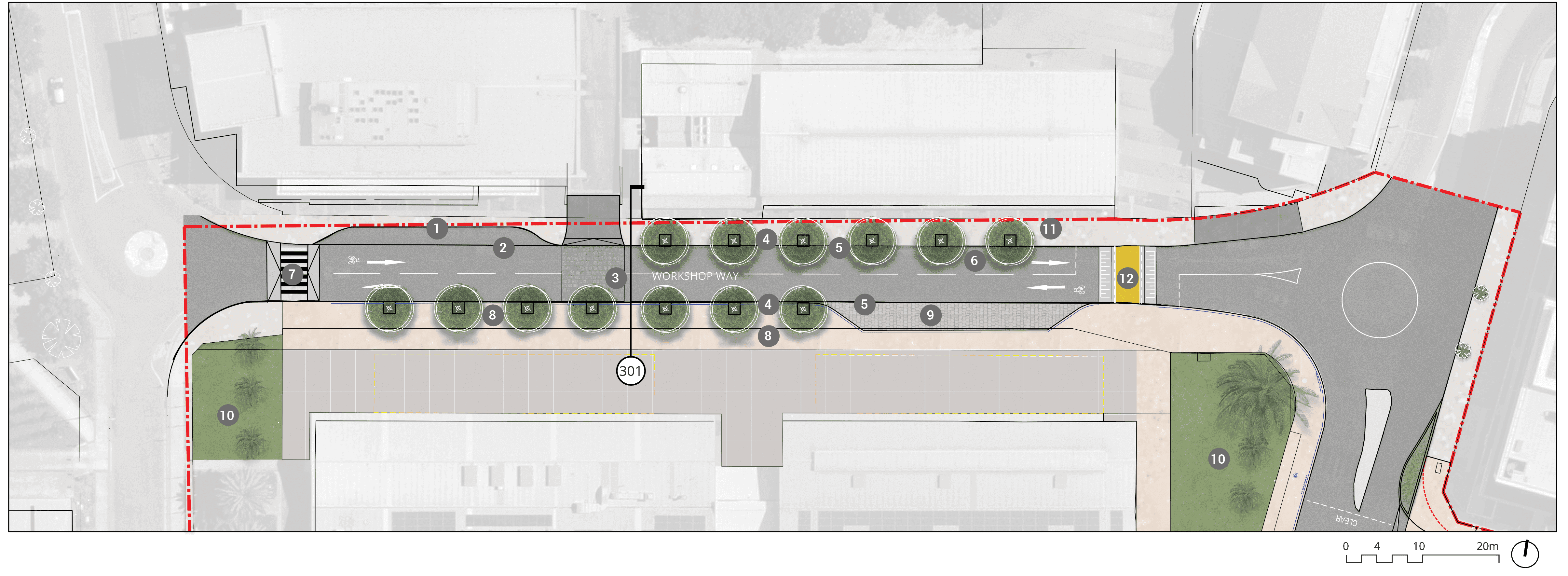
Long text alternative
A map of Workshop Way that shows the proposed plan for how the street will look when it’s been upgraded.
There are numbers marked from 1 to 13 which are associated with the descriptions in the legend.
On the northwestern side of workshop way (1) there is an existing loading zone to be retained, it is a ‘paved area to read as part of pedestrian zone’. Slightly east of this (2) there is a proposed dish drain. Near the middle of Workshop Way (3) there will be ‘feature cobble for traffic calming’ across the road.
On both the north and south side of Workshop Way (4) there are existing bollards to be removed. The northern side and a section of the southern side of Workshop Way (5) will change the kerb from a roll kerb to a standard box gutter to manage the footpath level and accessibility.
On the road (6) there will be an on-road cycle provision (quietway). At the end of Workshop Way on the western side (7) we are to upgrade the existing crossing to become a raised pedestrian crossing.
The southern side of the street (8) will be a shared pedestrian and cycle path. On the eastern end of the south side of the street (9) there is a proposed coach pull-in bay. It will be a ‘paved area to read as part of pedestrian zone’.
On the northeastern side of the street (11) we are to improve the footpath levels to be accessible. The final levels are to be confirmed in a future detail.
The existing crossing on the eastern end of Workshop Way (12) is to be upgraded to become a raised priority path crossing.
On both far ends of the south side of Workshop Way (10) there are existing street plazas.
Legend
|
|
Study area |
|
|
Existing kerb to be removed |
|
|
Carriageway / driveway |
|
|
Walkway |
|
|
Proposed priority pedestrian crossing (raised) |
|
|
Level threshold /continuous shared zone at driveway/road intersection |
|
|
Shared path |
|
|
Coach pull-in bay |
|
|
Existing tree |
|
|
Proposed tree |
|
|
Retain existing loading zone (paved area to read as part of pedestrian zone) |
|
|
Proposed dish drain |
|
|
Feature cobble for traffic calming |
|
|
Existing bollards to be removed |
|
|
Change kerb from roll kerb to standard box gutter to manage footpath level and accessibility |
|
|
On-road cycle provision (quietway) |
|
|
Upgrade existing crossing to become raised pedestrian crossing |
|
|
Shared pedestrian / cycle path |
|
|
Proposed coach pull-in bay (paved area to read as part of pedestrian zone) |
|
|
Existing street plaza |
|
|
Improve footpath levels to be accessible, final levels to be confirmed in future detail |
|
|
Upgrade existing crossing to become raised priority path crossing |


key plan
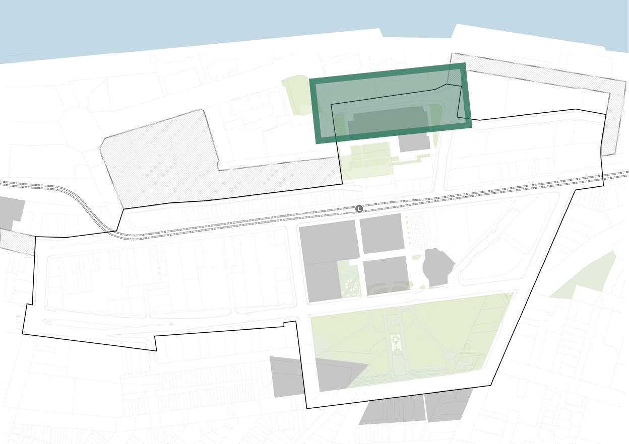
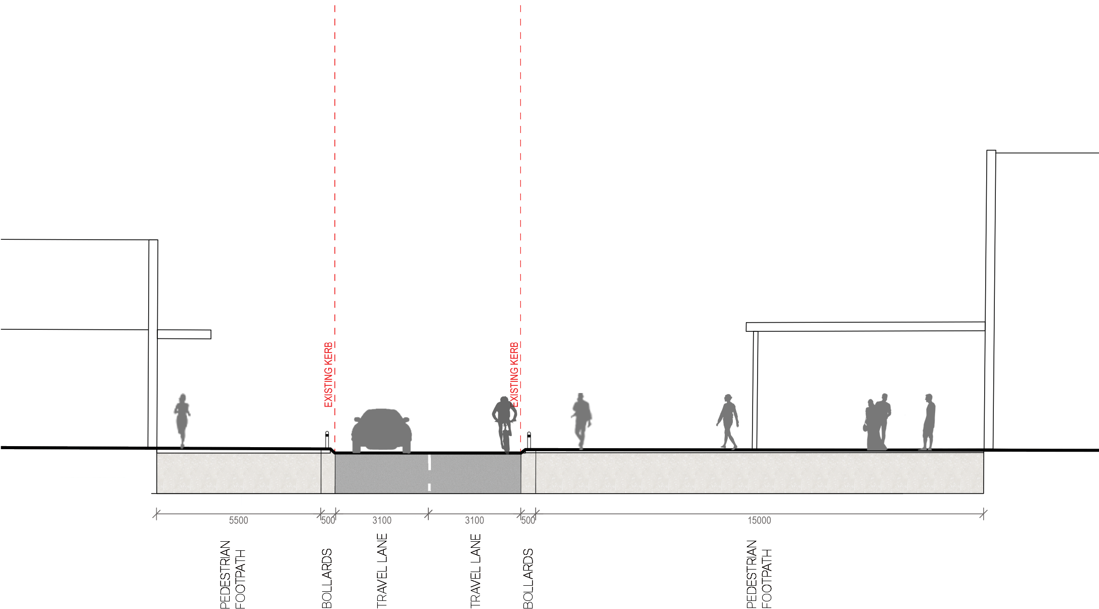
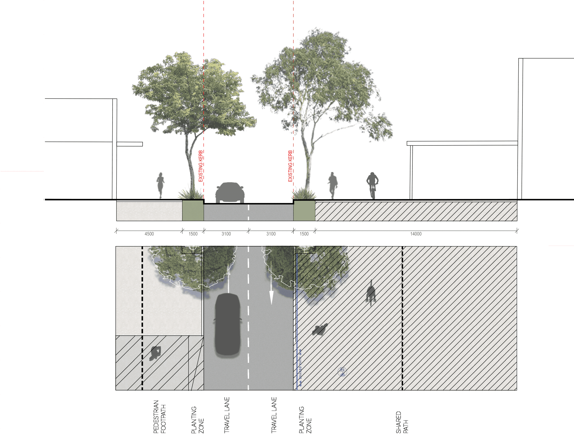
4.5 WORKSHOP WAY section - 301
Existing
proposed
key plan
4.6 UNION STREET plan
Legend
|
|
Study area |
|
|
Existing kerb to be removed |
|
|
Carriageway |
|
|
Walkway |
|
|
Planting zone |
|
|
Cycleway |
|
|
Level threshold /continuous shared zone at driveway/road intersection |
|
|
Shared path |
|
|
Existing tree |
|
|
Proposed tree |
|
|
Existing in-lane bus stop to be retained |
|
|
700mm kerb extension |
|
|
Proposed shared path |
key plan
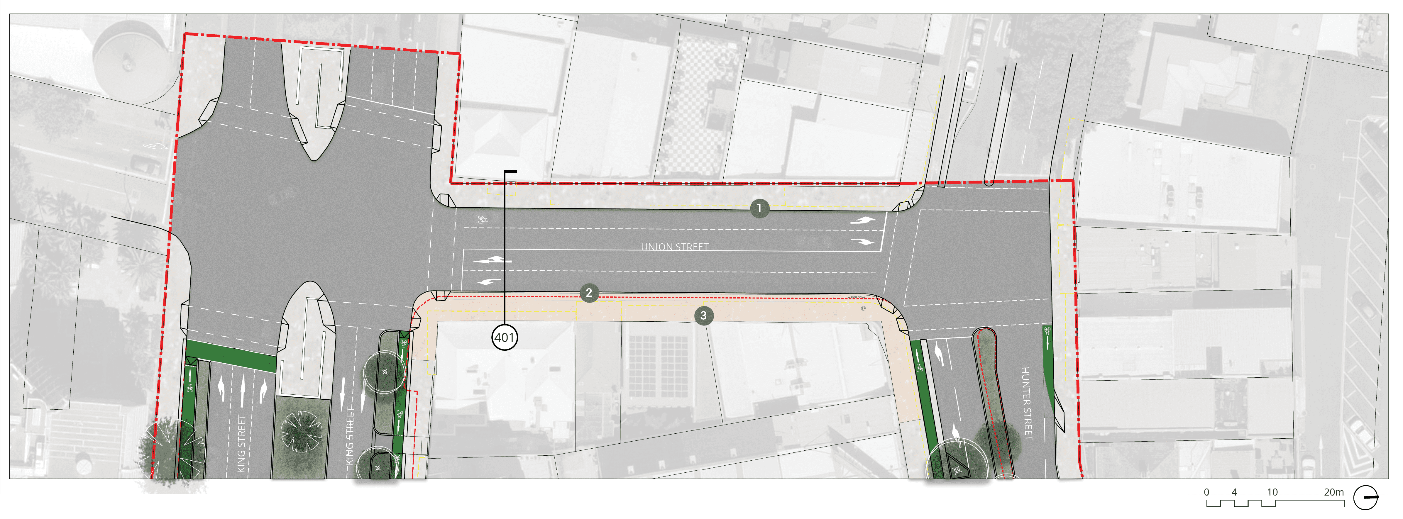
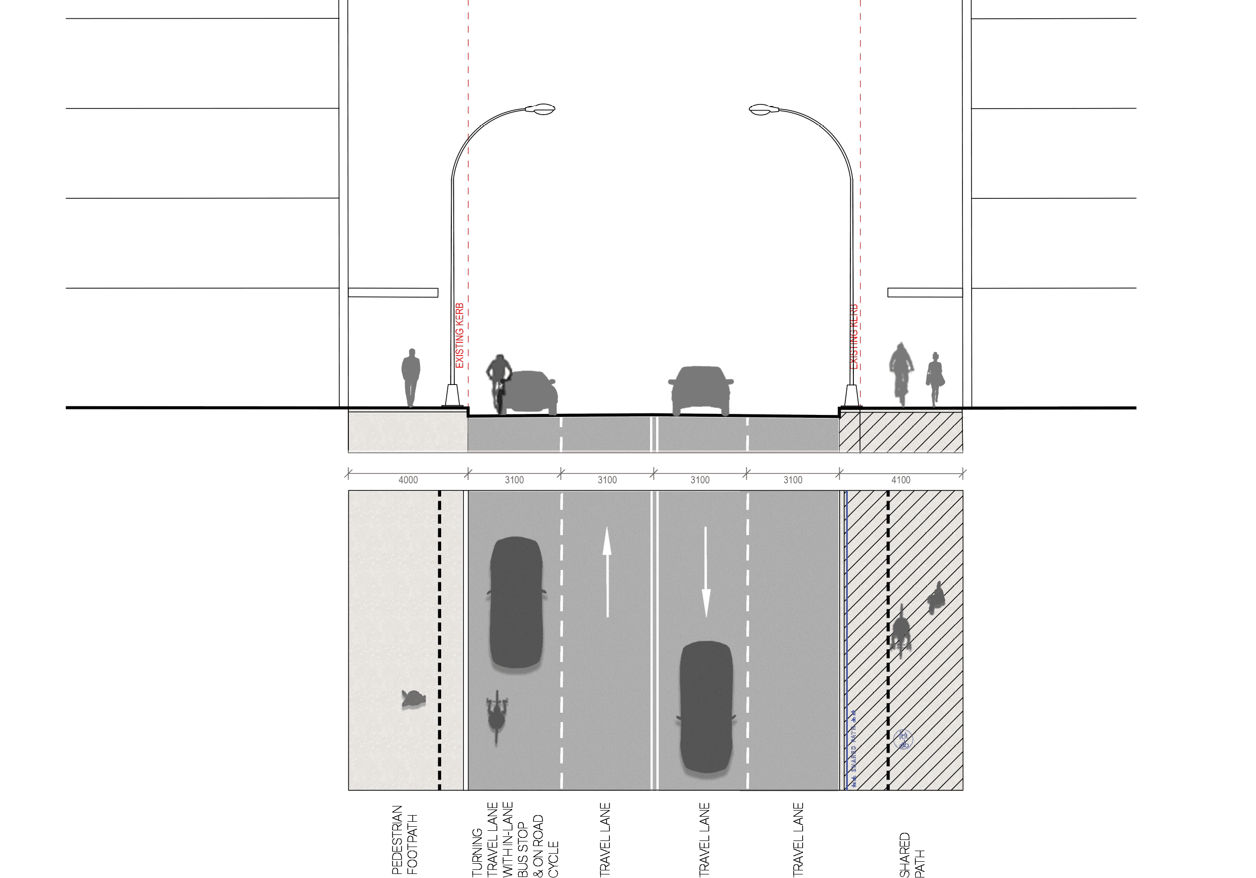
4.6 UNION STREET section - 401
Existing
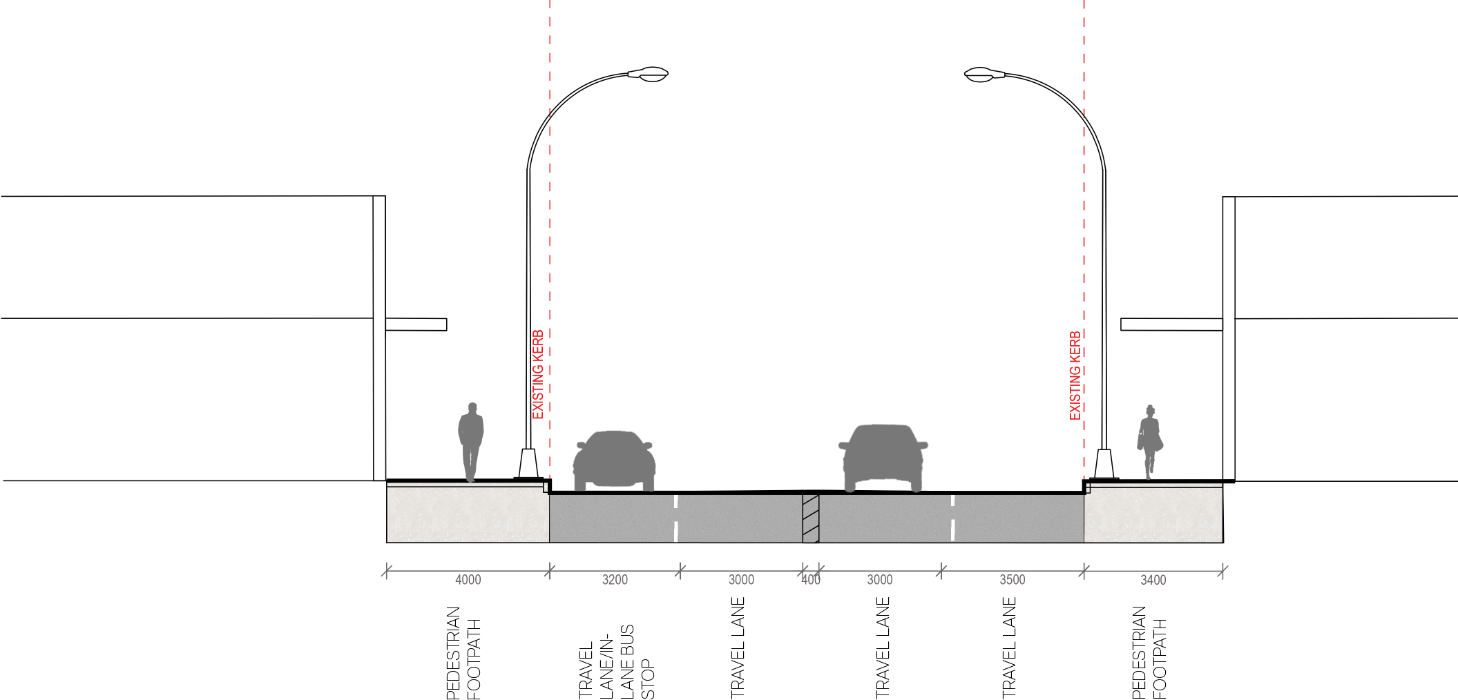
proposed
key plan
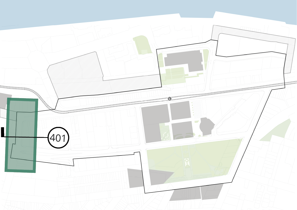
4.7.1 AUCKLAND STREET (SOUTH) plan
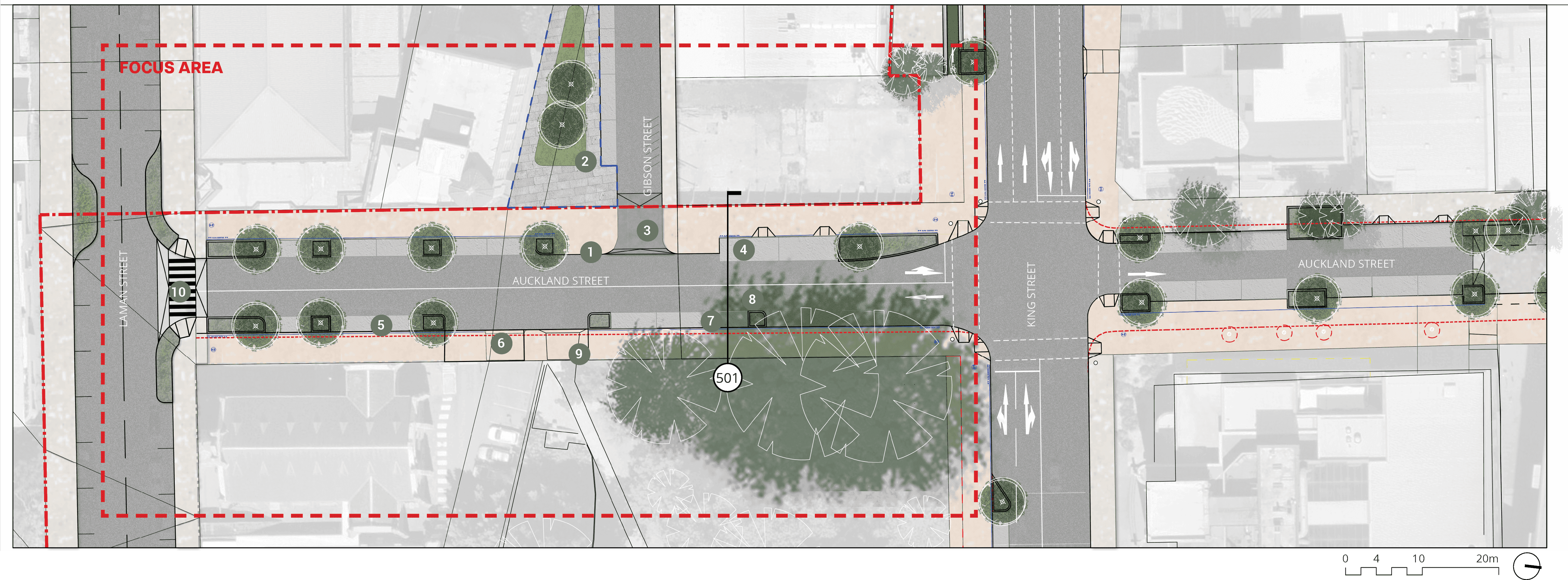
Long text alternative
A map of the south of Auckland Street that shows the proposed plan for how the street will look when it’s been upgraded.
The map includes the intersections with Laman Street and King Street.
There is a rectangle marking the area of Auckland Street that extends from King Street to the middle of Laman Street that is marked as the focus area.
There are numbers marked from 1 to 10 which are associated with the descriptions in the legend.
On the southern corner of Gibson Street and Auckland Street (1) there is a kerb extension to reduce the crossing distance to the park. On the southern side of Gibson Street (2) there’s a proposed kerb extension and a proposal to create a plaza space to ‘reduce the crossing distance’. At the entrance to Gibson Street (3) there is a proposed shared zone with a raised threshold and a continuous shared path across the intersection.
On the west side of Auckland Street between Gibson Street and King Street (4) there are 2 DDA parking spaces that are to be retained. On the east side of Auckland Street towards Laman Street (5) there is a proposed kerb extension. Slightly north of this (6) there is a proposed continuous footpath and shared path across a driveway. Slightly north of that by the beginning of the path in Civic Park (9) there is a proposed continuous footpath and shared path across a driveway to an existing maintenance driveway.
Across from the entrance to Gibson Street (7) there is an existing 2.3 metre wide parking space that will be retained. Running down Auckland Street (8) there is an existing on-road cycle provision and the ‘mixed traffic (quietway)’ to be retained.
At the intersection of Auckland Street and Laman Street (10) there is a proposal for a raised pedestrian crossing running from west to east.
Legend
|
|
Study area |
|
|
Existing kerb to be removed |
|
|
Plaza to future detail |
|
|
Carriageway / driveway |
|
|
Walkway |
|
|
Planting zone |
|
|
Cycleway |
|
|
Level threshold /continuous shared zone at driveway/road intersection |
|
|
Shared path |
|
|
Street parking |
|
|
Existing tree |
|
|
Proposed tree |
|
|
Kerb extension to reduce crossing distance to park |
|
|
Propose kerb extension / create plaza space to reduce crossing distance |
|
|
Proposed shared zone/ raised threshold/ continuous shared path across intersection |
|
|
Retain two DDA parking spaces |
|
|
Proposed kerb extension |
|
|
Proposed continuous footpath and shared path across driveway |
|
|
Retain existing parking space (2.3m wide) |
|
|
Existing on-road cycle provision / mixed traffic (Quietway) to be retained |
|
|
Proposed continuous footpath and shared path across driveway to existing maintenance driveway |
|
|
Proposed raised pedestrian crossing |

key plan
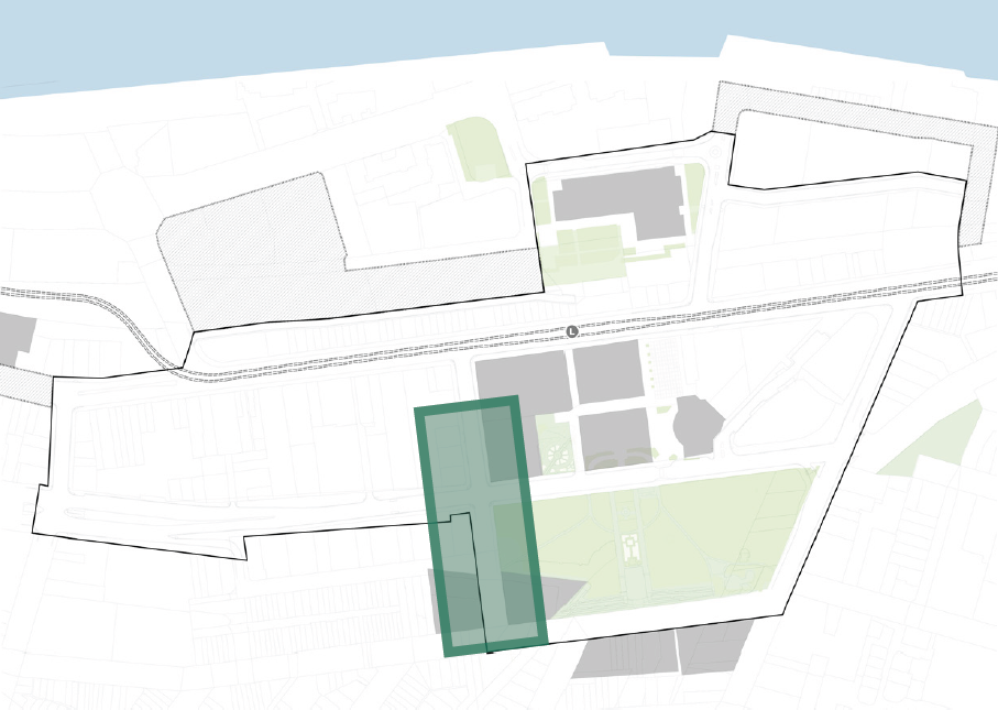
4.7.1 AUCKLAND STREET (SOUTH) section - 501
Existing
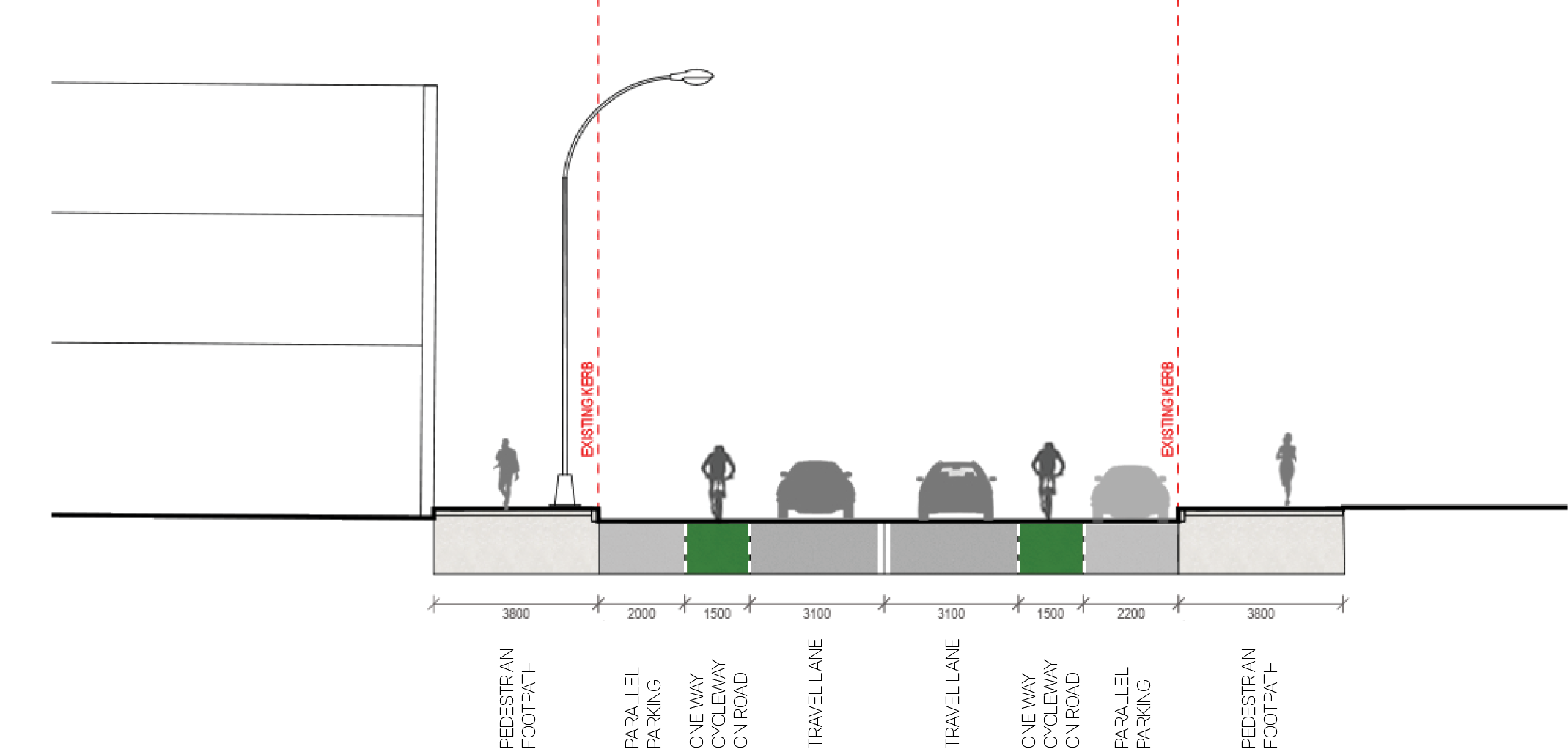
proposed
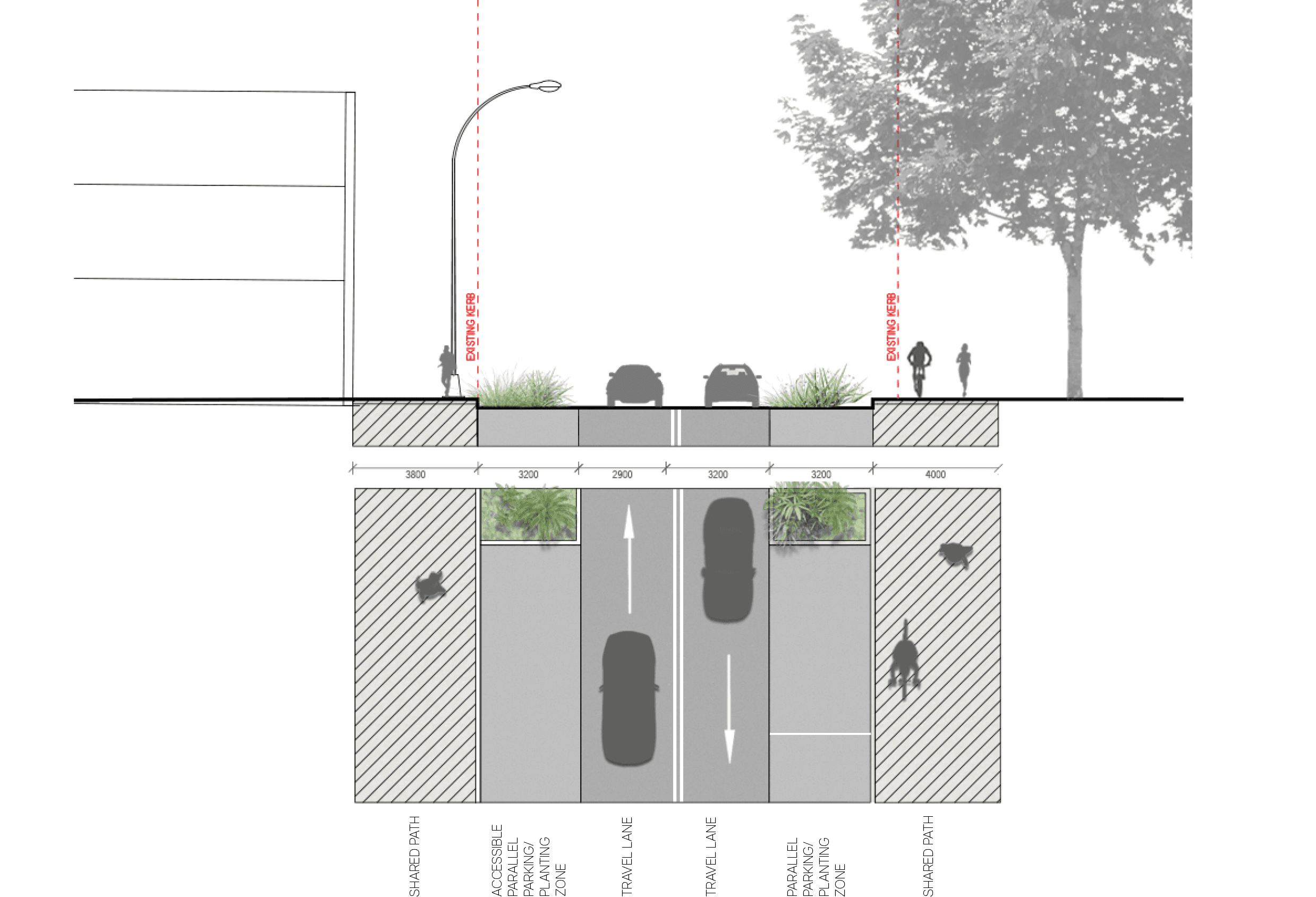
key plan
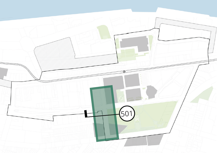
4.7.2 AUCKLAND STREET (NORTH) plan
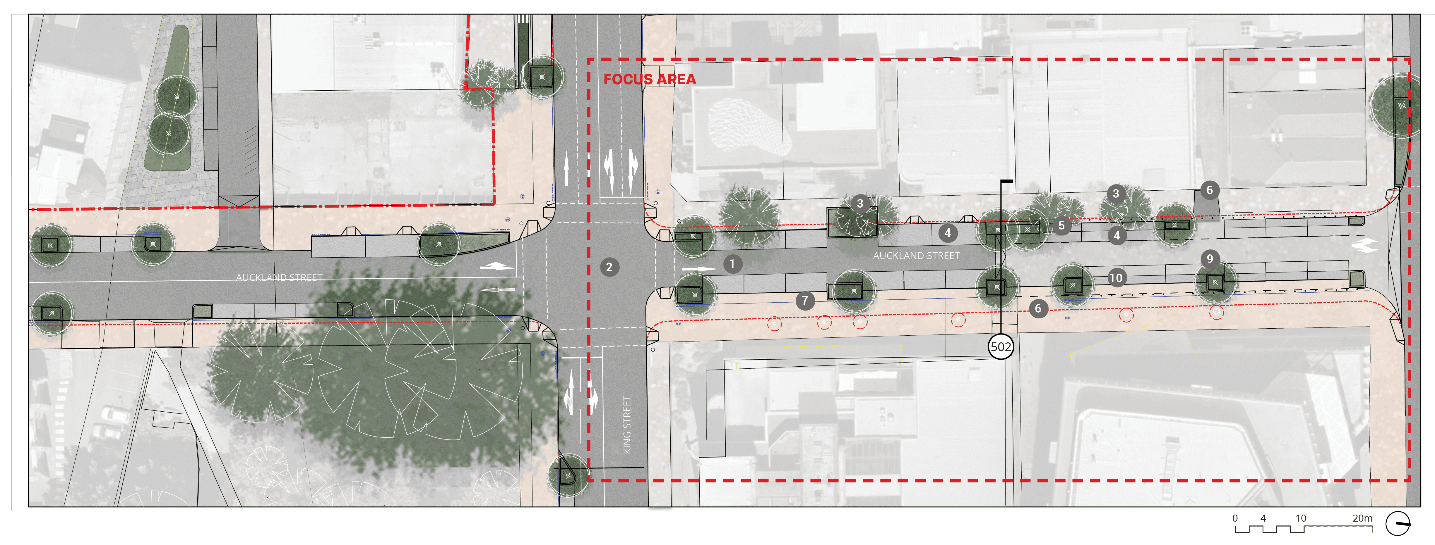
Long text alternative
A map of Auckland Street (north) that shows the proposed plan for how the street will look when it’s been upgraded. The area marked is south of King Street. The top of the map is facing east.
There are numbers marked from 1 to 10 which are associated with the descriptions in the legend.
Just north of the intersection of Auckland Street and King Street (1) there is a Northbound vehicular travel, where use of parking zone to maintain 7 metre clear travel in two directions for events times. In the middle of the intersection of King Street and Aukland Street (2) is an upgrade to traffic lights to a scramble crossing. Just north east of (1) on the footpath is a (7) proposed tree planting to replace existing failing trees. Across the road from (7) is (3) a plan to retain existing trees. North of (3) is (4) a plan to retain two existing accessible parking spaces 3.2 metres wide. North from that is (5) a tree pit to be replaced with bio-retention pit. A little bit north of that is another two spots labelled as number (3) and (4). There are two spots across the road from (5) and north of (5) where (6) a plan to maintain driveway access. On the northeast of Aukland Street is (10) proposed bollards. Further north from (10) is a (9) 10km/h shared pedestrian cycle/vehicle zone.
Legend
|
|
Study area |
|
|
Existing kerb to be removed |
|
|
Carriageway / driveway |
|
|
Walkway |
|
|
Planting zone |
|
|
Cycleway |
|
|
Level threshold /continuous shared zone at driveway/road intersection |
|
|
Driveway |
|
|
Shared path |
|
|
Street parking |
|
|
Existing tree |
|
|
Proposed tree |
|
|
Northbound vehicular travel. Use of parking zone to maintain 7m clear travel in two directions for events times. |
|
|
Upgrade traffic lights to a scramble crossing |
|
|
Retain existing trees |
|
|
Retain two existing accessible parking spaces 3.2m wide |
|
|
Tree pit to be replaced with bio-retention pit |
|
|
Maintain driveway access |
|
|
Proposed tree planting to replace existing failing trees |
|
|
2.7m wide carparking zone |
|
|
10km/h shared pedestrian cycle / vehicle zone |
|
|
Proposed bollards |


key plan
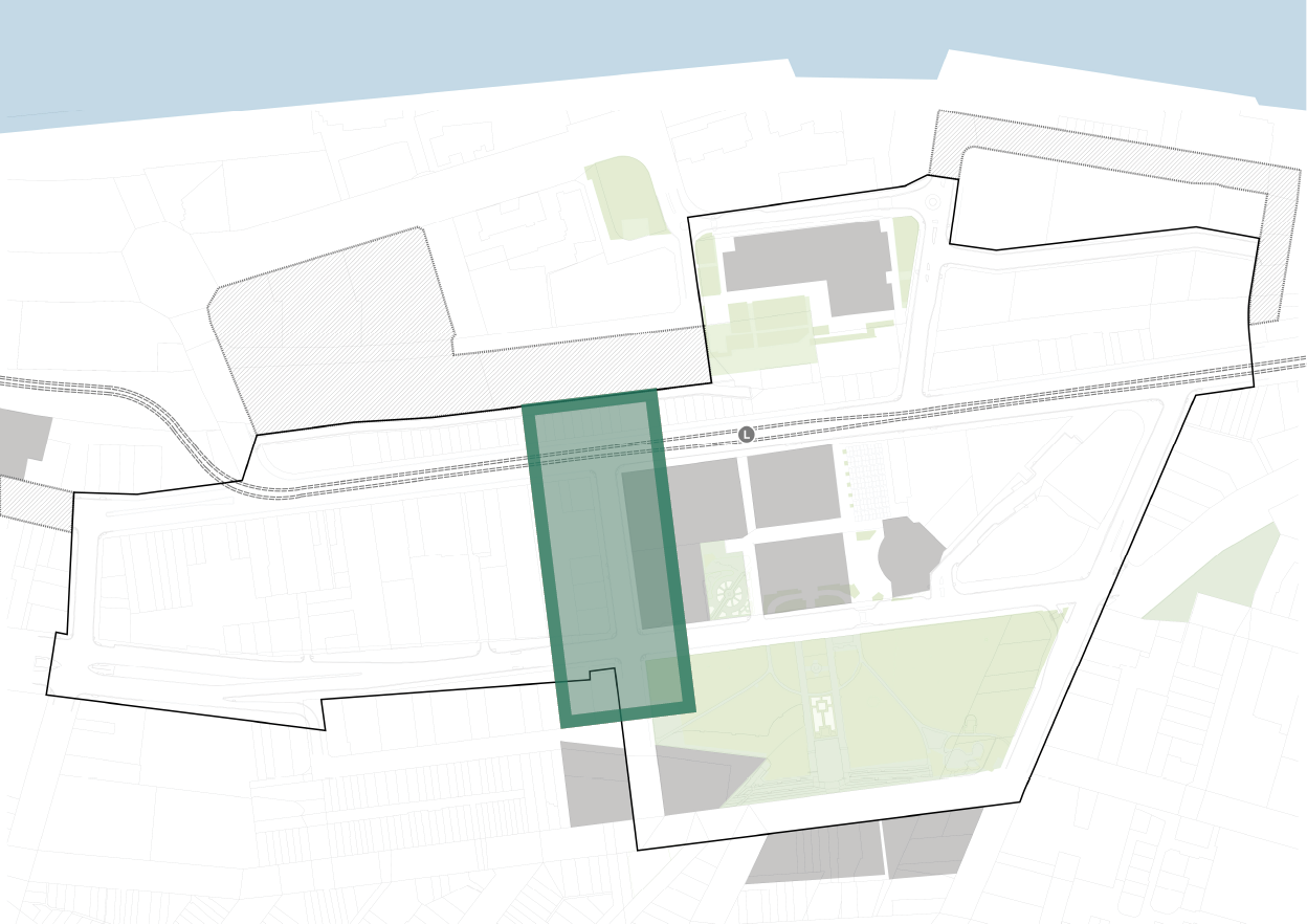
4.7.2 AUCKLAND STREET (NORTH) section - 502
Existing
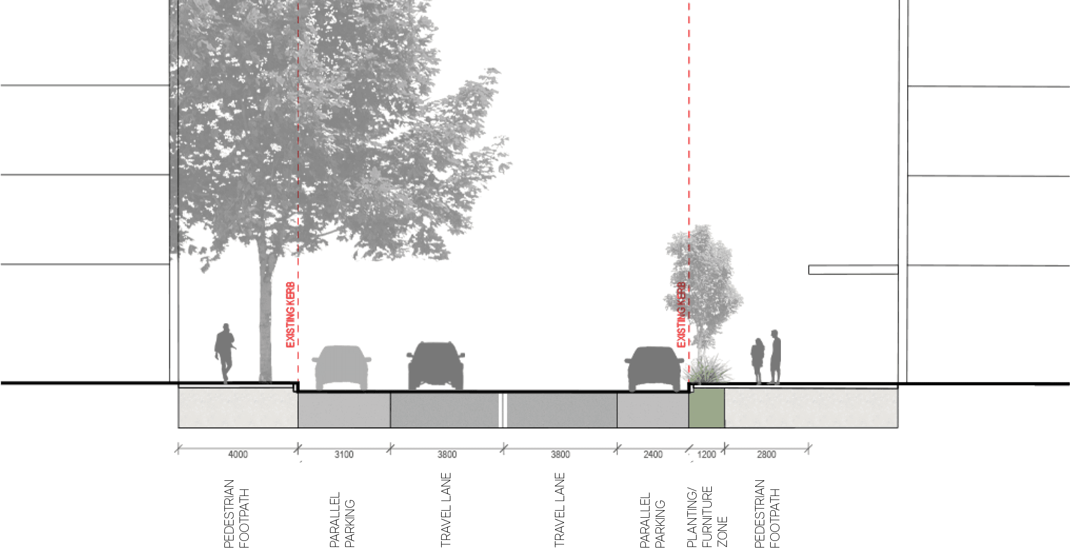
proposed
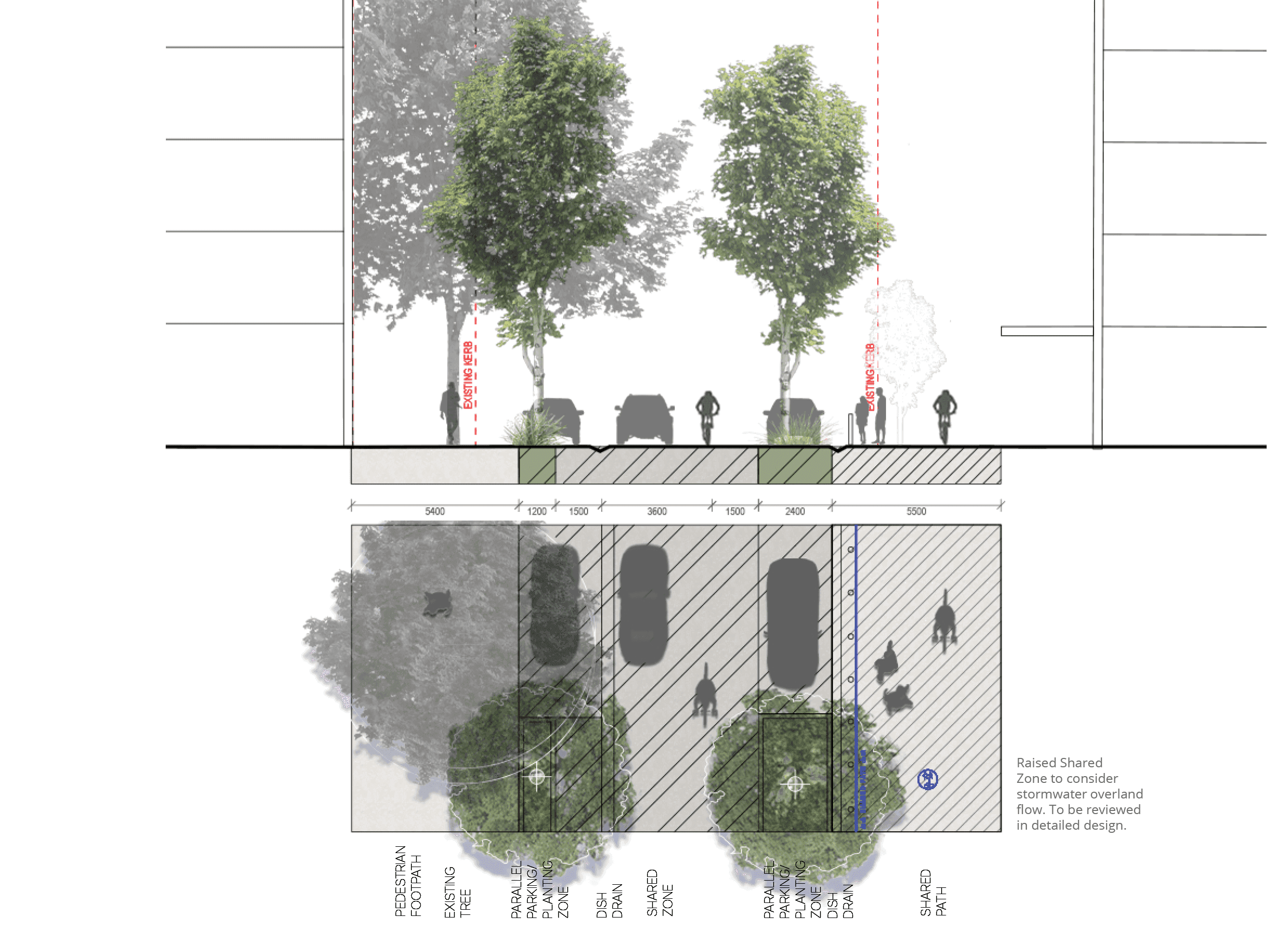
key plan
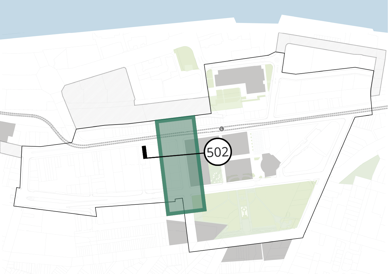
4.8.1 DARBY STREET (SOUTH) plan
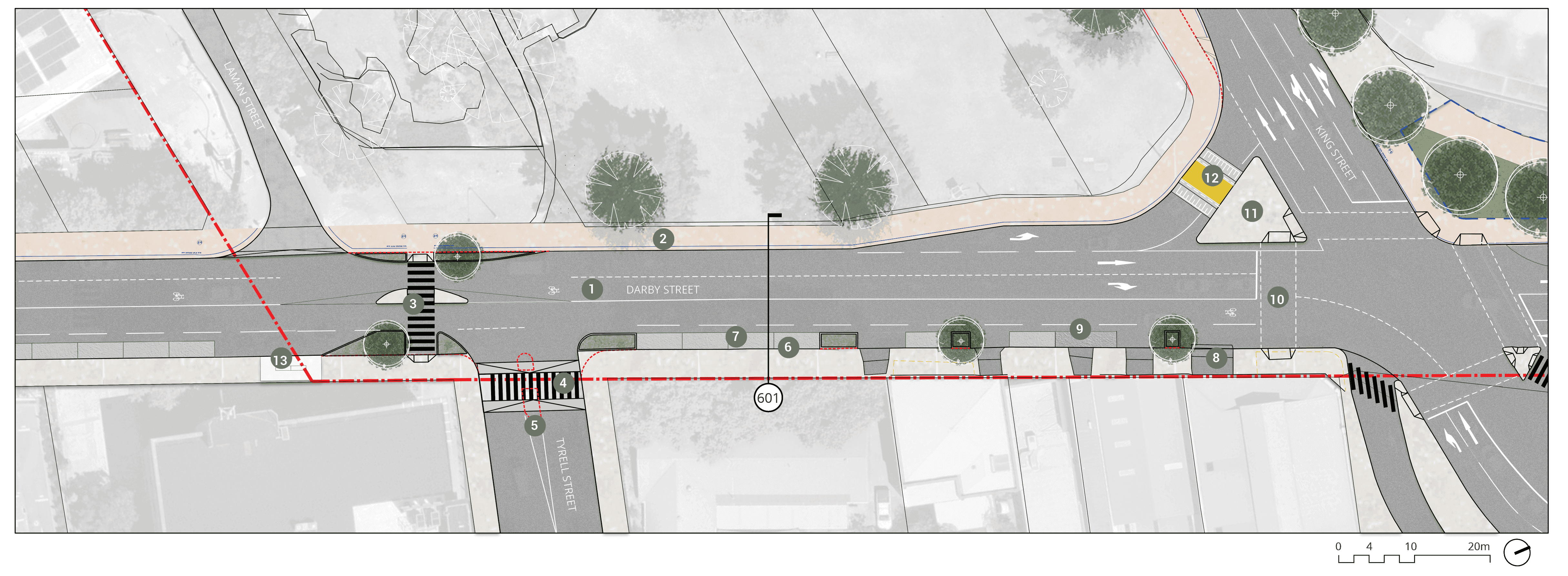
Long text alternative
A map of Darby Street (South) that shows the proposed plan for how the street will look when it’s been upgraded. The top of the map is facing northeast.
There are numbers marked from 1 to 13 which are associated with the descriptions in the legend.
On the south-most side is a (13) relocated bus shelter, which is just outside the Study Area boundary. Just south of Tyrell Street on Darby Street is a (3) proposed pedestrian crossing. At the intersection of Tyrell Street and Darby Street is a (4) proposed raised threshold pedestrian crossing and (5) an existing refuge island to be demolished. Just west of the intersection is (1) an existing on-road cycle provision / mixed traffic to be retained. On the west of Darby Street is (2) a proposed shared pedestrian/cycle footpath. On the east of Darby Street is a plan to (6) retain existing kerb, and to (7) retain existing kiss and ride parking. Further north is a plan to (8) retain existing driveways and (9) retain existing loading zone (2.5 metres wide). At the intersection of King Street and Darby Street, there is a (10) proposed signalised pedestrian crossing to southern leg of intersection. There is a slip road to turn west from Darby Street onto King Street with a road island. On the road island is a plan to (11) retain existing refuge island. On the slip road is a plan to (12) upgrade existing crossing to become raised priority path crossing.
Legend
|
|
Study area |
|
|
Existing kerb to be removed |
|
|
Plaza to future detail |
|
|
Carriageway / driveway |
|
|
Walkway |
|
|
Planting zone |
|
|
Proposed priority pedestrian crossing (raised) |
|
|
Level threshold /continuous shared zone at driveway/road intersection |
|
|
Shared path |
|
|
Street parking |
|
|
Existing tree |
|
|
Proposed tree |
|
|
Existing on-road cycle provision / mixed traffic to be retained |
|
|
Proposed shared pedestrian/cycle footpath |
|
|
Proposed pedestrian crossing |
|
|
Proposed raised threshold pedestrian crossing |
|
|
Existing refuge island to be demolished |
|
|
Retain existing kerb |
|
|
Retain existing kiss and ride parking |
|
|
Retain existing driveways |
|
|
Retain existing loading zone (2.5m W) |
|
|
Proposed signalised pedestrian crossing to southern leg of intersection |
|
|
Retain existing refuge island |
|
|
Upgrade existing crossing to become raised priority path crossing |
|
|
Relocated bus shelter |


key plan
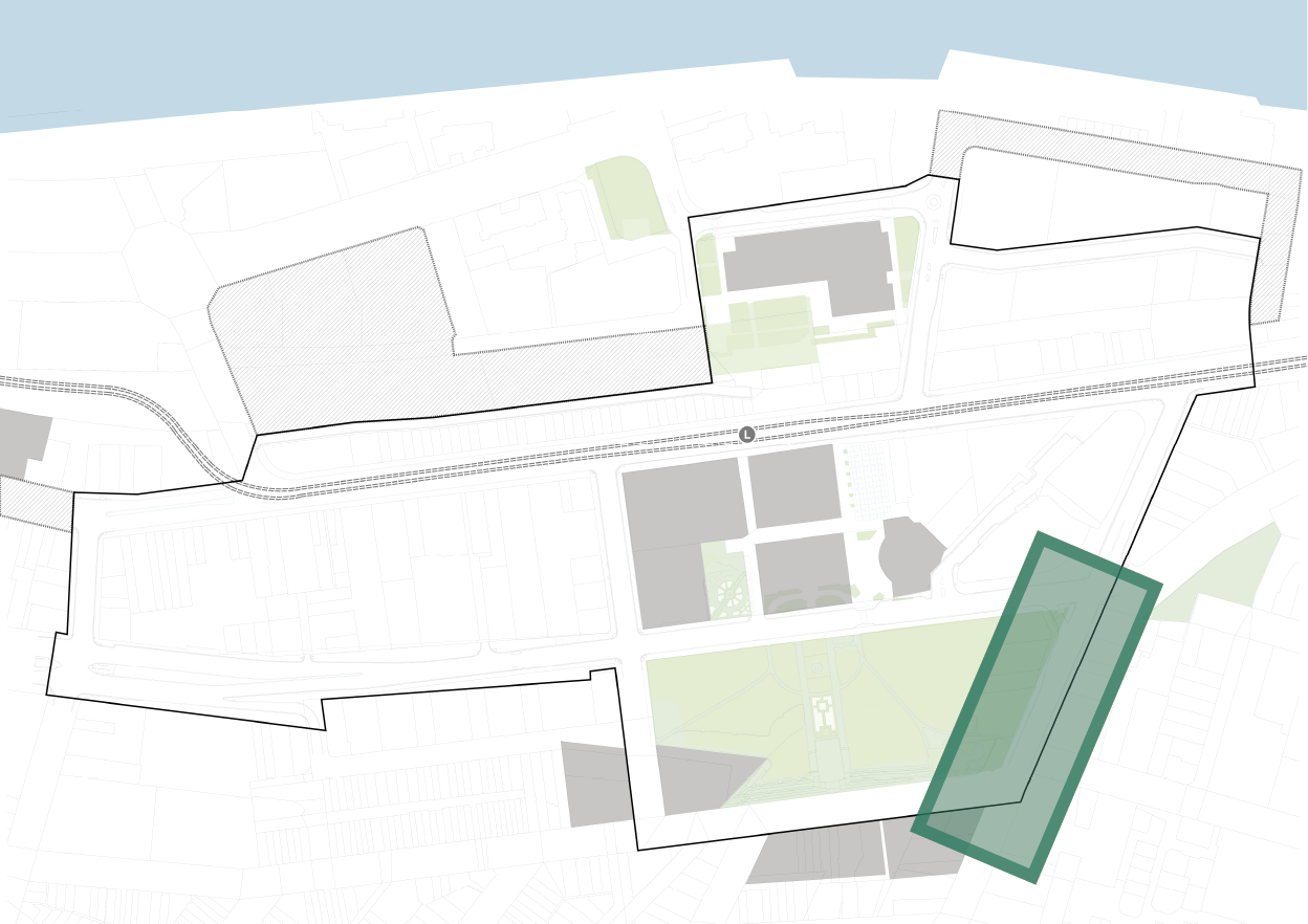
4.8.1 DARBY STREET (SOUTH) section - 601
Existing
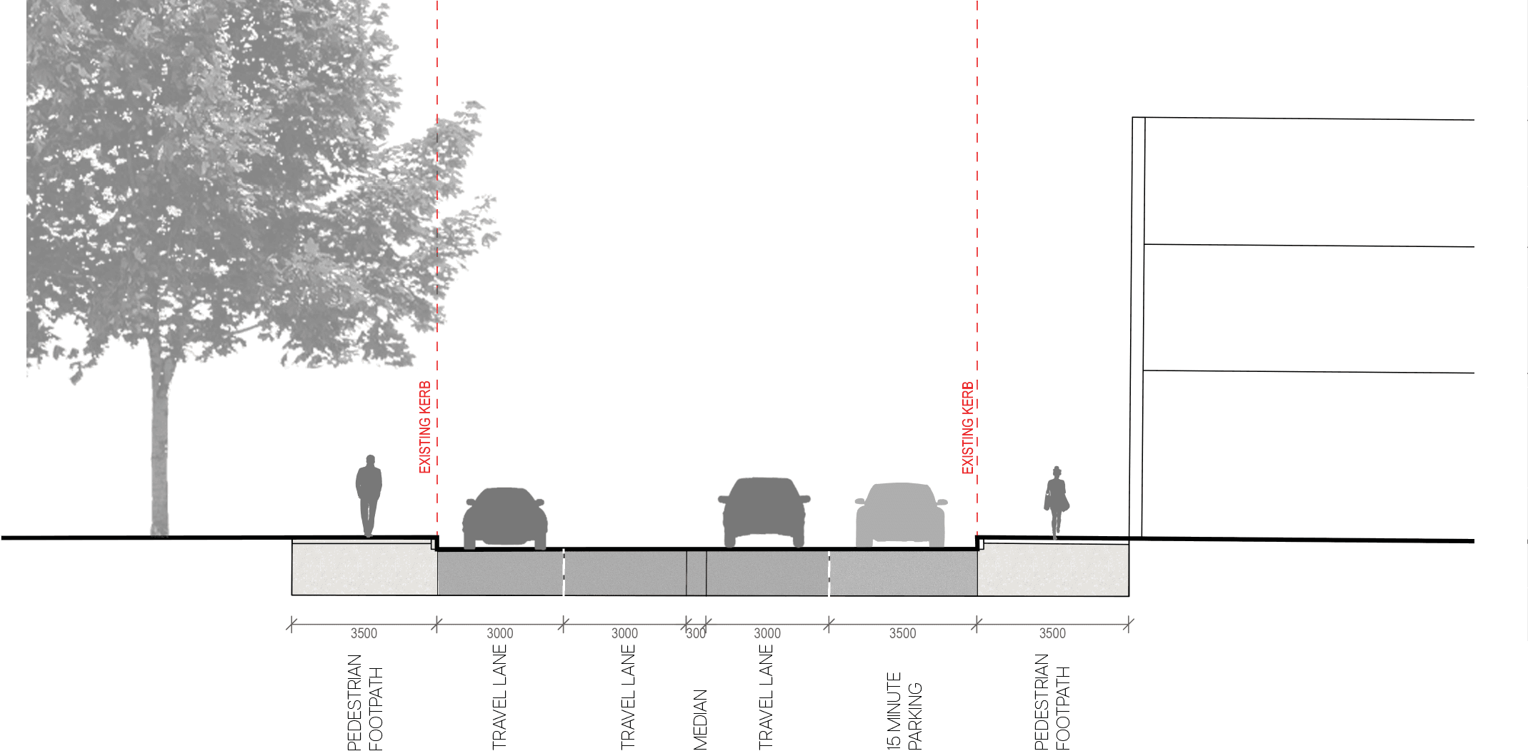
proposed
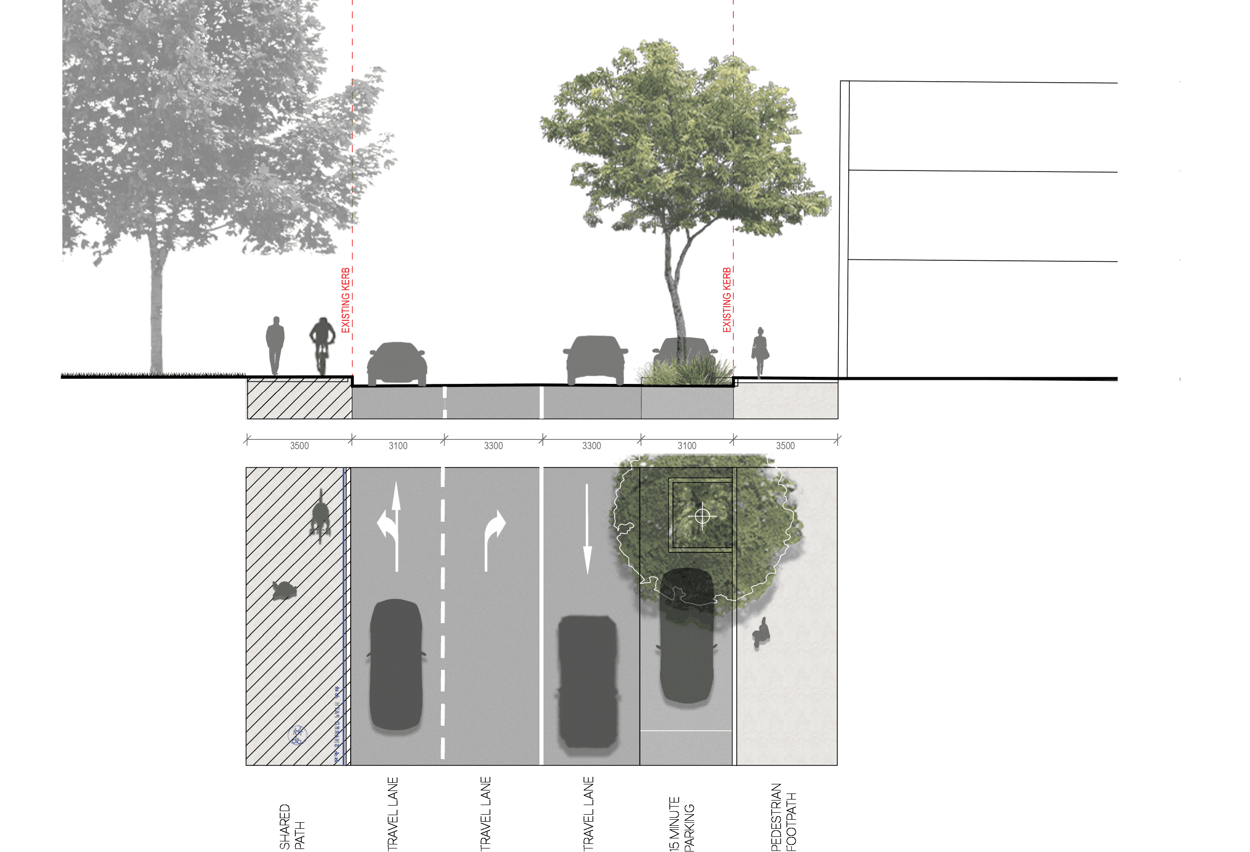
key plan
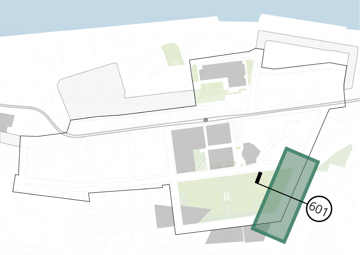
4.8.2 DARBY STREET (NORTH) plan
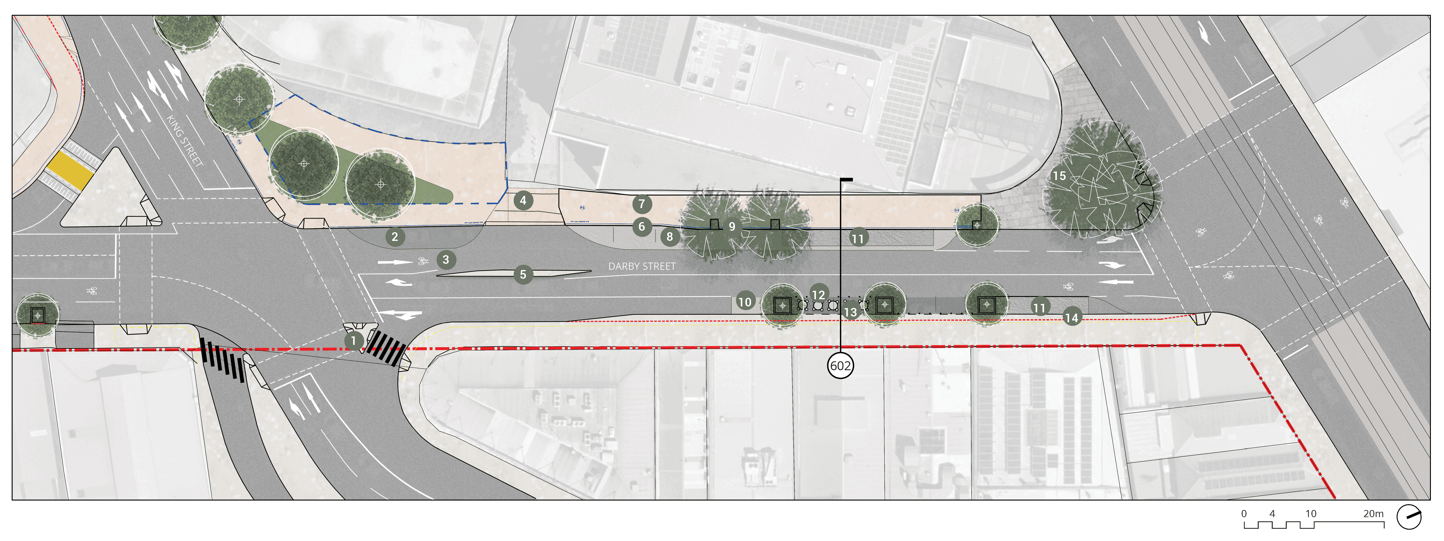
Long text alternative
A map of Darby Street (North) that shows the proposed plan for how the street will look when it’s been upgraded. The top of the map is facing northeast.
There are numbers marked from 1 to 15 which are associated with the descriptions in the legend.
At the intersection of King Street and Darby Street is a plan to (1) retain existing refuge island. Just north of the intersection on the west side of Darby Road is a plan to (2) maintain existing taxi zone. From there towards the middle of Darby Street is an (5) existing concrete median to be retained. Near the west of the median is an (3) existing on-road cycle provision / mixed traffic to be retained. West of (5) is a plan for (4) a level threshold continuous shared path across driveway. Further north of (4) is a plan to (6) retain existing kerb, a (7) shared pedestrian / cycle path, a plan to (8) retain existing parking zone, and a plan to (9) retain and protect existing trees. Across the road from (9) is a plan to (10) retain existing parking (2.3 metre width). Just north of that is a (12) flexible bollard system to allow for parking/outdoor dining, and a (13) proposed flush paving/parking zone with dish drain build out to accommodate widened footpath furniture zone (to future detail). Across the road from (13) is a plan to (11) retain existing loading zone (2.3 metres wide). Further north and just south of the intersection of Hunter Street and Darby Street is another mark labelled number 11 and a (14) kerb build out to accommodate loading zone and additional furniture / footpath zone. Adjust stormwater pits to new kerb alignment. On the north west corner of Darby Street and Hunter Street is an (15) existing plaza to be retained.
Legend
|
|
Study area |
|
|
Existing kerb to be removed |
|
|
Plaza to future detail |
|
|
Carriageway / driveway |
|
|
Walkway |
|
|
Planting zone |
|
|
Proposed priority pedestrian crossing (raised) |
|
|
Level threshold /continuous shared zone at driveway/road intersection |
|
|
Shared path |
|
|
Street parking |
|
|
Existing tree |
|
|
Proposed tree |
|
|
Retain existing refuge island |
|
|
Maintain existing taxi zone |
|
|
Existing on-road cycle provision / mixed traffic to be retained |
|
|
Level threshold continuous shared path across driveway |
|
|
Existing concrete median to be retained |
|
|
Retain existing kerb |
|
|
Shared pedestrian / Cycle path |
|
|
Retain existing parking zone |
|
|
Retain & protect existing trees |
|
|
Retain existing parking (2.3m W.) |
|
|
Retain existing loading zone (2.3m W.) |
|
|
Flexible bollard system to allow for parking/outdoor dining |
|
|
Proposed flush paving/parking zone with dish drain build out to accommodate widened footpath furniture zone (to future detail) |
|
|
Kerb build out to accommodate loading zone & additional furniture / footpath zone. Adjust stormwater pits to new kerb alignment |
|
|
Existing plaza to be retained |


key plan
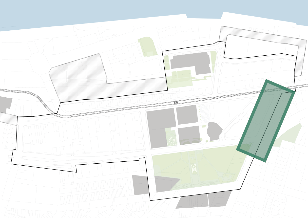
4.8.2 DARBY STREET (NORTH) section - 602
Existing
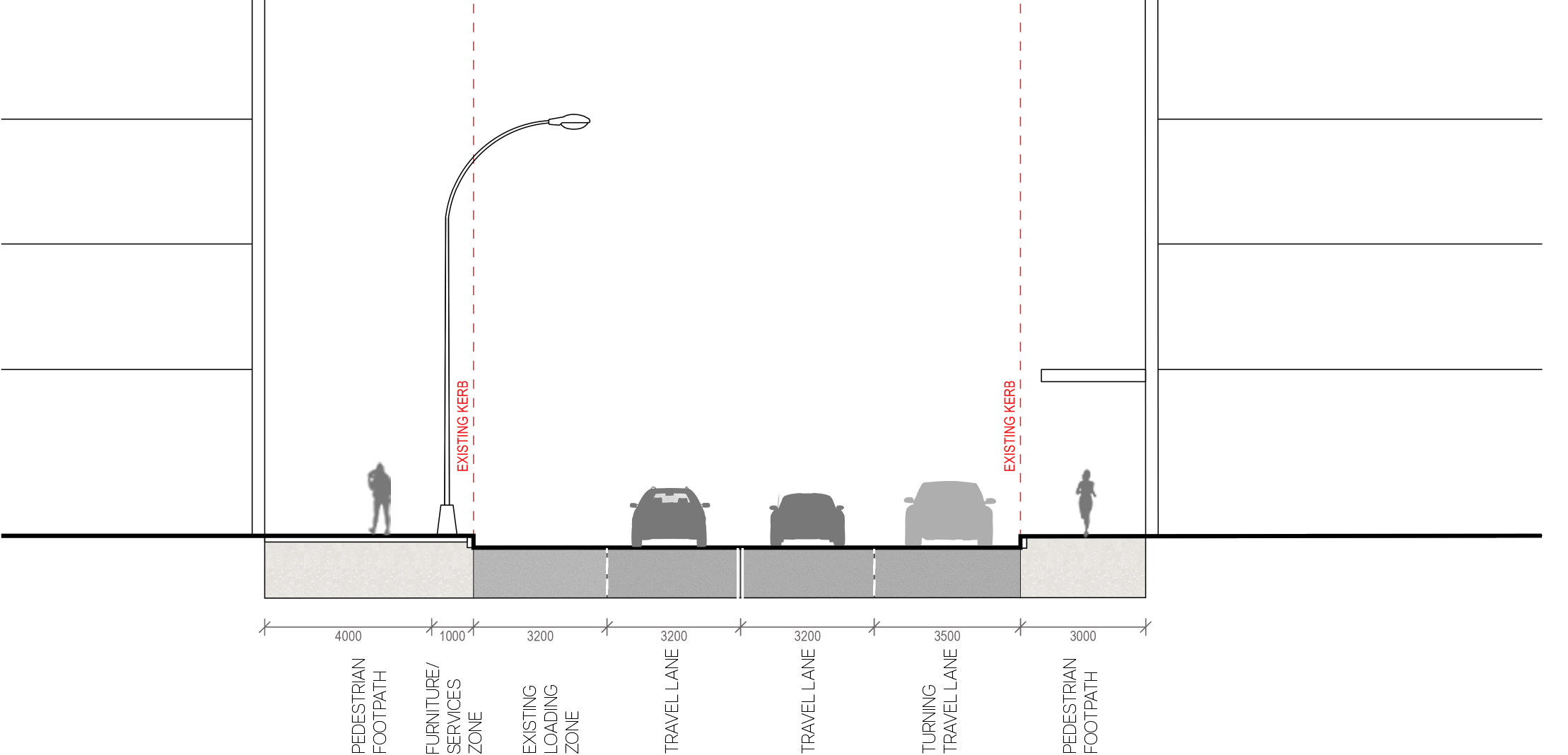
proposed
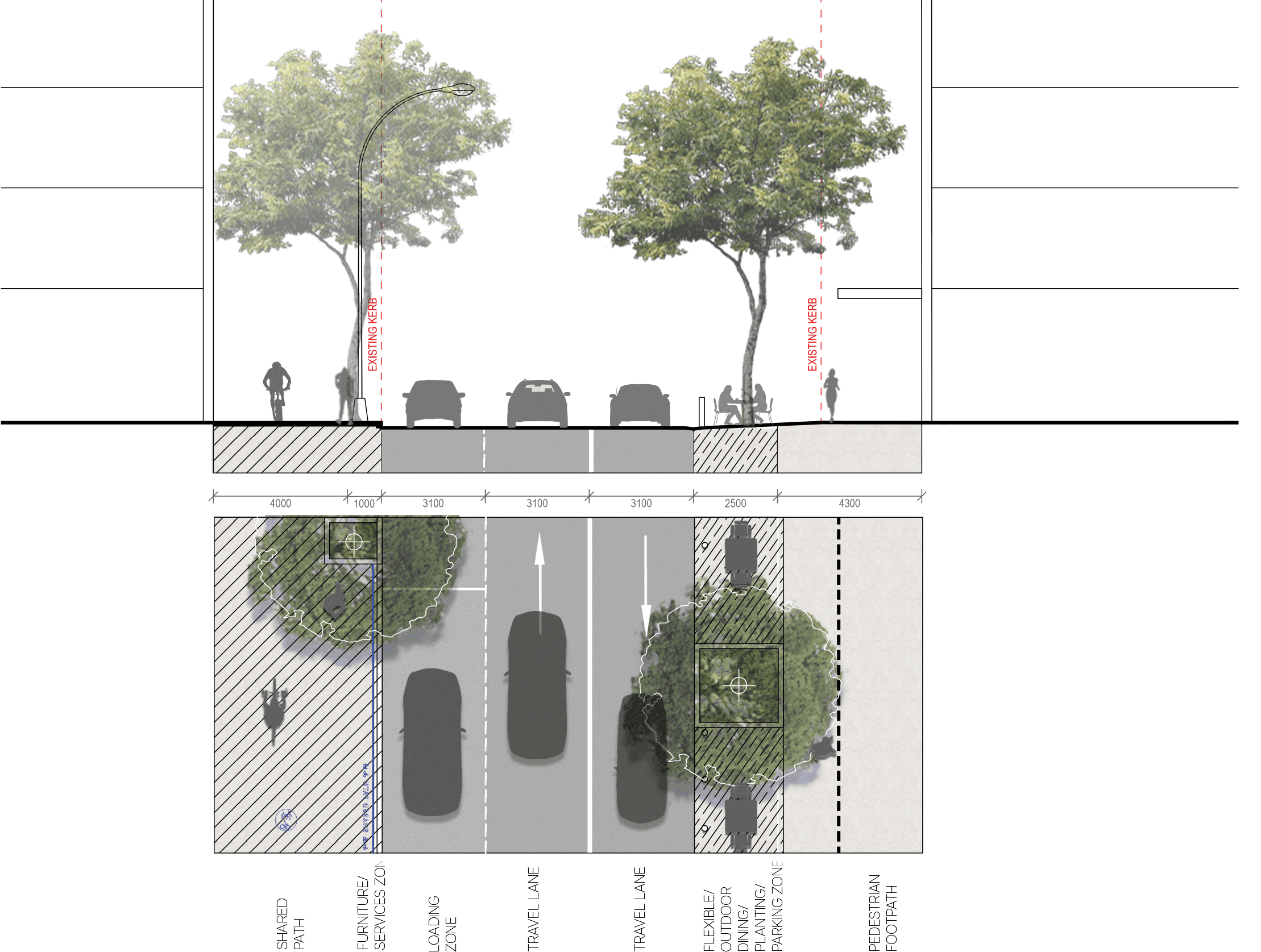
key plan
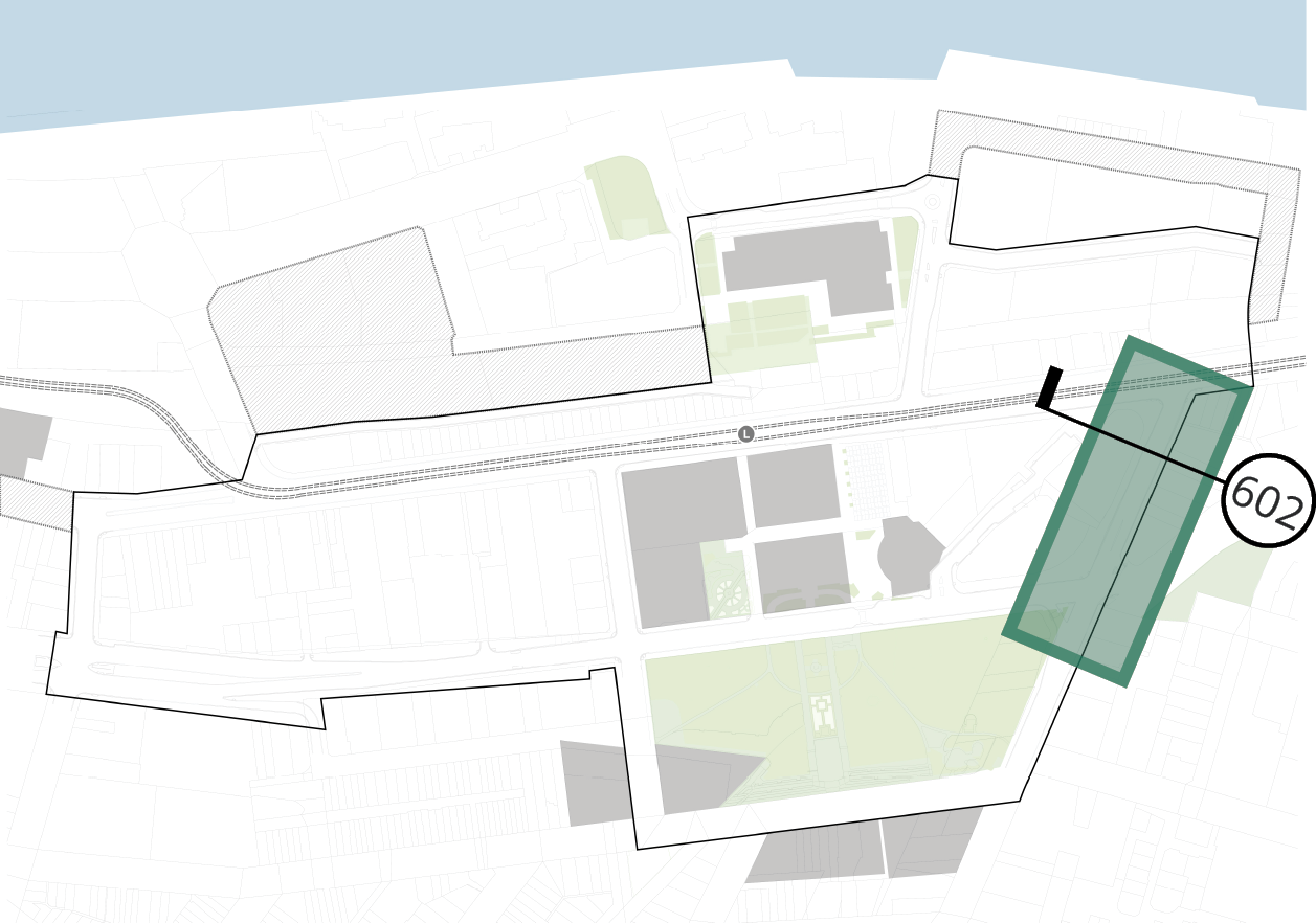
4.9 MEREWETHER STREET plan
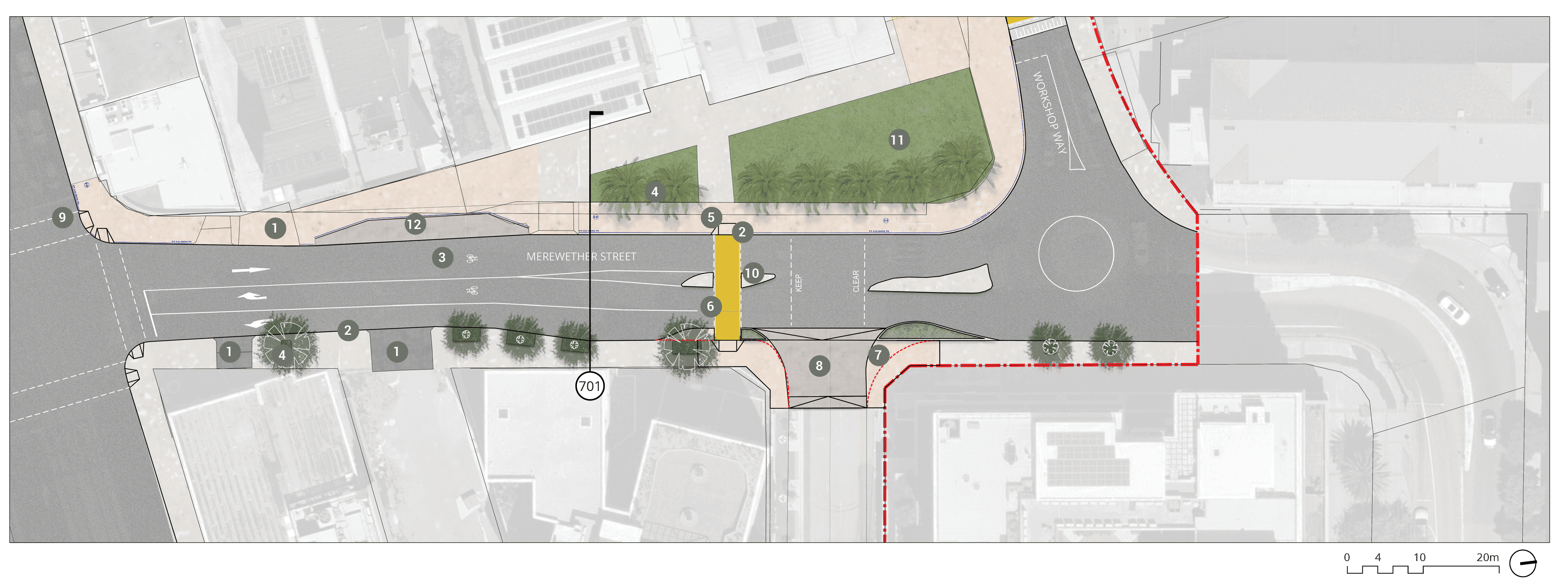
Long text alternative
A map of Merewether Street that shows the proposed plan for how the street will look when it’s been upgraded. The map extends from the roundabout at Workshop Way to Hunter Street.
There are numbers marked from 1 to 12 which are associated with the descriptions in the legend.
On the south side of Merewether Street (1) there is 1 existing driveway to be retained on the west side of the street, and 2 more existing driveways to be retained on the east side of the street. Between these 2 existing driveways (2) the kerb line is to be retained. This also applies to the kerb on the west side of Merewether Street closer to the roundabout.
Merewether Street (3) has an on-road cycle provision (quietway). On the southeast and northwest ends of the street (4) there are existing trees to be retained and protected.
The west side of Merewether street (5) has an existing shared path to be retained. Approximately 2 thirds of the way up Merewether Street heading north (6) there is a proposed ‘on-grade priority path crossing’. There is an existing refuge island either side of this to be retained (10). Just north of the existing refuge island, on the east side of Merewether street (8) there is a proposed ‘level raised threshold’ with a ‘continuous shared path across the intersection’. Next to this (7) the kerb will be built out to reduce the crossing distance. Across the street from this by the roundabout (11) there is an existing street plaza.
On the southwest side of Merewether street (12) there is an existing loading zone to be retained.
Legend
|
|
Study area |
|
|
Existing kerb to be removed |
|
|
Carriageway / driveway |
|
|
Walkway |
|
|
Planting zone |
|
|
Proposed priority pedestrian crossing (raised) |
|
|
Level threshold /continuous shared zone at driveway/road intersection |
|
|
Shared path |
|
|
Existing tree |
|
|
Retain existing driveway/lane-way access |
|
|
Retain existing kerb line |
|
|
On-road cycle provision (Quiet-Way) |
|
|
Retain & protect existing trees |
|
|
Existing shared path to be retained |
|
|
Proposed on-grade priority path crossing |
|
|
Build out kerb to reduce crossing distance |
|
|
Proposed level raised threshold continuous shared path across intersection |
|
|
Upgrade to signalised intersection to provide cycle phase |
|
|
Existing refuge island to be retained |
|
|
Existing street plaza |
|
|
Retain existing loading zone |


key plan
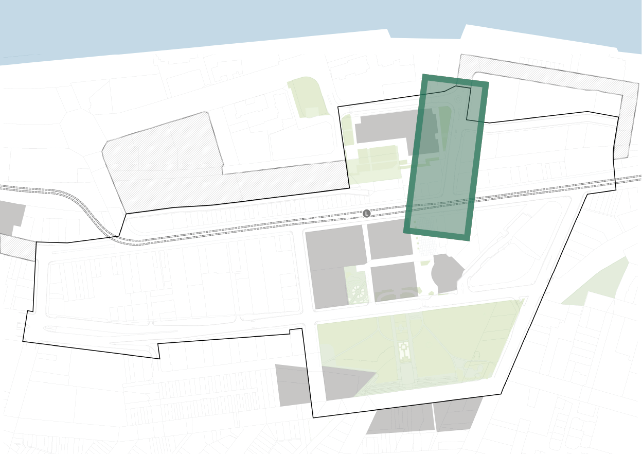
4.9 MEREWETHER STREET section - 701
Existing
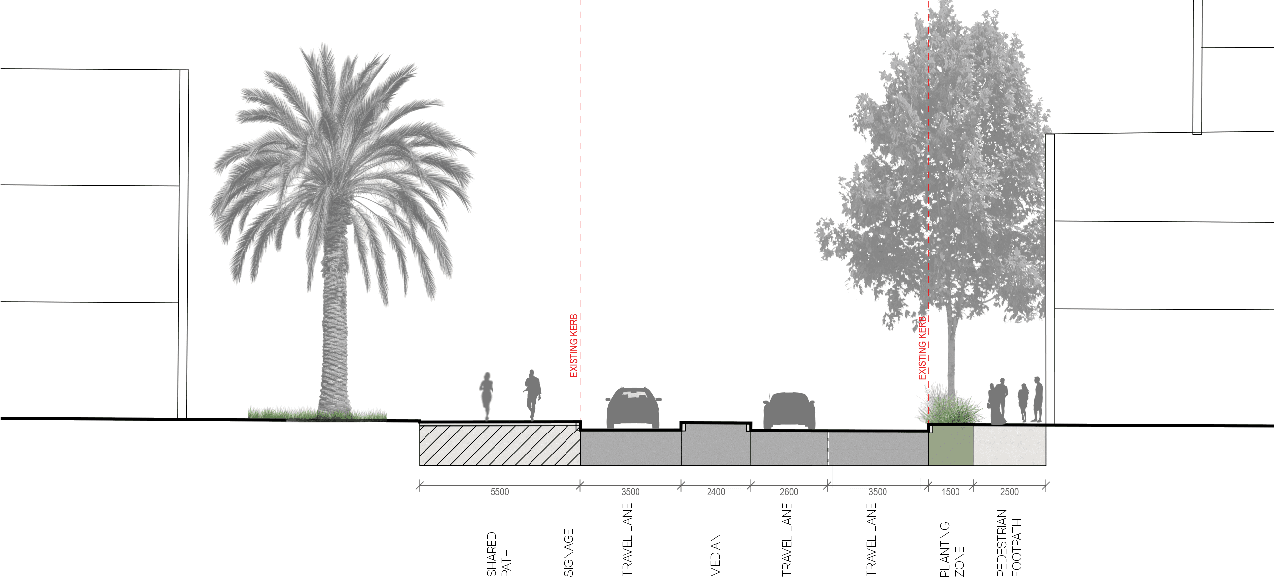
proposed
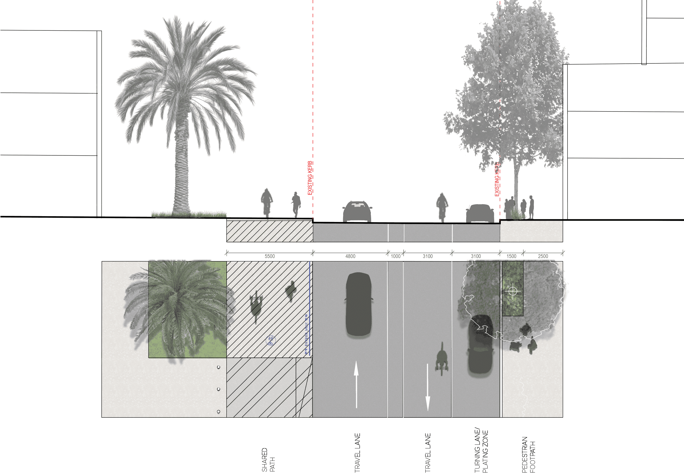
key plan
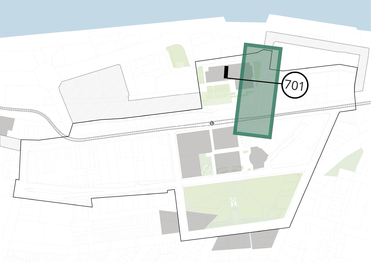
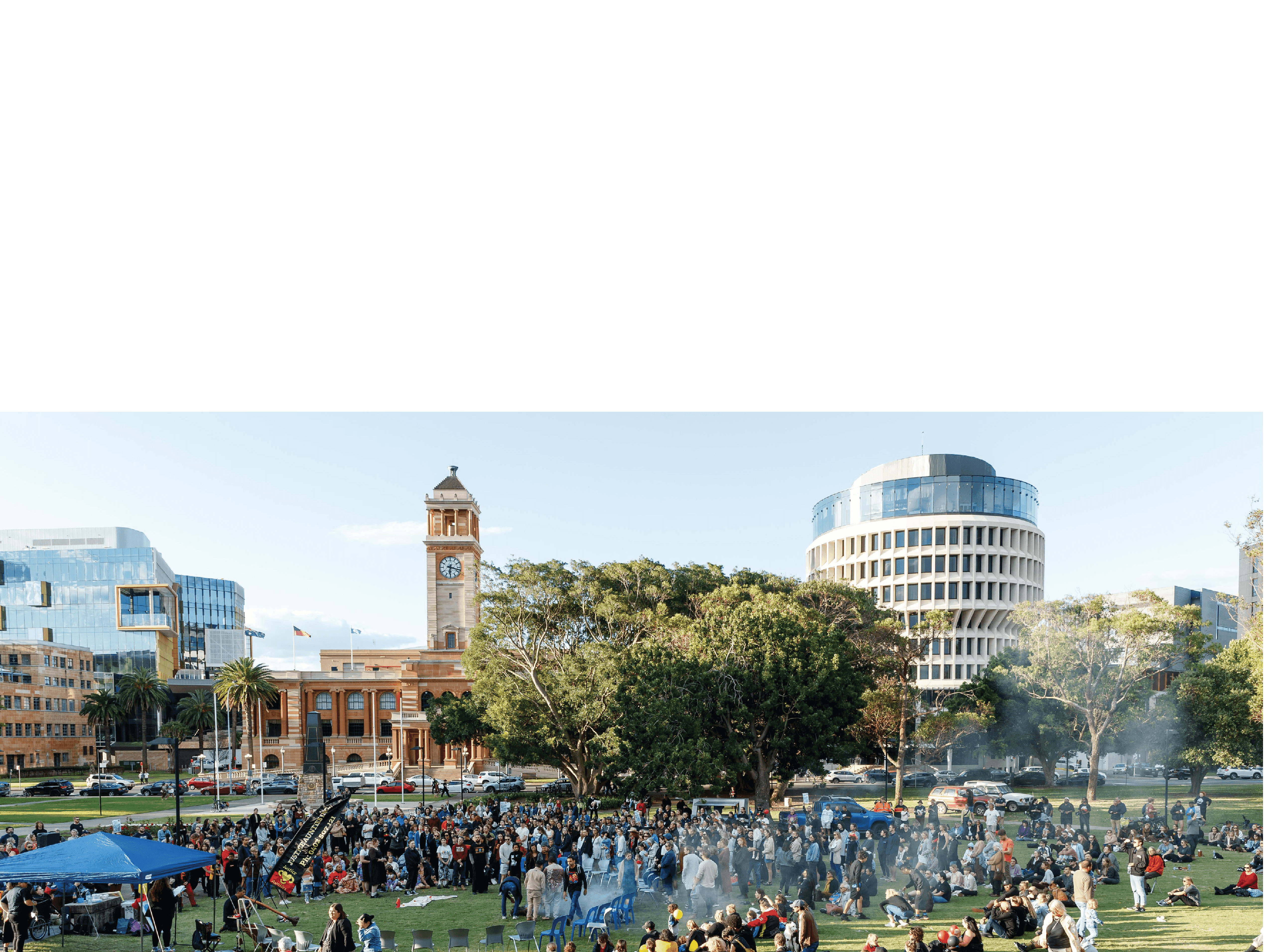
5 PARKS & PLAZAS
5.1.1 wheeler place key moves
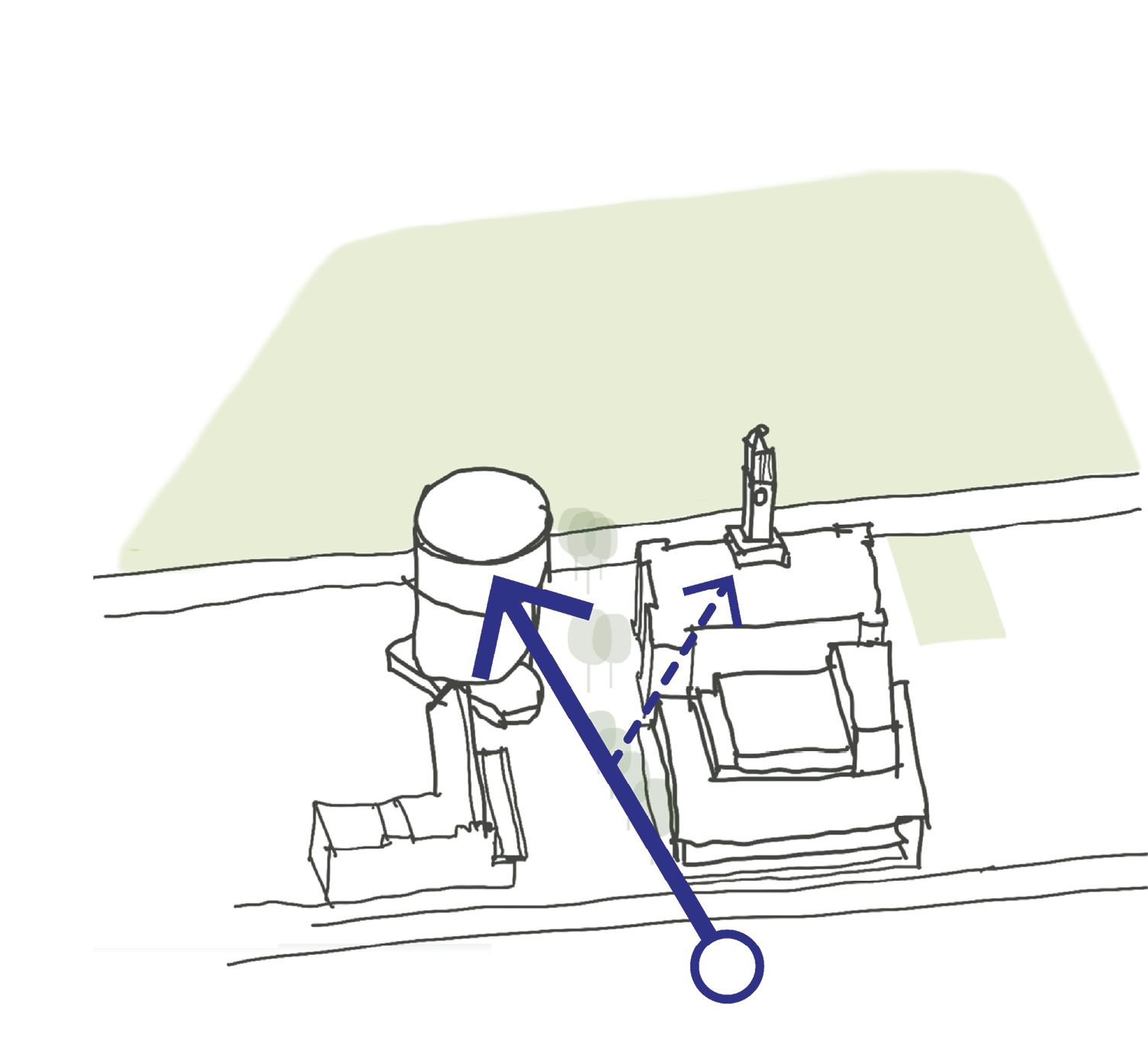
1 draw upon key sightlines
To strengthen the dynamic interplay between the iconic buildings & the public surrounds within the Civic precinct. By orchestrating the pedestrian’s gaze by strategically framing the key buildings, it gives opportunity to highlights the unique character of the Civic Precinct.
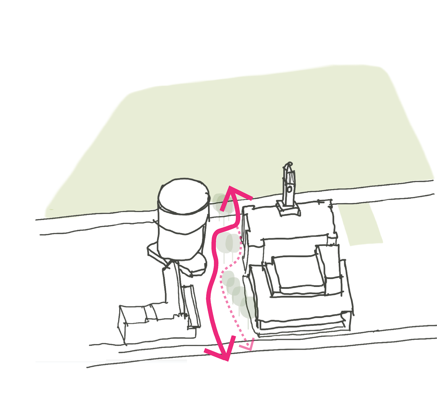
2 STRENGTHENING THE NORTH - SOUTH activity corridor
As aligned to the Newcastle Cultural Precinct Masterplan, activating Wheeler Pl is the key link to connecting the harbour front to Civic Park. Paths are clear & follow thoughtful desire lines to improve navigation. While at the same time, shade trees & a diversity of seating options offer moments of respite. Therefore, the proposed design options create a legible and comfortable pedestrian experience to reinforce the activity corridor.
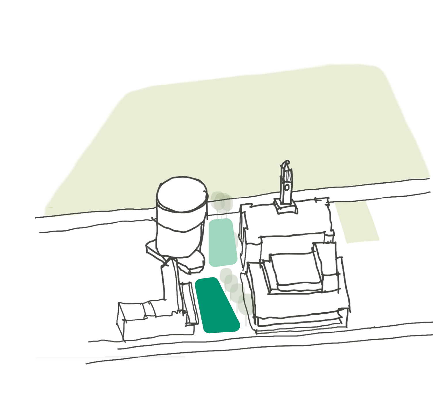
3 defining key distinctive zones
The proposed design options offer two varying areas (passive & active) to cater for different uses & users. The theatre forecourt (active) is versatile to changing uses & gatherings of diverse sizes of groups. While the link to King St (passive) offers a more tranquil space to dwell. We see the plaza come alive during vibrant events - while simultaneously hosting small groups and provide relief from the bustling urban precinct.
5.1.2 wheeler place concept plan
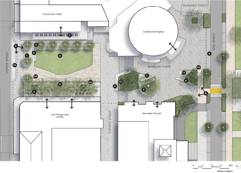
Long text alternative
A map of Wheeler Place showing the concept for when it gets upgraded. It is located between King Street and Hunter Street. The top of the map points northwest.
Just south of Hunter Street is (12) a ‘Kiss and drop’ area. Just south of the ‘kiss and drop’ area is an area with unit paving. In the northwest corner of this area are (1) trees planting to buffer Hunter Street, (2) gradual steps, and a (6) seating wall / signage. In the middle of this area is a (4) proposed lawn area. South of the proposed lawn and within this area is (14) existing bike racks to be relocated as required to suit updated design, (3) flexible outdoor dining, (8) proposed shade structure and (10) existing palms to be retained. Southeast of this area is the Civic Theatre Café and Bar. Northeast of the Civic Theatre Café and Bar is Christee Street. On the other side of Christee Street is another (6) seating wall / signage and (13) temporary event screen to detailed design. Southeast of this is Newcastle City Hall and Northwest of it is the Crystalbrook Kingsley. In between these two buildings is a (7) proposed passive seating area with shade structure and (9) existing trees to be retained. Just northwest of King Street is a (5) 5 minute timed parking. Near the Crystalbrook Kingsley is another (14) existing bike racks to be relocated as required to suit updated design, (11) a sculpture to be relocated and (6) seating wall / signage.
Legend
|
|
Carriageway |
|
|
Walkway |
|
|
Planting zone |
|
|
Priority path crossing |
|
|
Driveway |
|
|
Shared path |
|
|
Shared zone |
|
|
Unit paving |
|
|
Existing tree |
|
|
Existing palm tree |
|
|
Proposed tree |
|
|
Trees planting to buffer Hunter St |
|
|
Gradual steps |
|
|
Flexible outdoor dining |
|
|
Proposed lawn area |
|
|
5min timed parking |
|
|
Seating wall / Signage |
|
|
Proposed passive seating area with shade structure |
|
|
Proposed shade structure |
|
|
Existing trees to be retained |
|
|
Existing palms to be retained |
|
|
Relocate existing sculpture |
|
|
‘Kiss and drop’ area |
|
|
Temporary event screen to detailed design |
|
|
Existing bike racks to be relocated as required to suit updated design |
|
|
Building existing entry points |
|
|
Perspective viewpoints |


5.1.3 wheeler place PRECEDENT IMAGES
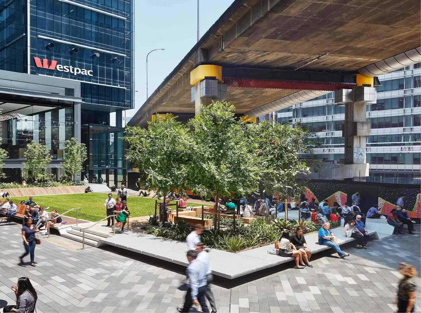
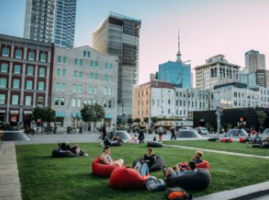
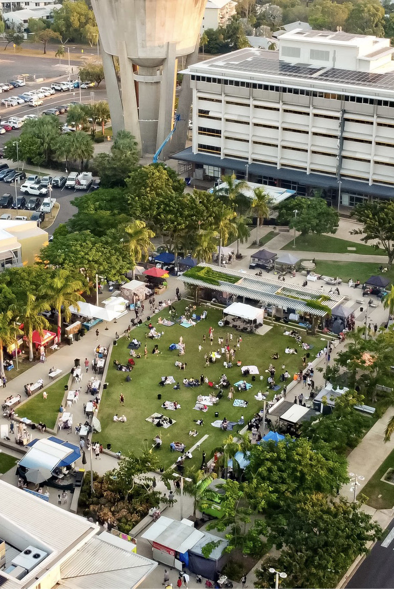
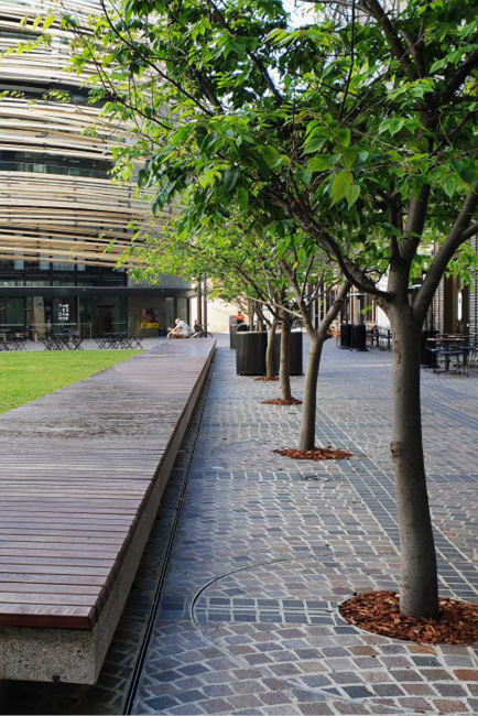
5.1.3 wheeler place PRECEDENT IMAGES - entry statement
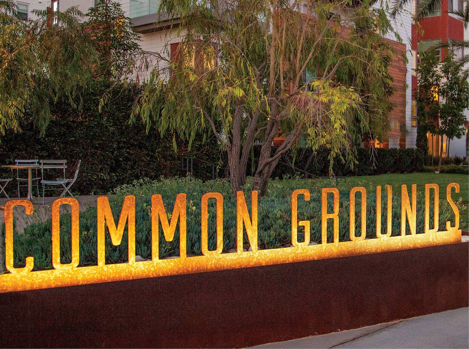
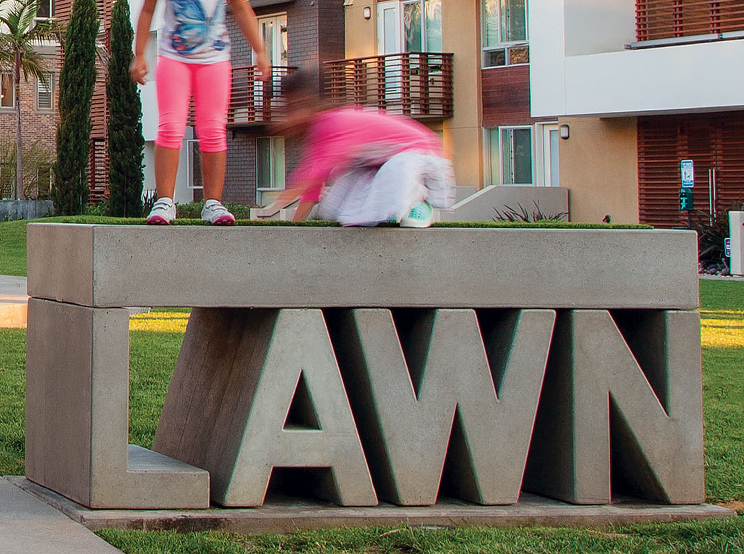
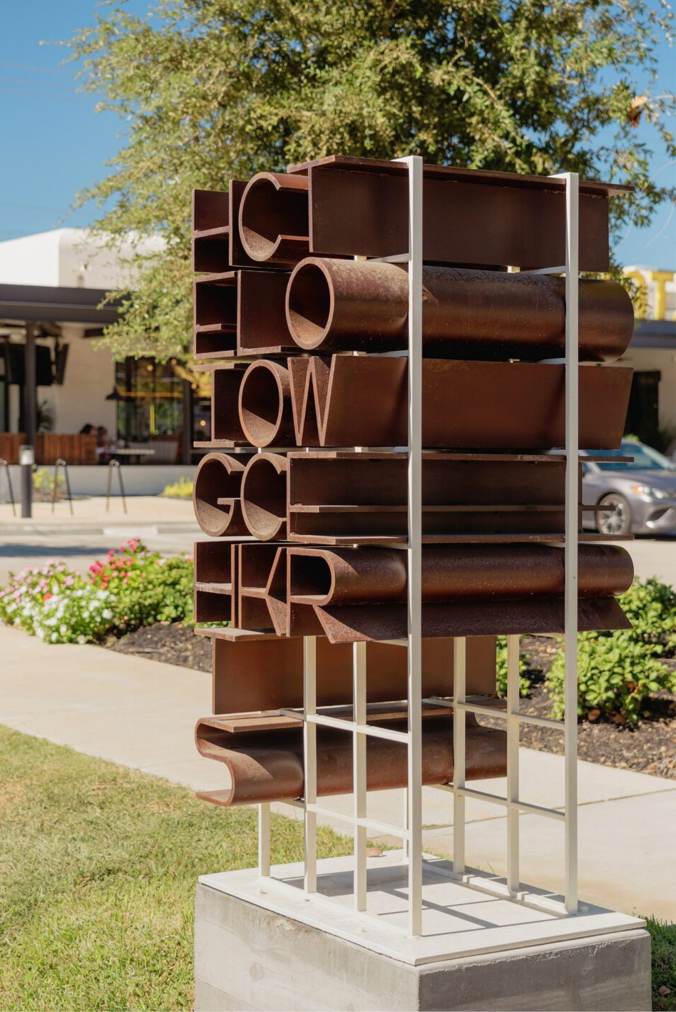
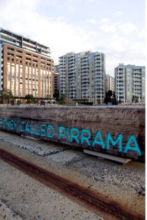
5.1.4 wheeler place PERSPECTIVE a - day
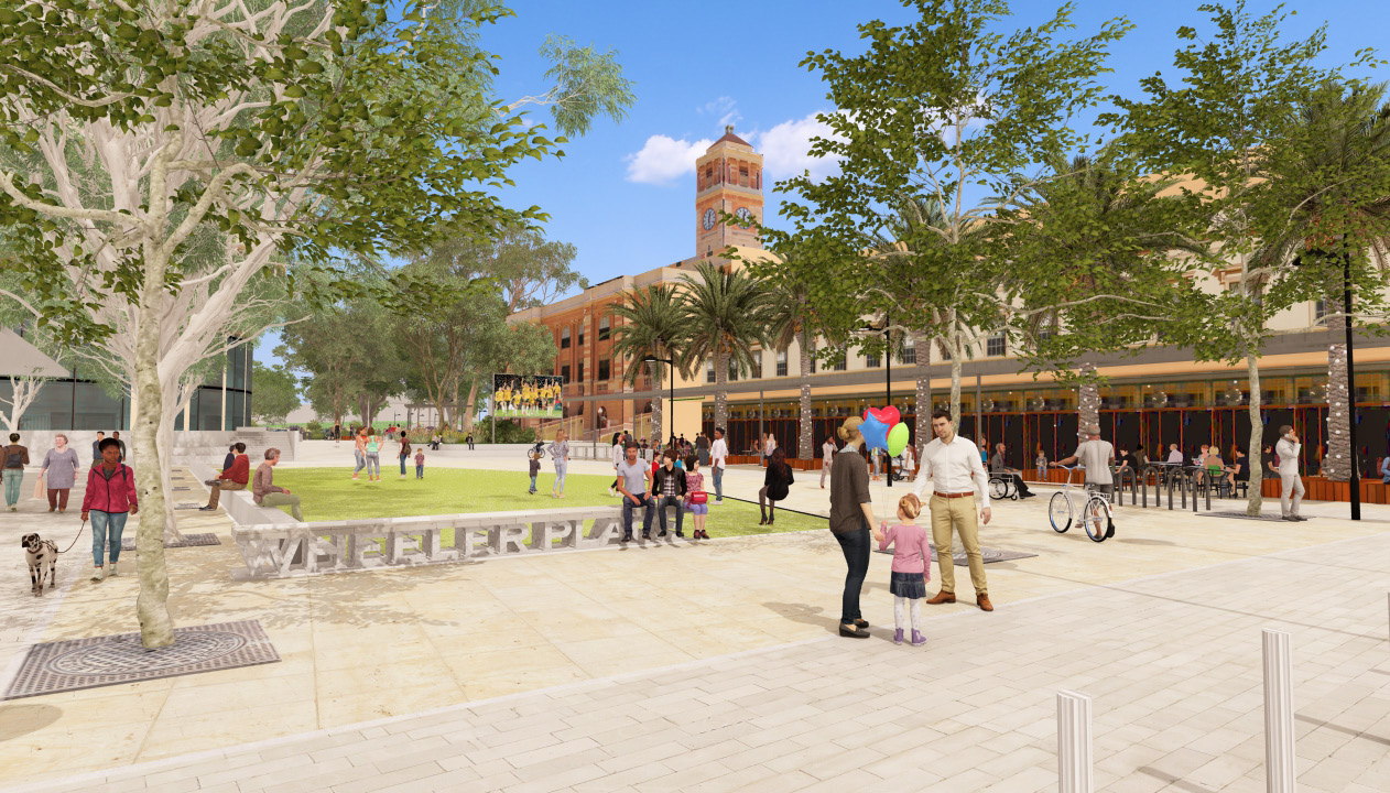
5.1.5 wheeler place PERSPECTIVE a - night
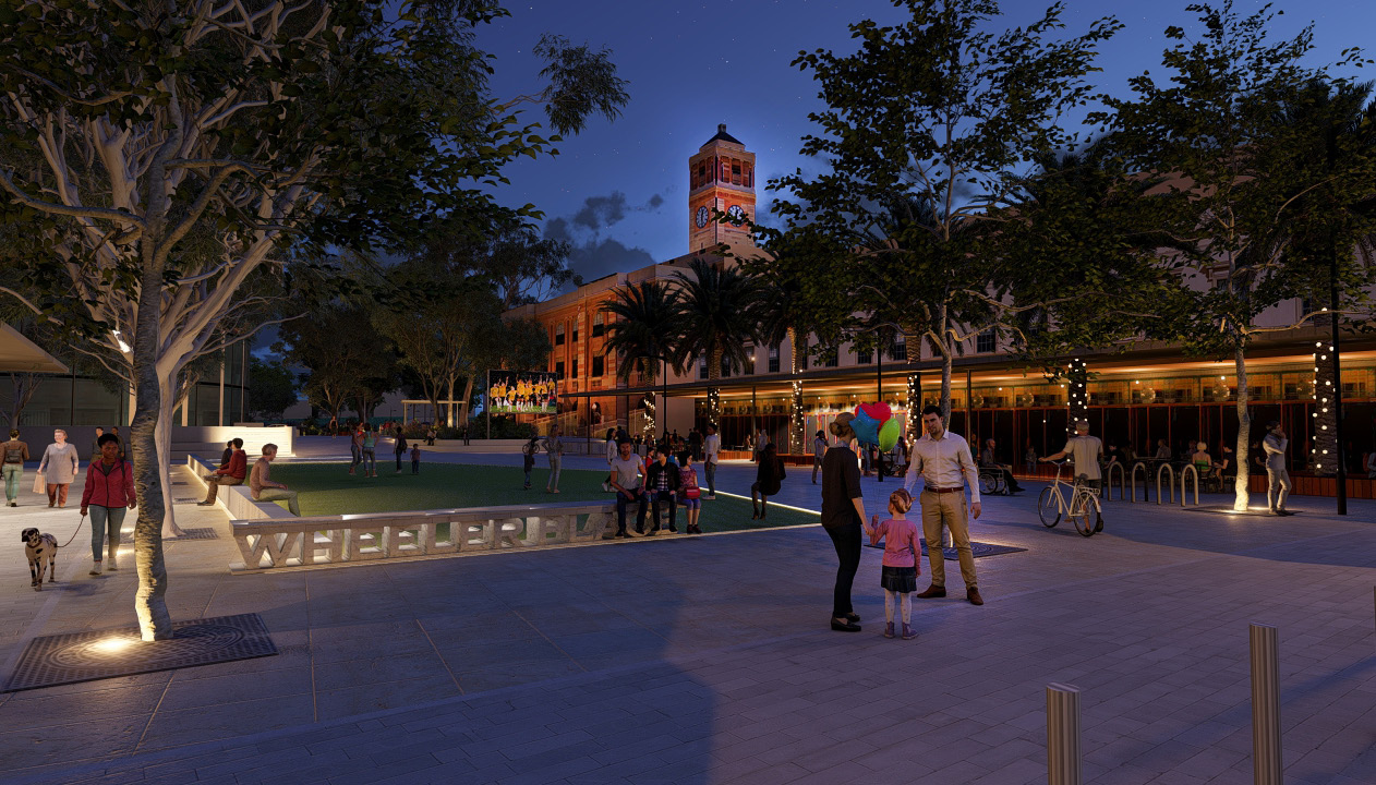
5.1.6 wheeler place PERSPECTIVE b - day
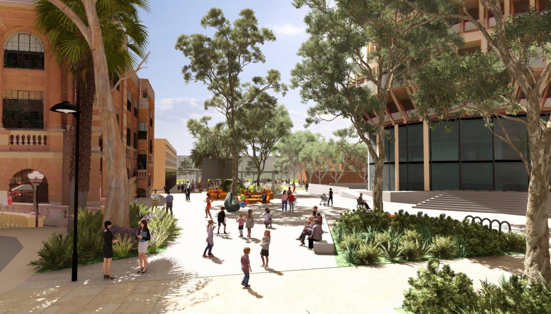
5.1.7 wheeler place PERSPECTIVE b - night
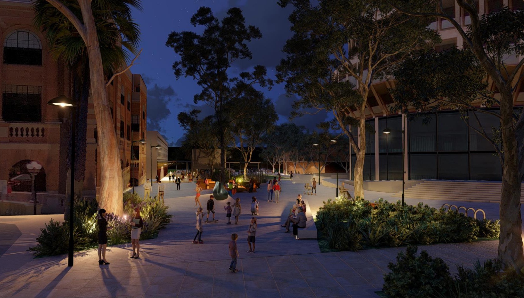
5.2.1 christie park key moves
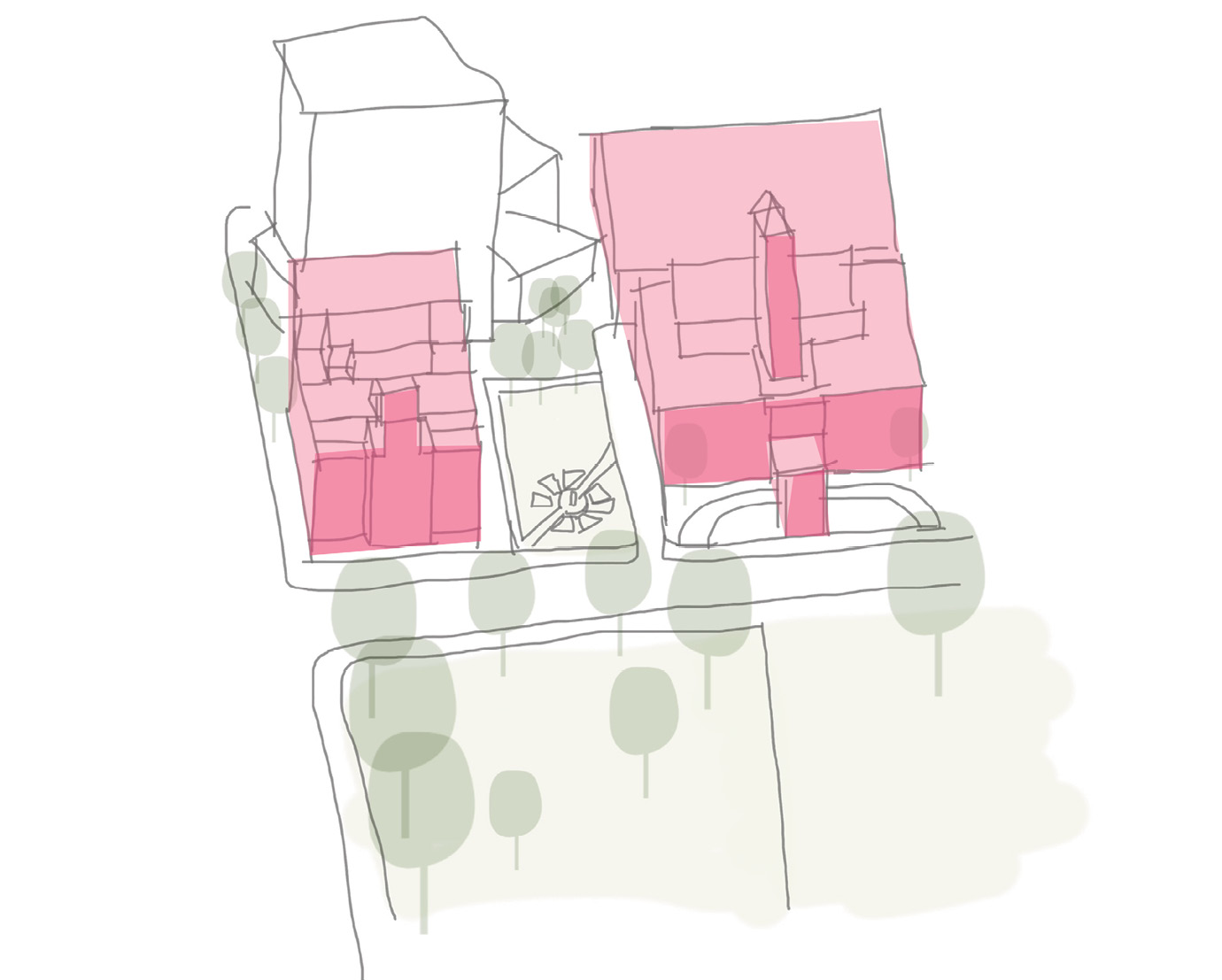
1 refine heritage style
Maintain heritage style of the planting to reflect the character of the surrounding significant buildings.
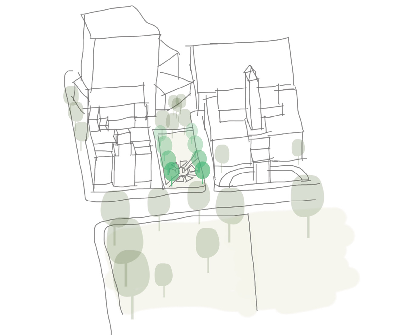
2 enhance amenity
Improve overall amenity, access, seating opportunities, maintainability & tree canopy.
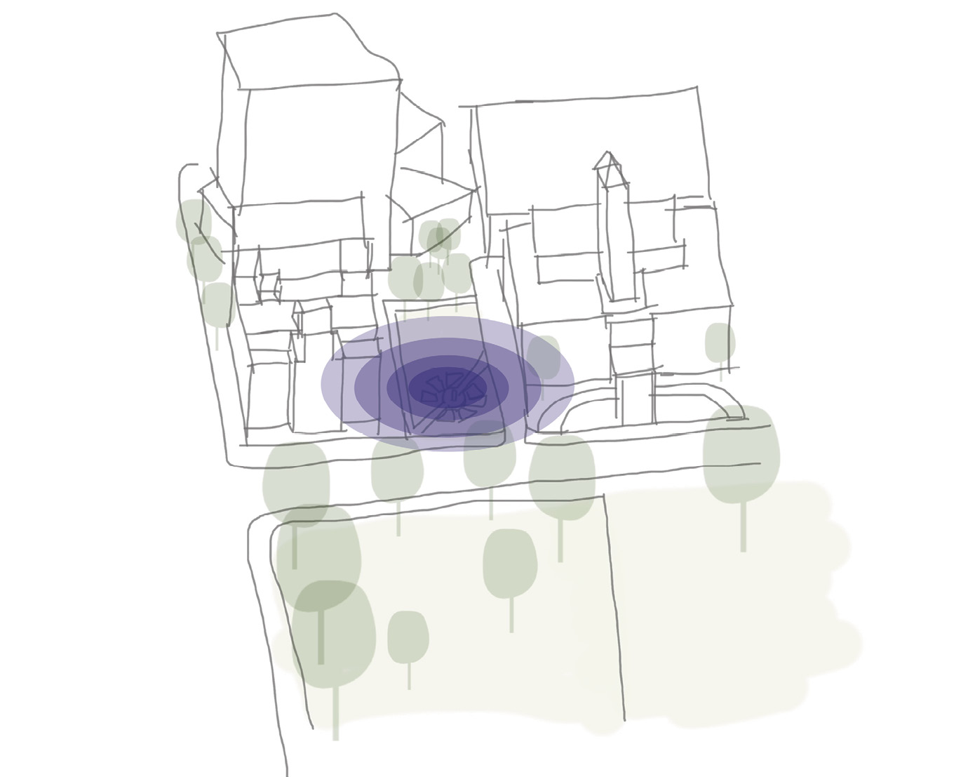
3 Improve connection to context
Define how Christie Place is connected and sits within the surrounding cultural precinct to enhance its role as a unique place.
5.2.2 christie park concept plan
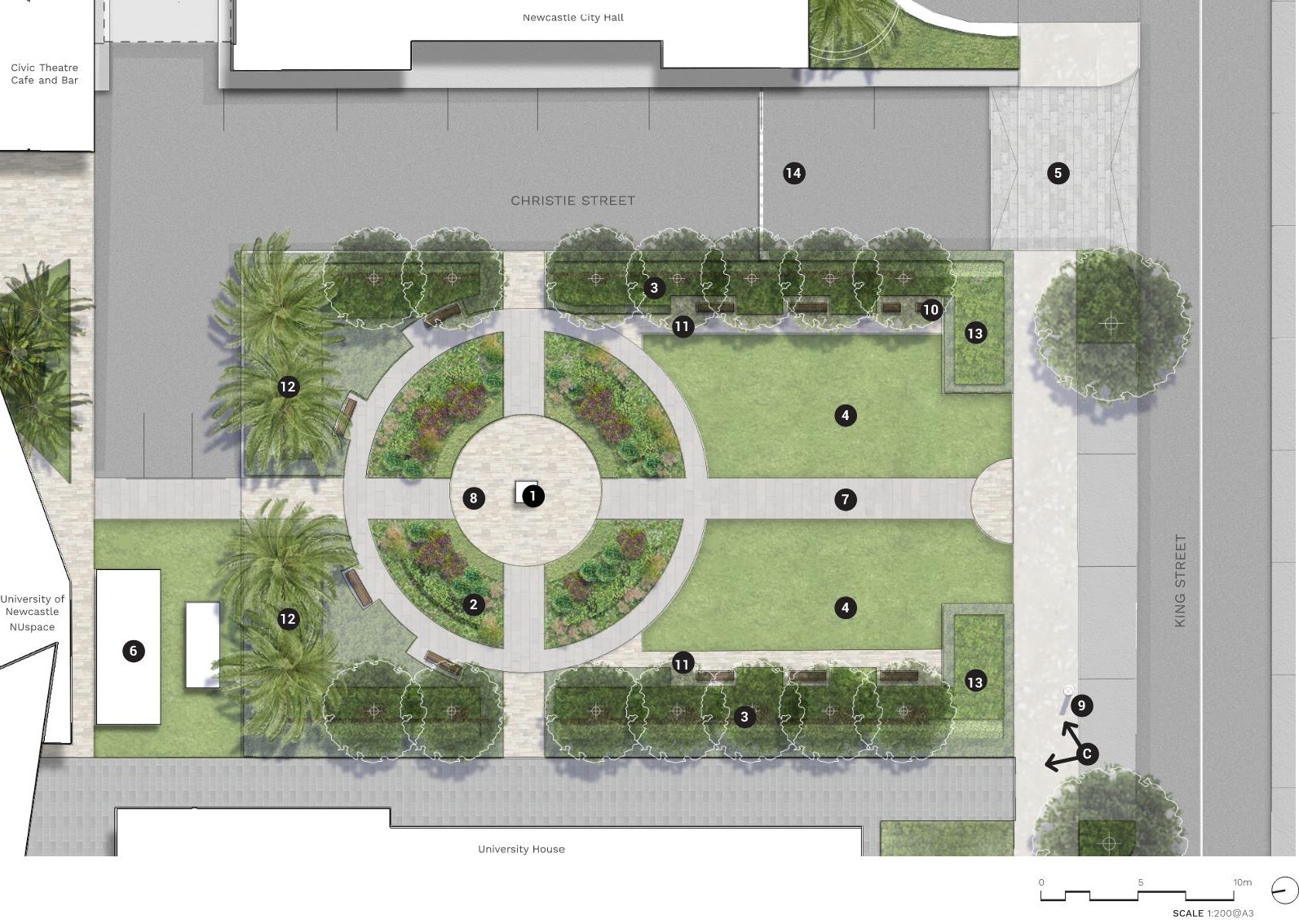
Long text alternative
A map of Christie Park that shows the proposed plan for how the park will look when it’s been upgraded. The top of the map shows the edge of Newcastle City Hall, and the bottom of the map shows the edge of University House. The park is a rectangle and has 2 main paths that run across it and intersect in the middle. The side closest to King Street has 2 lawns.
There are numbers marked from 1 to 14 which are associated with the descriptions in the legend.
The Shortland Centenary fountain will be relocated to the centre of the park slightly towards the north (1). There is a circle of feature paving around the fountain (8). Around this there is a circle of garden beds for ‘formal garden planting with perennials’ (2). On both the east and west side of the park (3) there will be an avenue of tree planting. The area of the park closest to King Street (4) has 2 lawns either side of a path that runs through the park from north to south. This path (7) will be ‘unit paving to path’. On the outer perimeter of these 2 lawns (11) there is a path to seating along the edge of the lawn. The southeast corner of the park (10) has accessible seating. The south end of the park closest to King Street (13) will have a space for proposed low shrub planting. The north end of the park (12) has existing palm trees that are to be retained. Just east of University House (6) there are existing services to be retained.
Along King Street on the west side of the park (9) there are heritage lamps to be retained. Along King Street to the east of the park (5) is a proposed ‘level raised threshold continuous path across driveway’. North of this on Christie Street (14) there is a proposed boom gate.
Legend
|
|
Carriageway |
|
|
Walkway |
|
|
Unit paving |
|
|
Existing palm tree |
|
|
Proposed tree |
|
|
Relocated shortland centenary fountain |
|
|
Formal garden planting with perennials |
|
|
Avenue tree planting |
|
|
Lawn |
|
|
Proposed level raised threshold continuous path across driveway |
|
|
Existing services to be retained |
|
|
Unit paving to path |
|
|
Feature paving |
|
|
Heritage lamps to be retained |
|
|
Accessible seating |
|
|
Path to seating edge |
|
|
Existing palms to be retained |
|
|
Proposed low shrub planting |
|
|
Proposed boom gate to future detailed design |
|
|
Perspective viewpoints |


5.2.3 christie park PRECEDENT IMAGES
.jpg)
Figure X. Shortland Centenary Fountain, Source: Monument Australia (2017)
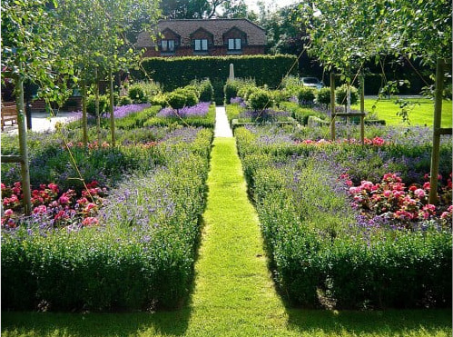
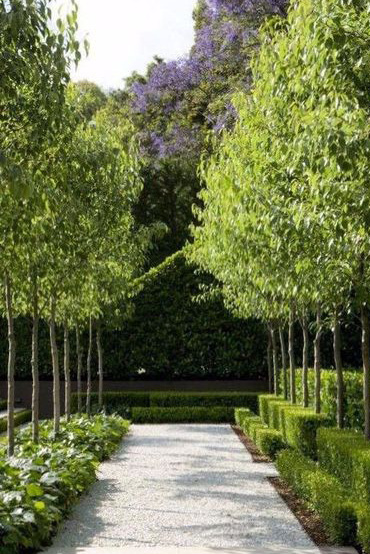
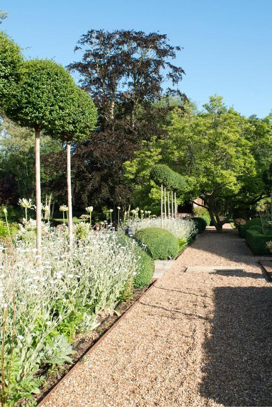
5.2.4 christie park PERSPECTIVE c
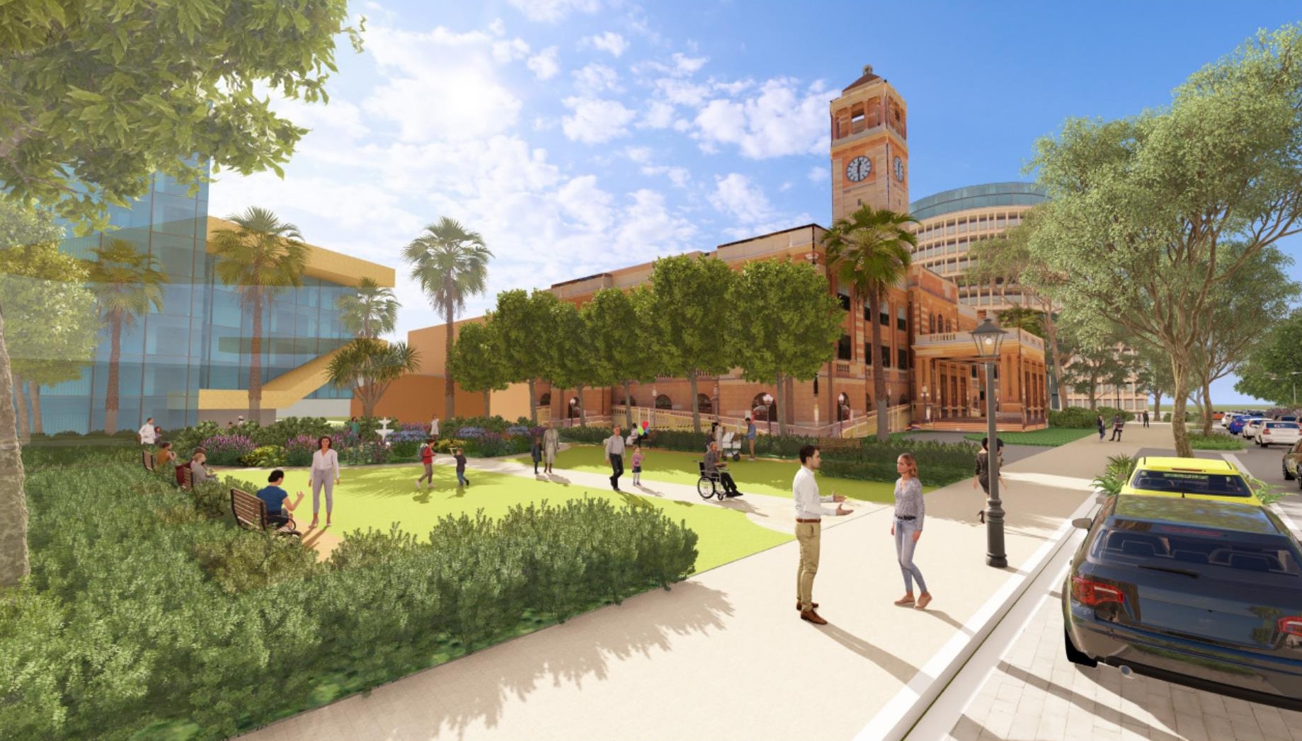
5.3.1 CIVIC park key moves
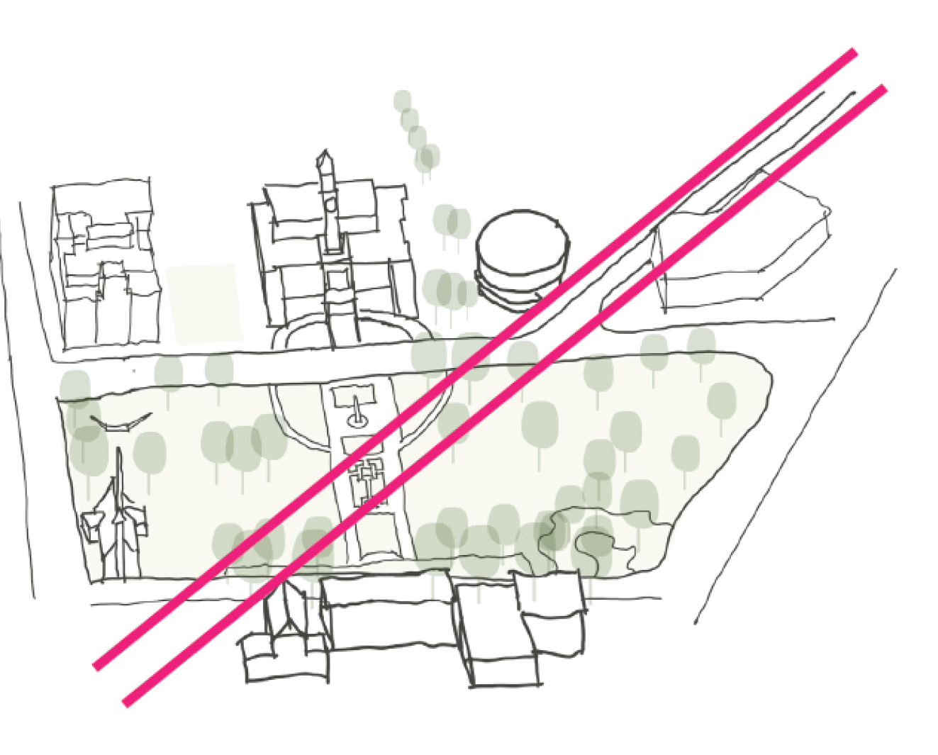
1 BRING PAST USES TO LIGHT
Reinterpreting the historical rail line to unveil stories which draw awareness to the precinct’s coal industry past.
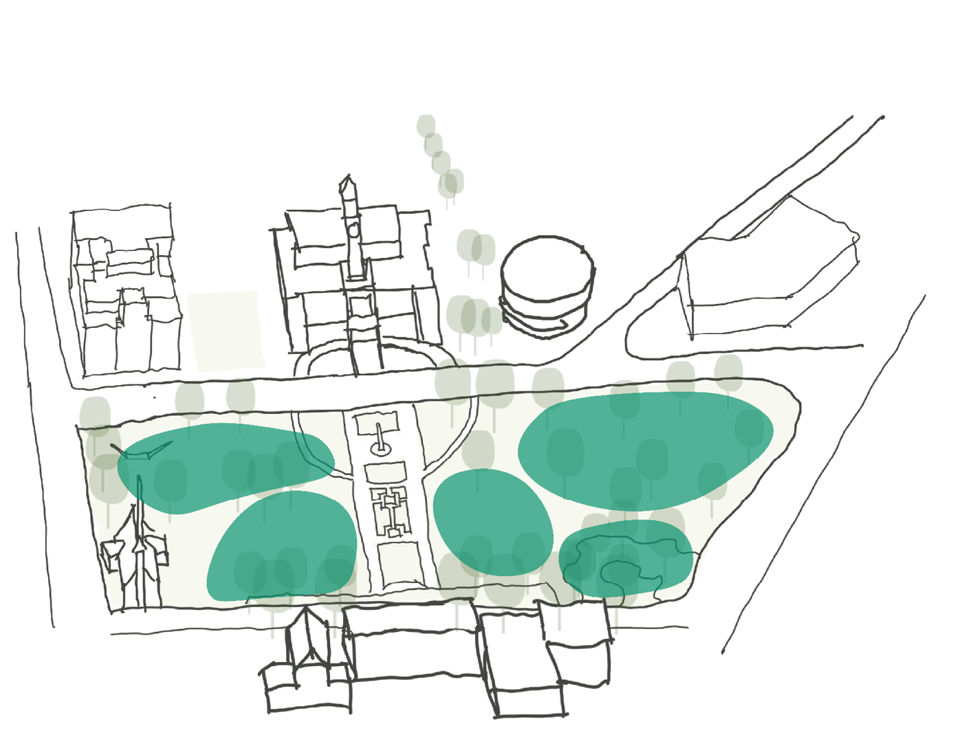
2 create flexible and dynamic spaces
Enhance Civic Park as a flexible event space to reinforce the sense of the park being the precincts art & cultural ‘green heart’. Improve the functionality of spaces within the park and entries to support and host both events and improve amenity to the everyday visitor.
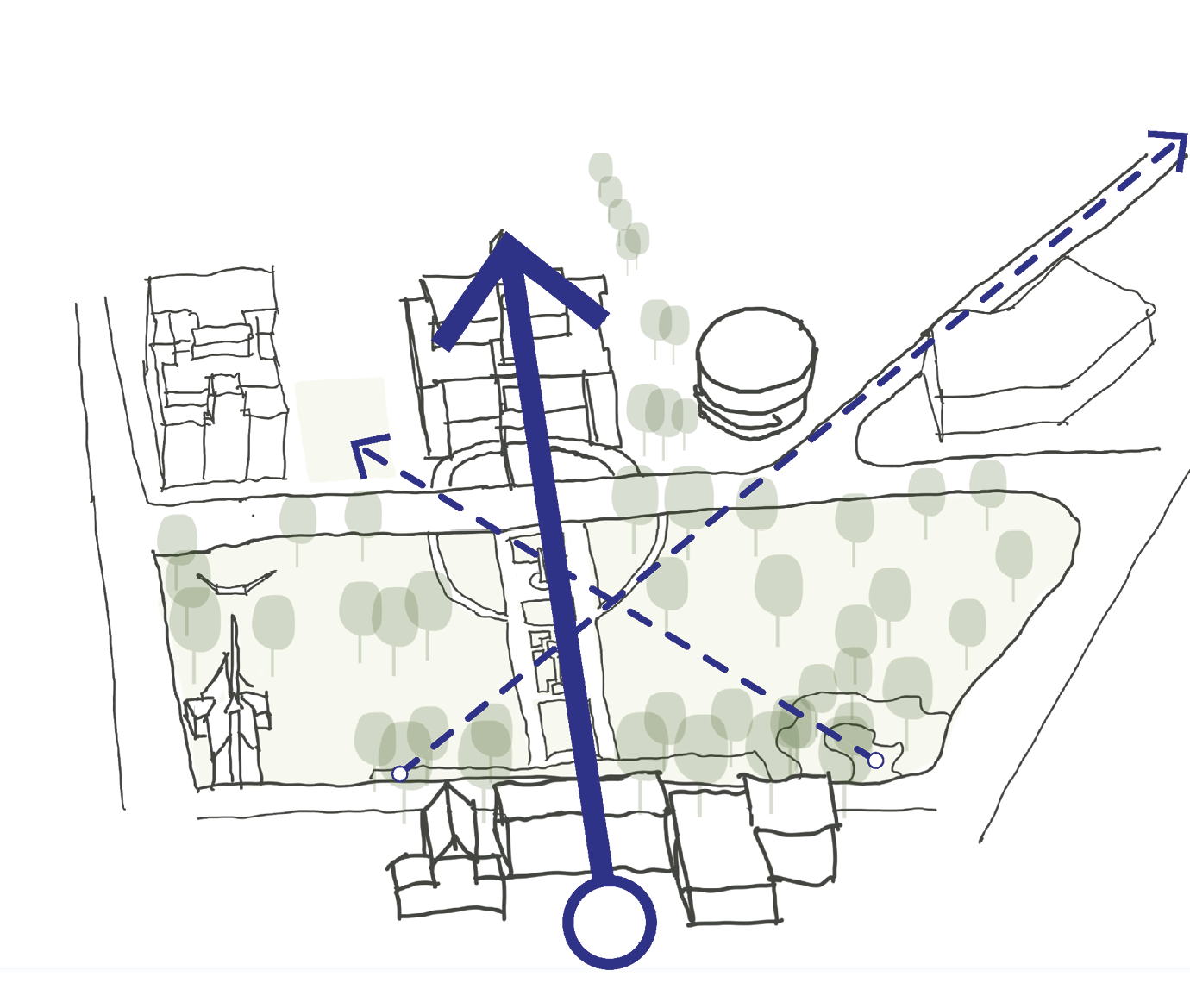
3 CAPTURING KEY SIGHT-LINES
Establishing a connection between the park and its surrounding attractions. By orchestrating the pedestrians gaze, strategically leading pathways & framing key buildings with tree plantings. Through this we strengthen the dynamic interplay between the iconic building structures which stand around Civic Park.
5.3.2 CIVIC park concept plan
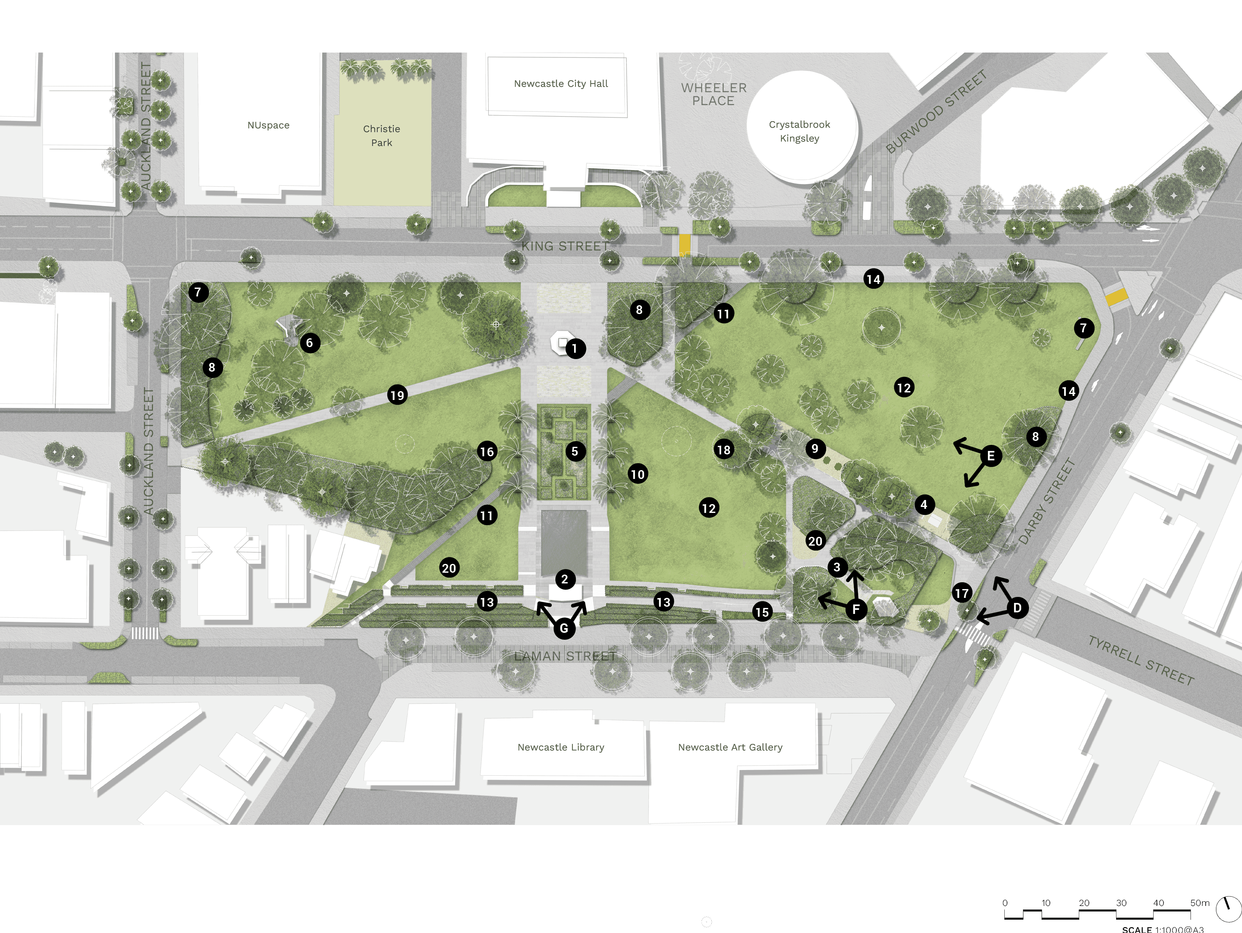
Long text alternative
A map of Civic Park that shows the concept of how it will look when it’s been upgraded. It is located in between King Street, Auckland Street, Laman Street and Darby Street.
There are numbers marked from 1 to 20 which are associated with the descriptions in the legend. In the middle just south of King Street is the (1) Civic Park War Monument. Further south of King Street is a (5) formal garden. Just north of Laman Street is the (2) Captain Cook Memorial Fountain. On the east side of the park, close to the middle is an (10) avenue tree planting to reinforce view corridor. In the northwest corner of the park is a plan to (8) include planting beneath major trees to improve amenity and reduce maintenance. North of Laman street, is (11) historic rail lines reinterpreted through pathway. This runs diagonally across the park, from southwest to northeast. Around the middle of the east side of the park is a proposal for (18) new tree plantings to complement event spaces and views throughout, (12) an open lawn area for events, i.e. festivals and markets, (9) a proposed picnic area, (20) a new armed services memorial wall, (3) an entry path and stairs adjusted to visually connect Memorial Grove Monument with Civil Park War Monument, and (4) amenities block to be upgraded and relocated to be aligned with CPTED guidelines. Along Laman Street on the east side of the park is (13) a plan to retain existing terraced walls and planting, (15) and accessible ramp retrofitted to existing terrace walling. Along the Darby Street are (17) improved amenity at entry to connect Art Gallery to park. Coordinating with the Art Gallery will provide an opportunity for incorporating public art to mark the entry and draw visitors into park. Further along Darby Street is (8) a plan to include planting beneath major trees to improve amenity and reduce maintenance, (14) a ‘Bump in and bump out’ area that will support access for large vehicles for events, and (7) a feature wall to mark key arrival points. Just south of King Street on the east side is another (14) a ‘Bump in and bump out’ area. On the west side of the park, close to the middle is (16) a reduce garden bed and prune back existing trees to improve sight-lines and CPTED. North of Laman street, towards the outer edge of the west side of the part is (20) a new armed services memorial wall. Towards the middle of west side of the part is (19) an improved path access to ANZAC Memorial. Further north from that is (6) a Vietnam War Memorial and National Service and Combined Forces Association of Australia Memorial. In the northwest corner of the park is a (7) feature wall to mark key arrival points and (8) a plan to include planting beneath major trees.
Legend
|
|
Civic Park War Monument |
|
|
Captain Cook Memorial Fountain |
|
|
Entry path and stairs adjusted to visually connect Memorial Grove Monument with Civi Park War Monument. |
|
|
Amenities block to be upgraded and relocated to be aligned with CPTED guidelines |
|
|
Formal garden |
|
|
Vietnam War Memorial and National Service and Combined Forces Association of Australia Memorial |
|
|
Feature wall to mark key arrival points |
|
|
Include planting beneath major trees to improve amenity and reduce maintenance |
|
|
Proposed picnic area |
|
|
Avenue tree planting to reinforce view corridor |
|
|
Historic rail lines reinterpreted through pathway |
|
|
Open lawn area for events i.e. festivals & markets |
|
|
Reatin existing terraced walls & planting |
|
|
‘Bump in bump out’ area - access for large vehicles for events |
|
|
Accessible ramp retrofitted to existing terrace walling |
|
|
Reduce garden bed and prune back existing trees to improve sight-lines and CPTED |
|
|
Improved amenity at entry to connect Art Gallery to park. Coordinate with Art Gallery opportunity for incorporating public art to mark the entry and draw visitors into park. |
|
|
New tree plantings to complement event spaces and views throughout |
|
|
Improved path access to ANZAC Memorial |
|
|
New armed services memorial wall |
|
|
Perspective viewpoints |
|
|
Carriageway |
|
|
Walkway |
|
|
Planting zone |
|
|
Priority path crossing |
|
|
Driveway |
|
|
Shared path |
|
|
Shared zone |
|
|
Feature paving plaza |
|
|
Existing tree to be retained |
|
|
Proposed tree |
|
|
Palm tree |

|
Existing tree to be removed |
|
|
Decomposed granite |


General notes:
a. Major paths to be engineers for maintenance and heavy vehicles.
b. Perimeter paths to designed as shared paths
c. Existing trees to be retained and protected unless noted otherwise.
d. Memorials in Civic Park are to be armed service related.
5.3.3 CIVIC park PRECEDENT IMAGES - entry statement
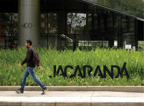
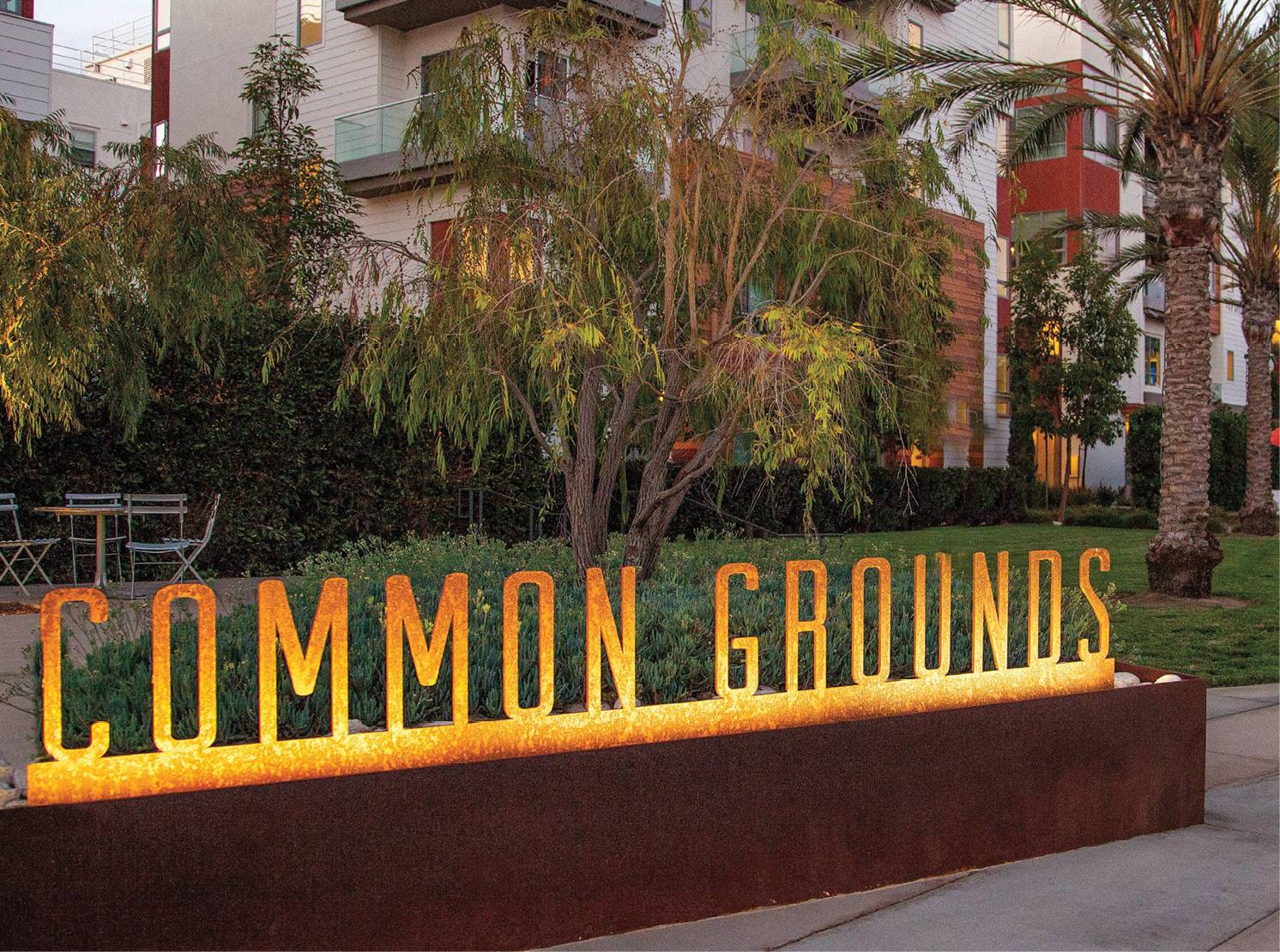
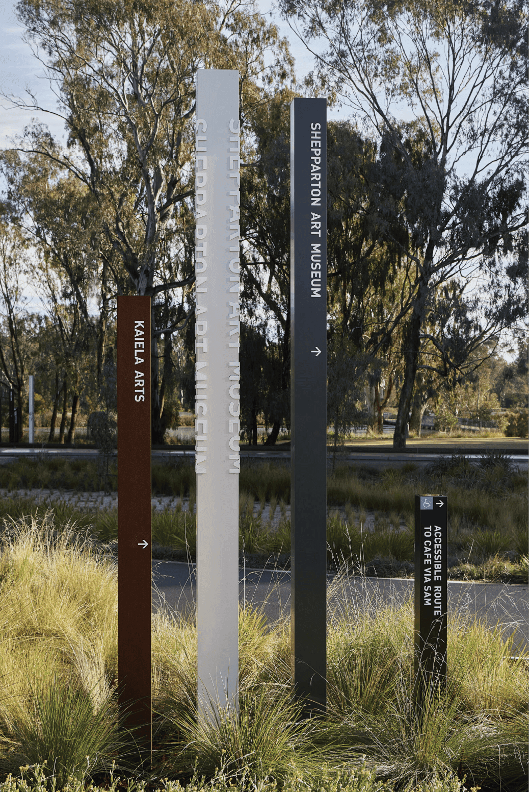
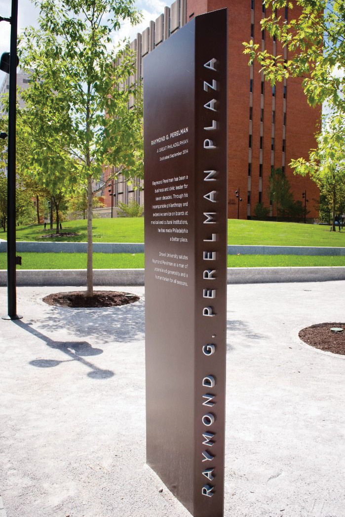
5.3.4 CIVIC park PRECEDENT IMAGES - picnic area
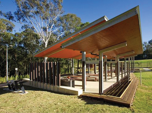
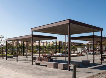
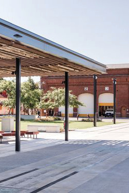
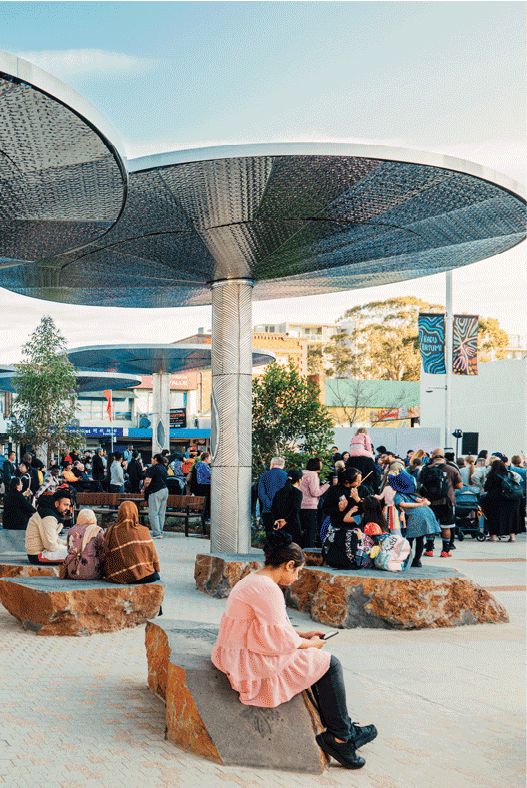
5.3.5 CIVIC park PRECEDENT IMAGES - activating CORNER OF darby St & laman St
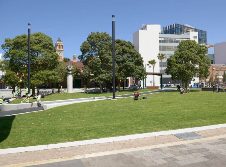
-5fd1f4a3cee79.jpg)
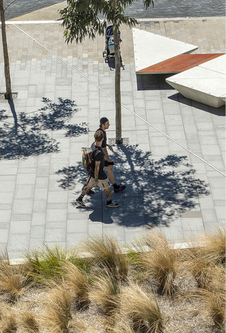
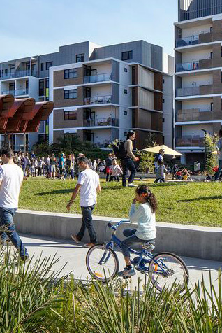
5.3.6 CIVIC park PRECEDENT IMAGES - amenities block
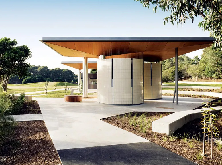
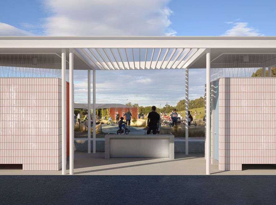
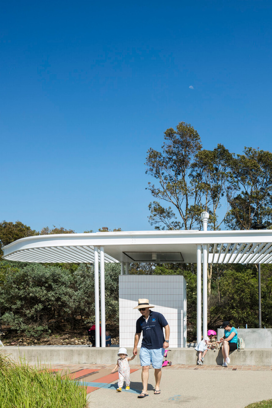
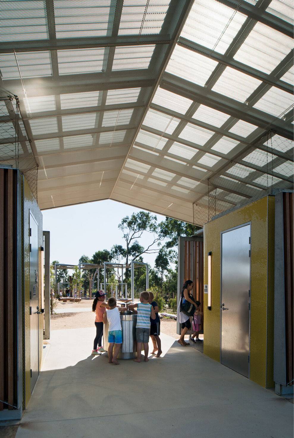
5.3.7 CIVIC park perspective d - darby st entry
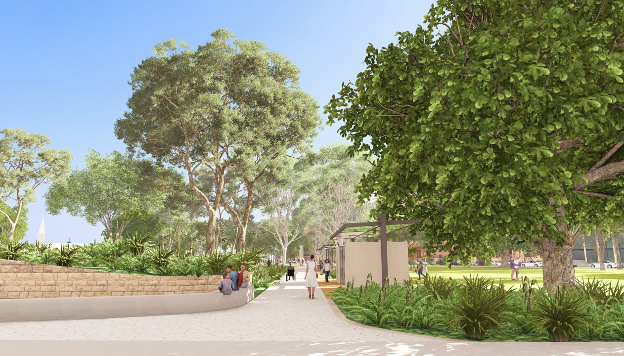
5.3.8 CIVIC park perspective e - amenities block
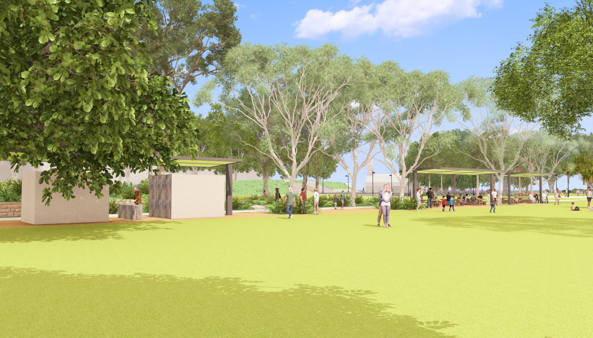
5.3.9 CIVIC park perspective f - memorial grove
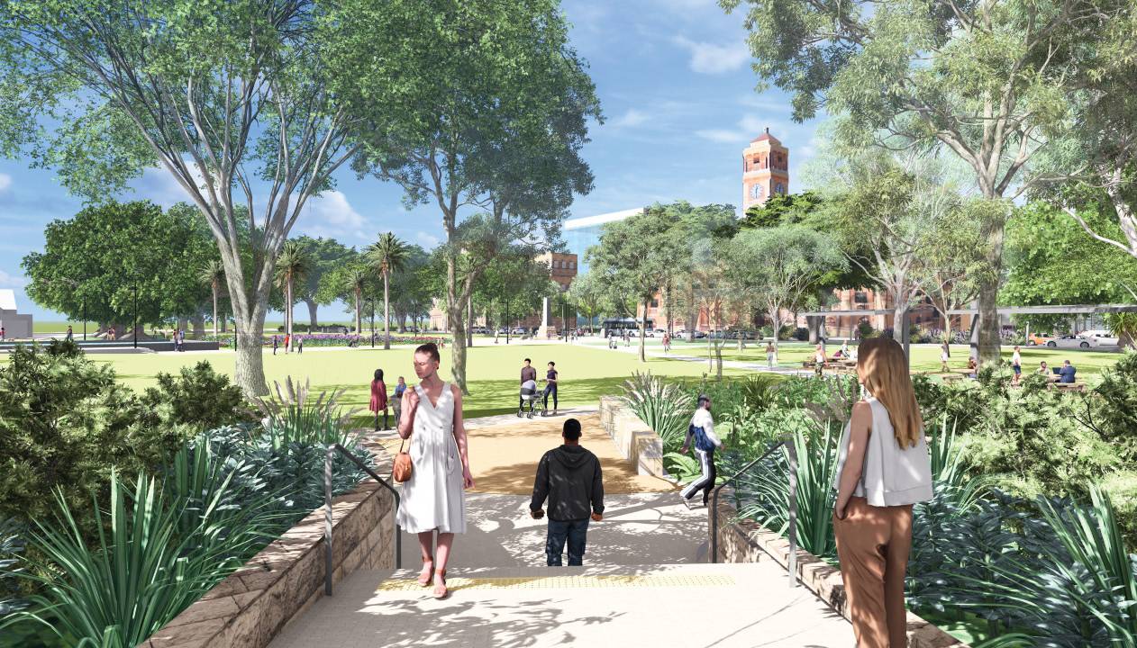
5.3.10 CIVIC park perspective g - war memorial tree avenue
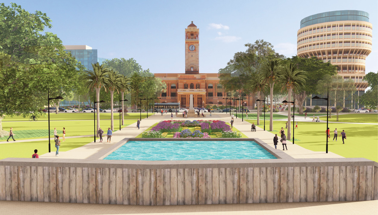

Figure X. Mural by Fintan Magee. Source: Wilt Living


