Purpose of the flood study
The outcomes of the study will be used to reduce risk to life and property, build community resilience, and improve emergency planning and response.
From 24 July to 21 August, we invited the community to help us gather information about flooding in the local area. Your knowledge and experiences will help us to improve the accuracy and reliability of the flood study, as well as helping us to understand how we can best manage flood risk and improve community resilience.
Thanks to everyone who participated!
Read the Engagement Summary to find out what we heard.
City of Newcastle, in partnership with the NSW Government, Maitland City Council and Cessnock City Council, has engaged a specialist consultant to carry out a flood study for the Hexham and Woodberry Swamp Catchments to help us plan for and manage existing and future flood risks.
The study area includes suburbs such as Wallsend, Jesmond, Fletcher, Beresfield, Thornton, Woodberry, Millers Forest and Black Hill.
We asked you to share your experiences with flooding and knowledge of historical flood events to improve the accuracy and reliability of the flood study. Thanks to everyone who participated by completing the survey, or adding to the interactive map on this page.
Your responses will help inform how we plan for and prepare for flood events to reduce the risk to life and property. The outcomes of the flood study will also be shared with emergency services to improve emergency planning and response.
The outcomes of the study will be used to reduce risk to life and property, build community resilience, and improve emergency planning and response.
The Newcastle, Maitland and Cessnock local government areas are largely built on floodplains, with many properties being impacted by flash flooding.
We've recently experienced the impacts of flash flooding with more than 3 times the monthly average rainfall in May.
Flash flooding is when there's heavy rainfall over a short period of time. It can happen with little to no warning.
If you live in the western areas of Newcastle, or Thornton, Woodberry, Millers Forest, Stockrington and Black Hill we want to hear from you.
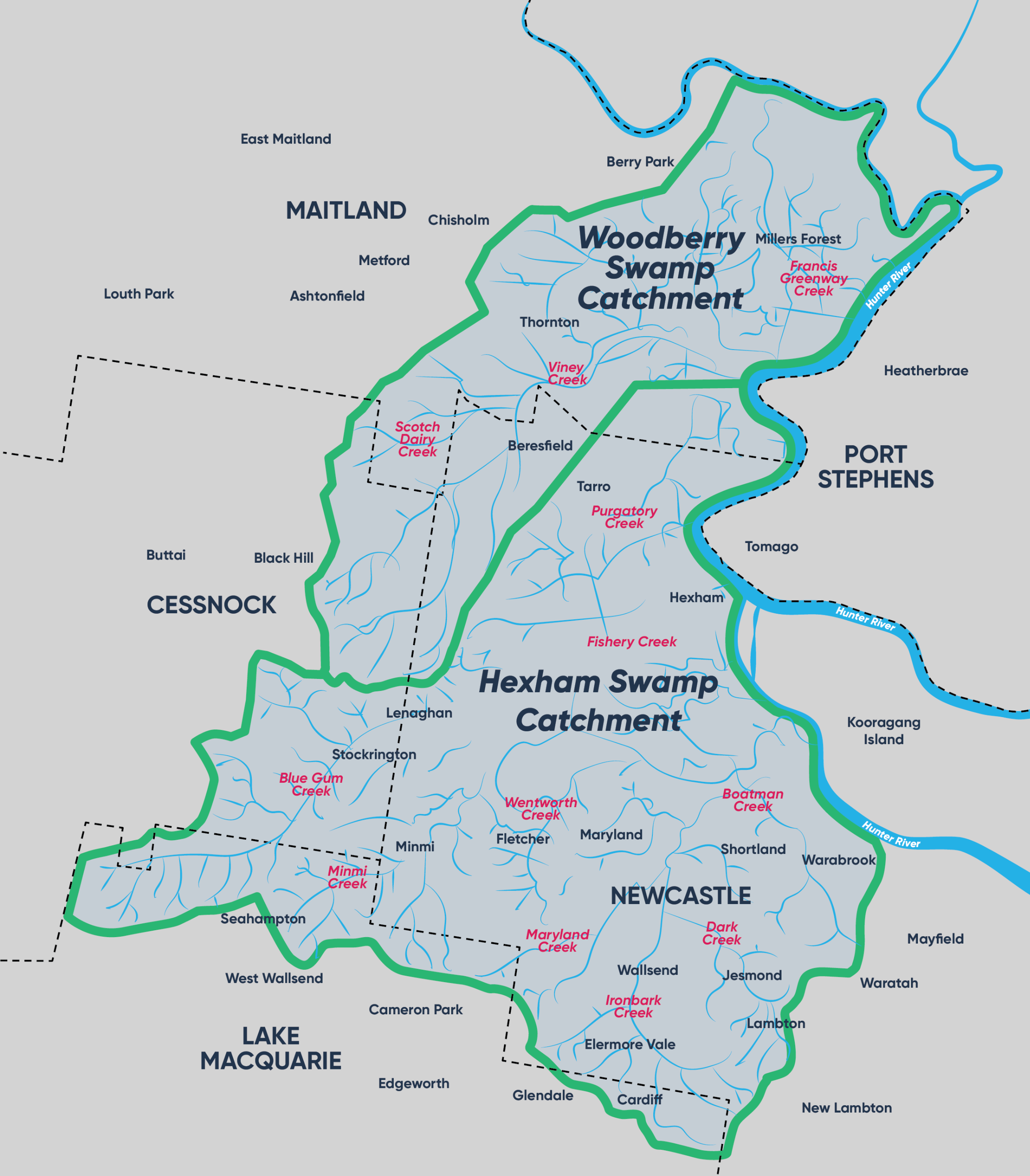
Map of the Hexham and Woodberry Swamp catchment area
Find out how you can plan and prepare for flooding with key information from the NSW SES.
![]()
Have questions or want to learn more about a project, contact us below:
| Phone | 02 4974 2000 |
|---|---|
| Website | newcastle.nsw.gov.au |
| In writing | 12 Stewart Avenue |


