Date: 07/02/2023
Consultation package

Wickham Concept Public Domain Plan Vision & Principles
“Wickham will continue to transform into a dynamic urban neighbourhood that supports a diverse mix of uses, which complement the adjoining commercial core of the Newcastle City Centre located within Newcastle West.
Urban renewal within the area is envisaged to build on the existing urban structure to deliver greater connectivity, improved public domain amenity, and a built form reflecting the envisage function and character.”
Wickham Master Plan Key Objectives
Improve accessibility and connectivity within Wickham and to adjoining areas
Create safe, attractive, and inclusive public places
Ensure built environment is functional, responsive, and resilient
Principles
1. Re-establish Wickham’s essential relationship with water
-
 Improve access to waterfront / water Country from the broader Wickham precinct (including future consideration of a bridge link over Hannell Street) and connect Wickham Park to the creek
 -
 Remove physical and visual barriers between the waterfront and the broader precinct (including the visual barrier of parking along development lots fronting Hannell Street)
 -
 Broaden the extent and accessibility of public access to the water along the waterfront, including to the potential new ferry stops and public launch
 -
 Celebrate water stories and features within proposed urban activation areas
 -
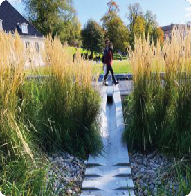
 Comprehensively integrate Water Sensitive Urban Design provisions into the streetscape and urban activation areas
 -
 Futureproof the neighbourhood against flooding with the sensitive design of building interfaces with the street
2. Unlock delightful and protected movement within and through Wickham
-
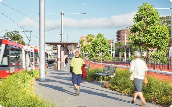
 Implement people-focused movement solutions that prioritise pedestrians and cyclists and create separation where there are risks or amenity impacts
 -
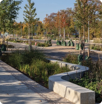
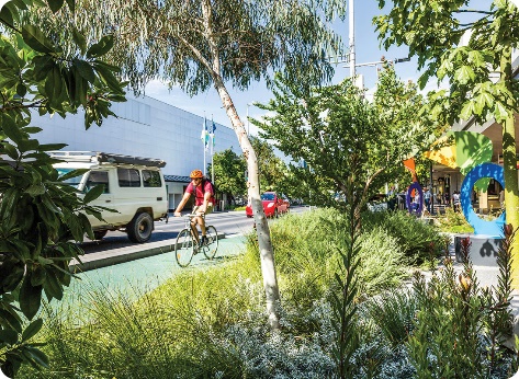
 Implement abundant green planting for shade and a more pleasant experience for people on foot or bikes
 -
 Balance movement and place outcomes for Union Street as the village spine and protect it from non-local traffic
 -
 Support separated cycling connections linking parks and waterfront
 -
 Create a fine grain network of streets which support walking and cycling
 -
 Creates accessibility throughout the precinct and provide amenity for people whilst moving
 -
 Address needs of commuters, visitors and locals
3. Create integrated solutions which incorporate key features of Wickham
- Ensure places are multi-functional and bring together public and place features
- Consider interface to buildings with considered transitions required in levels and from public to private conditions
-
 Bring together engineering and design solutions into cohesive and place-responsive solutions which unlock access to features of Country
 -
 Support connectivity and the communities’ experiences of public space as they transition between Wickham and other parts of the city with consideration of gateway points and features
 -
 Unlocking the edges of Wickham Park particularly along the former rail corridor and integrating to it so that this significant open space supports the community.
 - Increase shade and reduce heat impact through generous and careful planting of trees
4. Craft places for continued Wickham community connection and gathering
-
 Create a safe and vibrant heart to the ‘Village Hub’
 - Reinforce Union Street as the ‘Village Spine’ with places to stay, meet and play
-
 Establish a hierarchy of scales and uses for other urban activation areas to provide diversity in public space provision
 -
 Enable clear lines of sight to public spaces with planting provisions to support sense of safety
 - Ensure high levels of community amenity within new public spaces
-
 Distribute set of small delightful found elements to be discovered across the precinct
 - Continue character as incubator for artistic expression
- Reintegrate with County with a landscape that is both regenerative and biophilic.
5. Celebrate the varied, diverse, and characterful layers of Wickham
- Reveal traces stories of Wickham across the millennia within the public domain spaces in a layered rather than singular way. Undo the over-writing and let layers be read in response to Country
- Public spaces to respond to varied precinct character and recongise natural expansion of character areas as appropriate beyond boundaries given layered nature of evolution of Wickham
-
 Create opportunities for wandering and material exchange across interpretation across Country and Heritage interpretation proposals, including a foraging trail.
 - Retain and celebrate the gritty and quirky character as part of the layering
-
 Respond to established amenities and existing landmarks, including mature trees
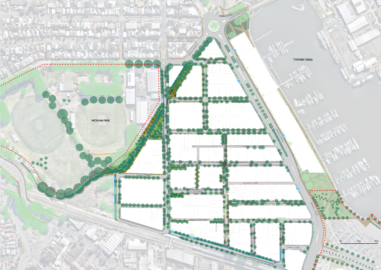
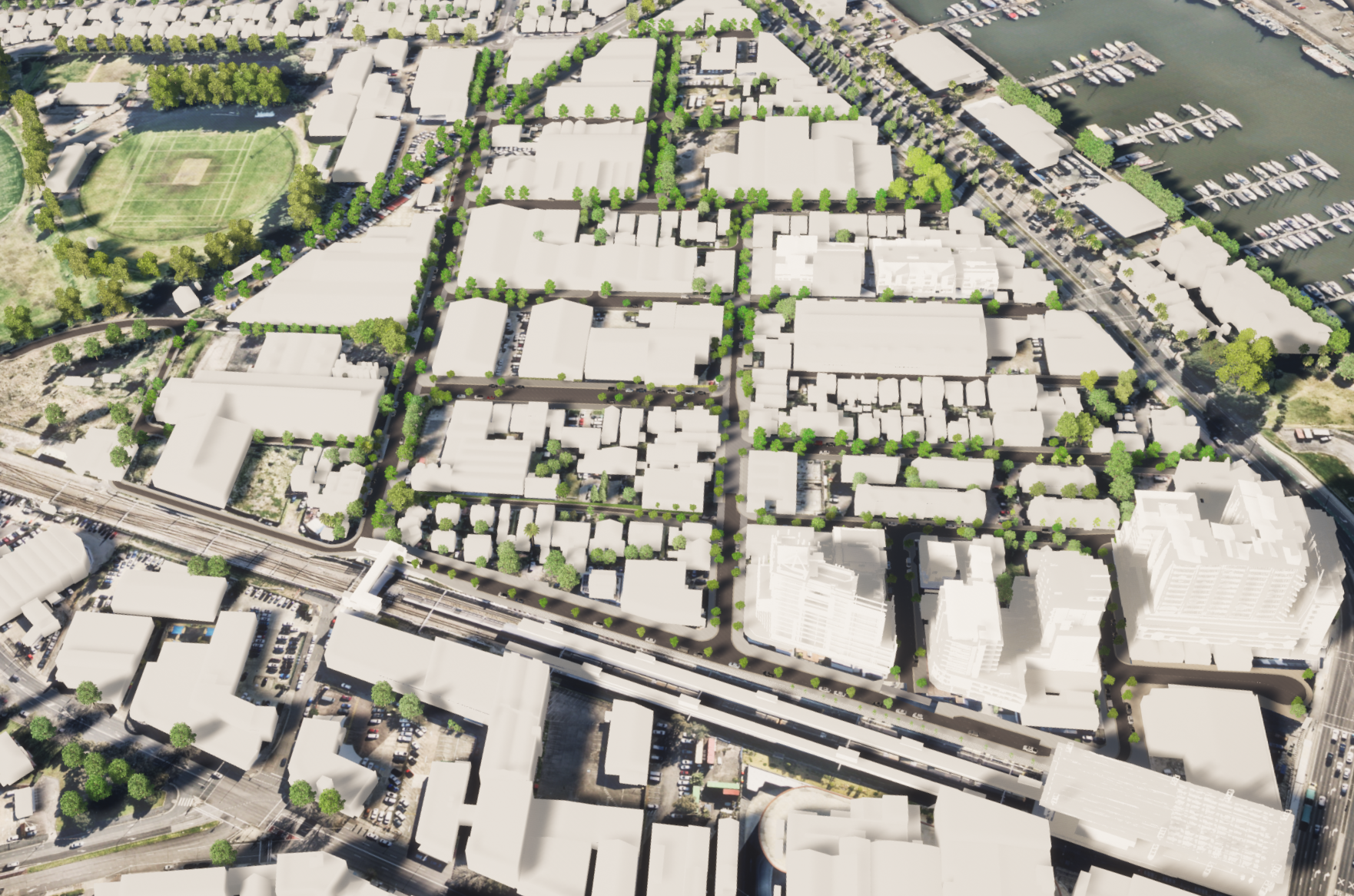
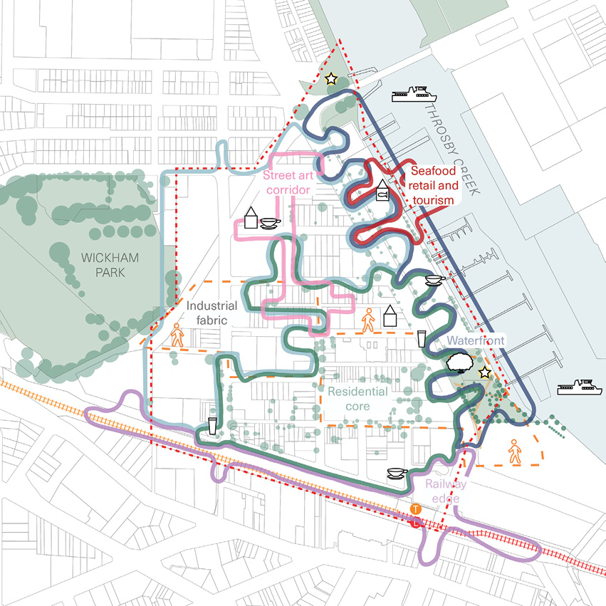
Wickham Concept Public Domain Plan: Overview & Aspirations
Notes: This public domain plan is for strategic design purposes only. Tree placements and footpath extents are indicative and to be refined in future design detail stages.
The Wickham Public Domain Plan (PDP) is delivering on the directions outlined within the Wickham Master Plan. Within the process there has been integration across place, sustainability and engineering approaches.
Place Responsive
The Principles established to guide the Wickham PDP have been anchored in a thoughtful consideration of Wickham’s places and their importance and meaning to those who call Wickham home.
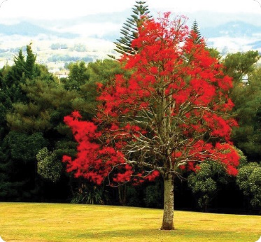
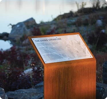
Provision has been made for the future integration of public art and interpretation of both Aboriginal and European heritage.
Shifts to traffic access, parking provisions and increased greening will result in significantly improved amenity for locals and visitors alike.
Country perspective
The Wickham PDP recognises the multiple perspectives of the Knowledge Holders of this area. Supported by Bangawarra, we have integrated Indigenous knowledges and approaches. This support, and further engagement with Indigenous communities, will continue to provide the foundation of our understanding of place.
Labels
- 1. Branch & Albert St - The Avenue – Signifying the presence of Wickham Park and entry to Wickham along key access streets with an extended avenue of trees and Welcome Nodes
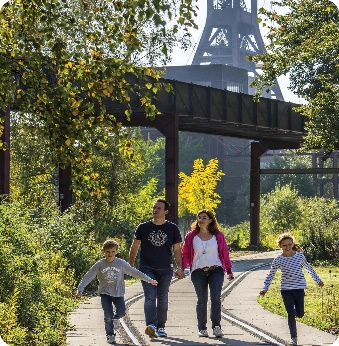
- 2. Bullock Island Railway Corridor – New pedestrian and cycling access connections to/from Wickham Park along a series of public spaces that interpret former histories of the area
- 3. Wickham Park – Upgraded to improve community, transport and recreational facilities in line with Wickham Masterplan (Subject to separate detailed design)
- 4. Railway St - Green Connector – Transformed into a green street and key transport spine of Wickham providing quality multi-modal movements
- 5. The Park Edge Streets – Transitioning from Wickham Park into the suburb, the new and improved, low-speed streets draw together the park and village characters
- 6. Union St - Village Heart – A calmed heart in the centre of the Village supporting community use through new public domain amenity the removal of all traffic bar local
- 7. Station St - Interchange Connector – Upgrades to the setting and access of Newcastle’s new ‘front door’, where locals and visitors alike arrive, depart, and change modes.
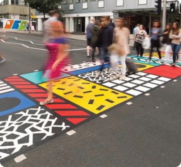
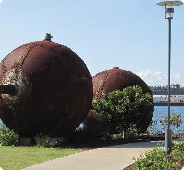
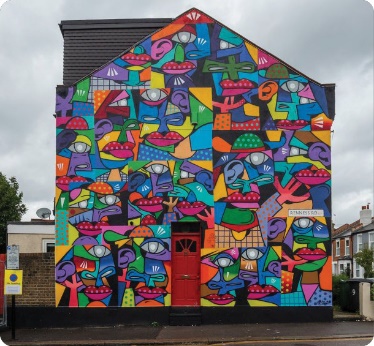
- 8. The Emerging Industry Streets – Upgraded streets supporting emerging industries and community, which celebrate industrial character, street art and creativity
- 9. Waterfront - The Promenade – Greater integration with waterfront with upgrades to shared path and improved visual/physical permeability through private sites progressively
- 10. Church St - Park to Water – A green spine that improves high amenity access and legibility between the two important community assets of Wickham Park and the waterfront
- 11. Throsby St - Village Activator – A dynamic and vibrant east-west corridor, with upgrades to provide amenity nodes, integrated public art and works that celebrate place
- 12. Tree of Knowledge Parkland – Integration of upgrades to the parkland which extend the foreshore works from Honeysuckle and provide greater public access to water
- 13. Hannell St - The Boulevard – Extension of the significant fig and palm feature trees along edges to expand Hannell Street as a distinctive green boulevard
- 14. The Village Streets – Changes to traffic patterns and upgrades to protect the close knit, characterful and quiet network of local streets
Key for map
Surface treatment
|
Symbol |
Meaning |
|---|---|
 |
Carriageway |
 |
Raised Cobbled Road Surface |
 |
Parking (Permeable Paving) |
 |
Verge planting |
 |
Continuous footpath treatment |
 |
Union Street paving |
 |
Village Street paving |
 |
Emerging Industries paving |
 |
Civic Streets paving |
 |
Park edge paving |
 |
Paving improvements subject to plans beyond this PDP’s scope |
 |
Private property |
 |
Cycleway |
 |
Driveway |
 |
Works as per masterplans beyond Wickham PDP scope |
 |
Bus stop |
 |
Passively irrigated tree pits |
 |
Proposed trees |
 |
Existing trees |
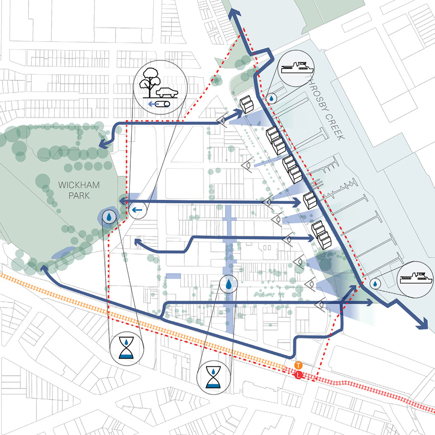
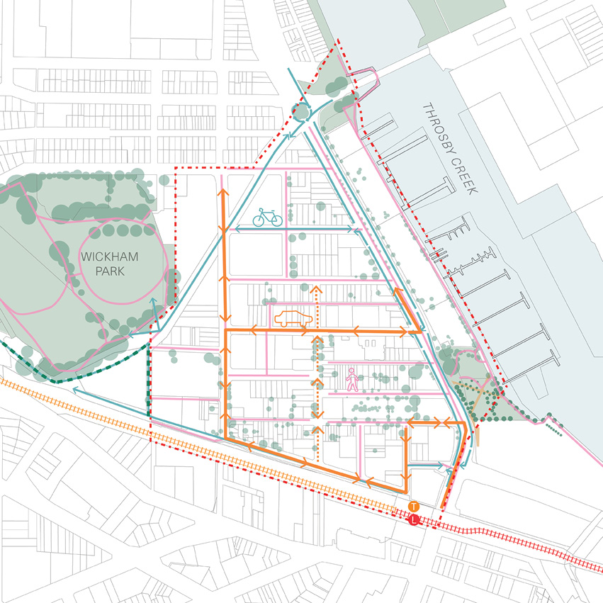
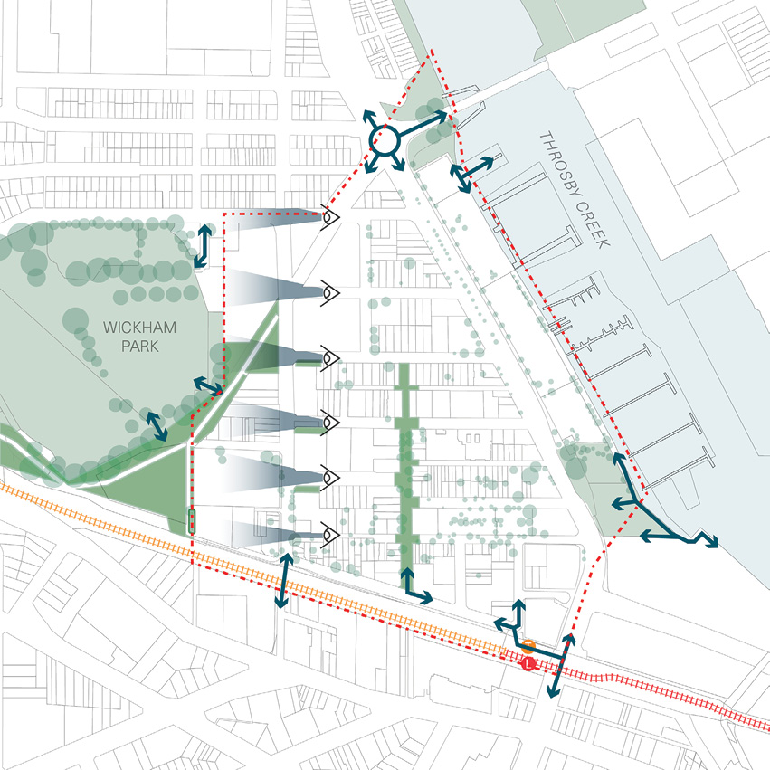
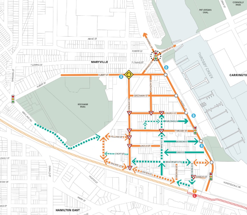
Wickham Concept Public Domain Plan: Access & Movement Framework
Transport solutions: summary
The transport components of the public domain plan have been informed by the 2017 and 2021 Wickham Masterplans, the Local Area Traffic Management Study (2017), and the Wickham Area Parking Study (2019).
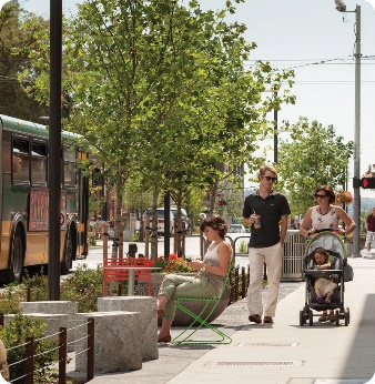
Pedestrian movement
A key focus of this public domain plan is to facilitate movement in and around Wickham by foot. This includes introducing ‘self-enforcing’ low speed zones across Wickham, achieved through improvements including:
- Continuous footpath treatments and wombat crossings. These types of crossing calm traffic and ensure pedestrians have priority. They ensure crossing is more accessible for those using wheelchairs or strollers.
- Kerb build outs at intersections. These reduce the crossing distance for pedestrians across side streets and force vehicles to reduce their speed when turning.
Key for map
Land cover
|
Symbol |
Meaning |
|---|---|
 |
Green space / open space |
 |
Surface and tidal water |
Traffic management
|
Symbol |
Meaning |
|---|---|
 |
Kerb extension |
 |
Continuous footpath treatments (CFT) |
 |
Potential raised road |
 |
Raised intersection |
 |
Wombart crossing delivered on Day 1 |
 |
At-grade crossing delivered on Day 1 and wombart crossing delivered during Stage 2 |
Transport
|
Symbol |
Meaning |
|---|---|
 |
Heavy rail stop and alignment |
 |
Light rail stop and alignment |
Cycling movement
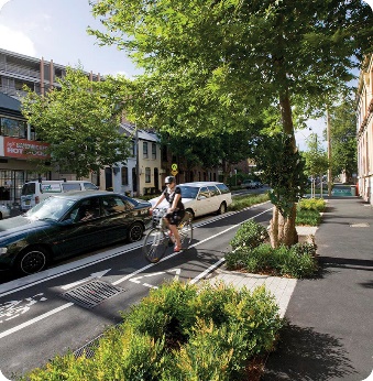
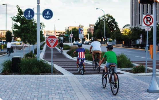
Another key focus of this public domain plan is to facilitate movement in and around Wickham by bike. This will also be achieved through low speed zones, which make cycling a safer and more pleasant experience. Other improvements will include:
- A new separated and bidirectional cycleway along the former Bullock Island Railway Corridor between the Cowper Street/Branch Street roundabout and southern end of Wickham Park.
- A new separated and bidirectional cycleway along Station Street, connected to the wider Newcastle cycle network by Quietways and shared paths.
Key for map
Land cover
|
Symbol |
Meaning |
|---|---|
 |
Green space / open space |
 |
Surface and tidal water |
Bicycle infrastructure
|
Symbol |
Meaning |
|---|---|
 |
Alternative/temporary option for Day 1/Stage One cycleway connectivity |
 |
Active transport connection proposed in 2021 Wickham masterplan |
 |
Exisiting shared user path |
 |
Existing on-road cycle lane |
 |
Proposed routes of Newcastle Cycling Plan |
Transport
|
Symbol |
Meaning |
|---|---|
 |
Heavy rail stop and alignment |
 |
Light rail stop and alignment |
Vehicle movement
Another key focus of this public domain plan is to encourage vehicle movement in and around Wickham in ways that make the area safer, quieter, and with more space for people who are walking or riding bikes. This will be achieved through changes to parking and to vehicle circulation.
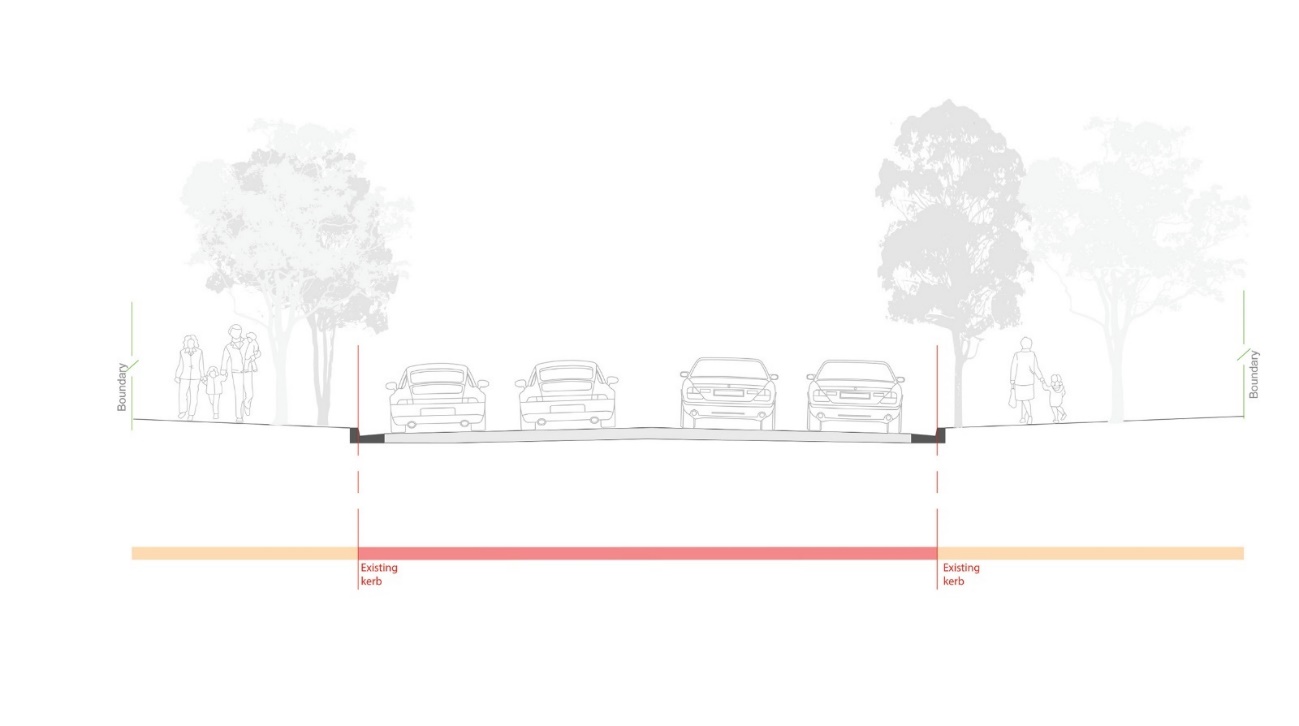
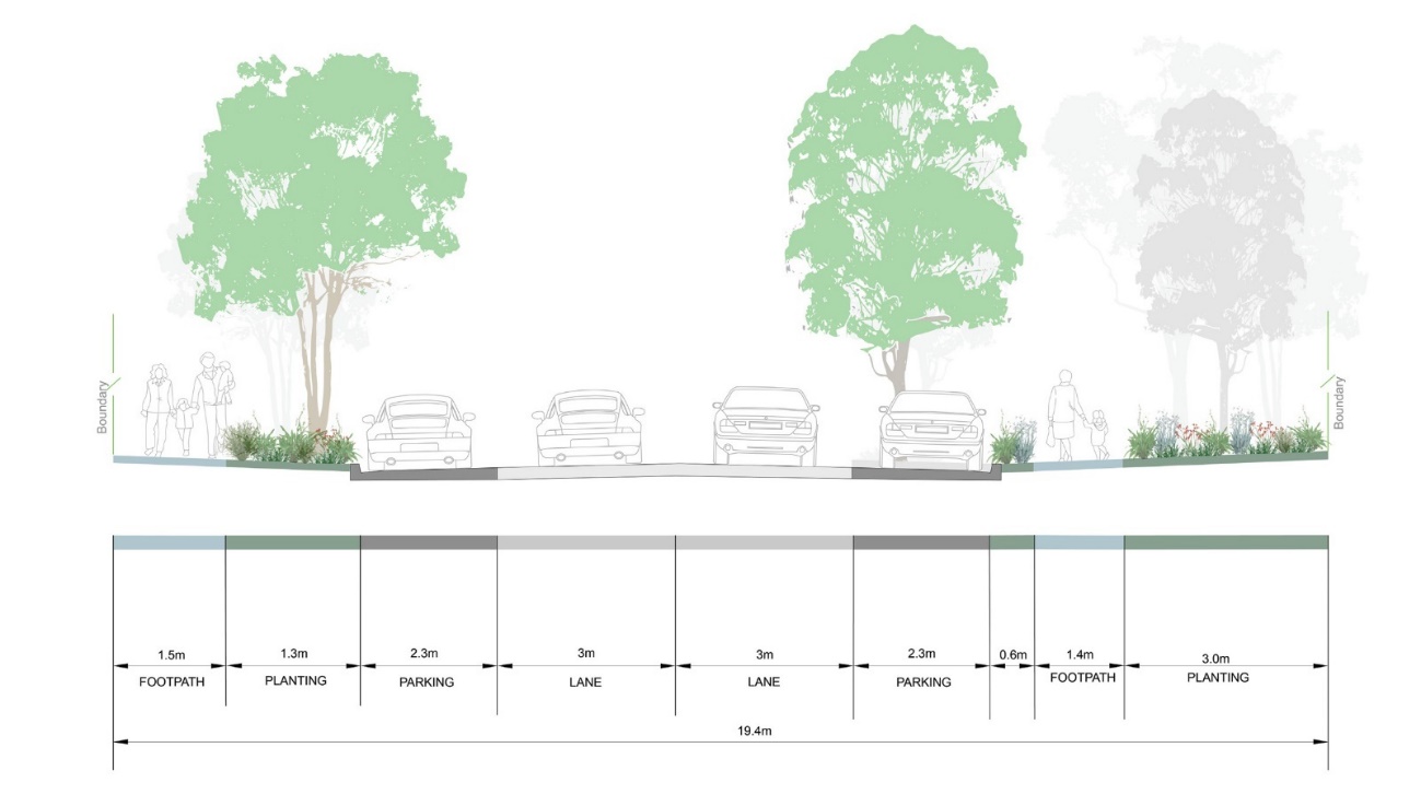
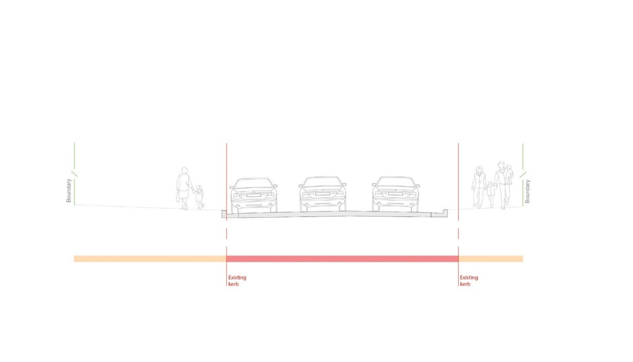
Where studies have shown that on-street parking is consistently under-utilised, there is an opportunity to introduce wider footpaths, which will enhance the pedestrian environment and increase space for trees. Changes to vehicle circulation in Wickham are also proposed. These include changes to Union Street in order to prevent it from being used as a northbound through-route by vehicles dropping off or picking up passengers at Newcastle Interchange. Reducing the volume of traffic of Union Street will enhance its role as a safe and green heart of the village.
The proposed vehicle circulation changes for Wickham include:
- Converting Station Street to two-way between Wickham Street and Railway Street.
- Converting Union Street to one-way northbound between Bishopsgate Street and Church Street
Key for map
Land cover
|
Symbol |
Meaning |
|---|---|
 |
Green space / open space |
 |
Surface and tidal water |
Vehicle circulation
|
Symbol |
Meaning |
|---|---|
 |
Existing two-way link |
 |
Proposed two-way link |
 |
Existing one-way link |
 |
Proposed one-way link |
 |
Traffic signal |
 |
Proposed signalised roundabout |
 |
Roundabout |
 |
Left-in left-out |
 |
Priority intersection |
Transport
|
Symbol |
Meaning |
|---|---|
 |
Heavy rail stop and alignment |
 |
Light rail stop and alignment |
Wickham Concept Public Domain Plan: Canopy cover
Proposed canopy cover
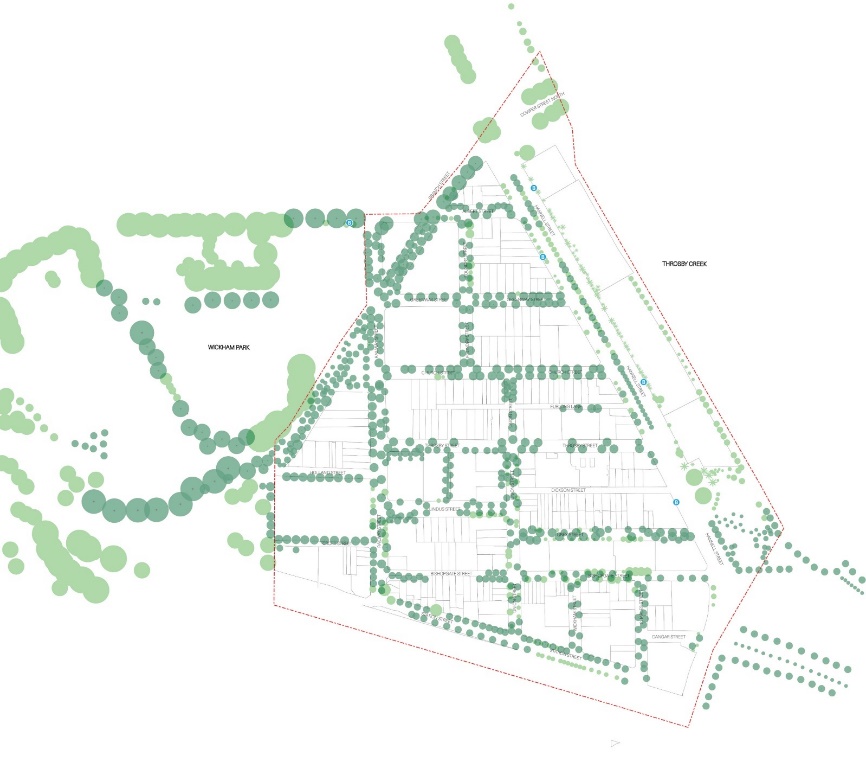
Existing canopy cover
Canopy overview
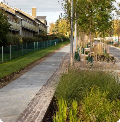
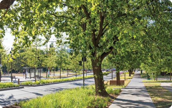
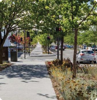
This Concept Public Domain Plan provides for a substantial increase in canopy cover for Wickham, important for biodiversity, mitigation of the heat island effect, and for the enhancement of the experience of the street for people on foot and on bikes.
The existing tree canopy cover, as a percentage of the streetscape (within the Focus Area but excluding Hannell Street) is approximately 7%. The proposed tree canopy cover for the same area will be approximately 49%, once trees reach maturity.
Note that these are approximations and subject to detail design in the subsequent stages of delivery.
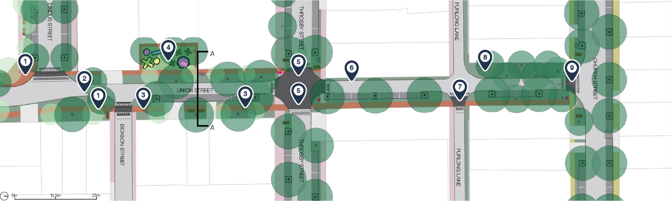
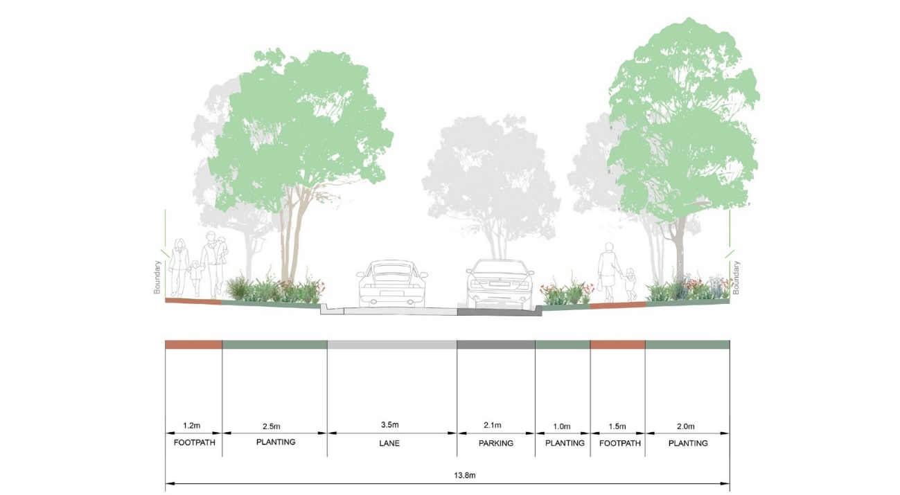
Wickham Concept Public Domain Plan: Union Street - Village Heart
Union Street New Public Domain and Traffic Plan - Southern Zone
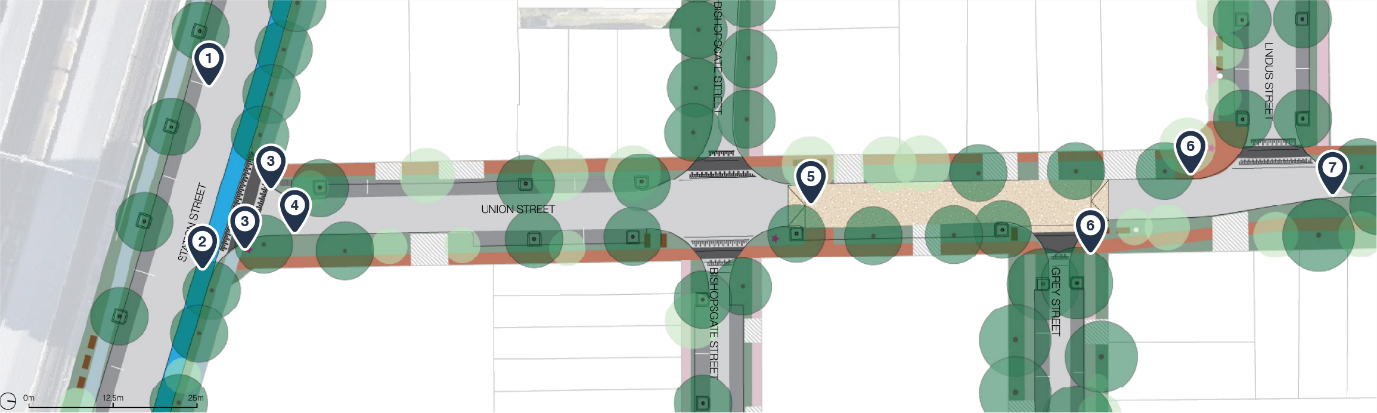
Labels
- 1. Upgrades to Station Street to include new passively irrigated street trees between parking bays along southern side of street.
- 2. Bidirectional separated cycleway on northern side Station Street
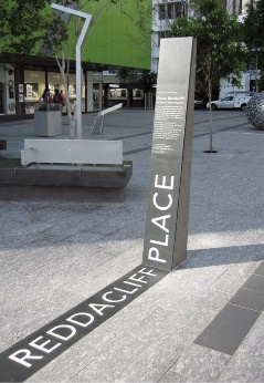
- 3. New Welcome Nodes at key entrance points to precinct. Form of elements to be determined via Community Feedback
- 4. 1 no existing tree removed given new carriageway alignment. All other existing trees retained
- 5. Raised/slow street treatments between Bishopsgate Street and Grey Street
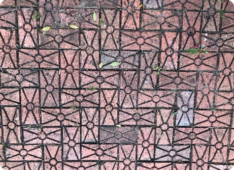
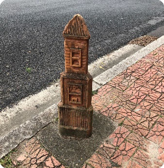
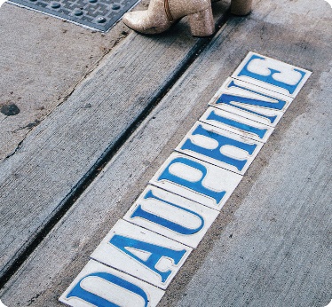
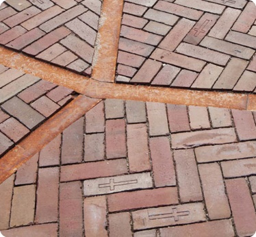
- 6. Enhanced setting for heritage footpath pavers and terracotta bollards around intersections with Lindus Street and Grey Street
- 7. Width of street narrowed north of Lindus Street into one way network for local vehicle movements only
Key for map
Surface treatment
|
Symbol |
Meaning |
|---|---|
 |
Carriageway |
 |
Parking (Permeable Paving) |
 |
Verge planting |
 |
Continuous footpath treatment |
 |
Union Street paving |
 |
Village Street paving |
 |
Emerging Industries paving |
 |
Civic Streets paving |
 |
Private property |
 |
Cycleway |
 |
Driveway |
Street furniture
|
Symbol |
Meaning |
|---|---|
 |
Benches |
 |
Bin |
 |
Bicycle parking racks |
 |
Bollards |
 |
Interpretation Node |
Trees and associated elements
|
Symbol |
Meaning |
|---|---|
 |
Tree grate |
 |
Passively irrigated tree pits |
 |
Existing / proposed medium tree |
 |
Existing / proposed |
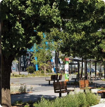
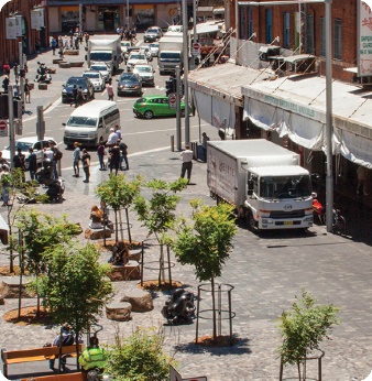
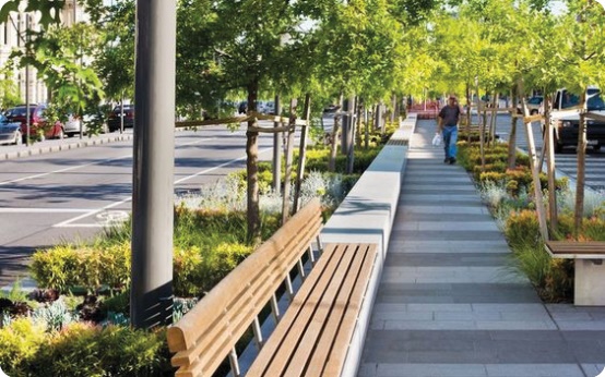
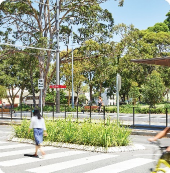
Character & Precedent/Images
Union Street New Public Domain and Traffic Plan - Northern Zone
Labels
- 1. Enhanced setting for heritage footpath pavers and terracotta bollards around intersections with Lindus Street and Dickson Street
- 2. Width of street narrowed north of Lindus Street into one way network for local vehicle movements only
- 3. Open space/parklet with opportunity for Community input to appropriate amenities, such as a dog park
- 4. Opportunities for seating and incidental play provisions along wider eastern side of Union Street between Lindus Street and Thorsby Street
- 5. No footpath potential on west side of Union Street given lot location. Provide crossings to transition to east side of Union Street
- 6. Opportunity for integration of place-based treatments within verge & raised intersection materials of Union Street and Throsby Street, including intersections of trails
- 7. Open space/parklet with opportunity for Community input to appropriate amenities
- 8. Trail opportunities to be signified via wayfinding and integration of elements within verge & CFT materials
- 9. Continuous footpath treatment at mouth of Union Street to facilitate greater west-east travel along Church Street
Key for map
Surface treatment
|
Symbol |
Meaning |
|---|---|
 |
Carriageway |
 |
Parking (Permeable Paving) |
 |
Verge planting |
 |
Continuous footpath treatment |
 |
Union Street paving |
 |
Village Street paving |
 |
Emerging Industries paving |
 |
Civic Streets paving |
 |
Private property |
 |
Driveway |
Street furniture
|
Symbol |
Meaning |
|---|---|
 |
Benches |
 |
Bin |
 |
Bicycle parking racks |
 |
Bollards |
 |
Interpretation Node |
Trees and associated elements
|
Symbol |
Meaning |
|---|---|
 |
Tree grate |
 |
Passively irrigated tree pits |
 |
Existing / proposed medium tree |
 |
Existing / proposed |
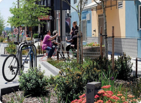
Character & Precedent/Images

Section at A-A
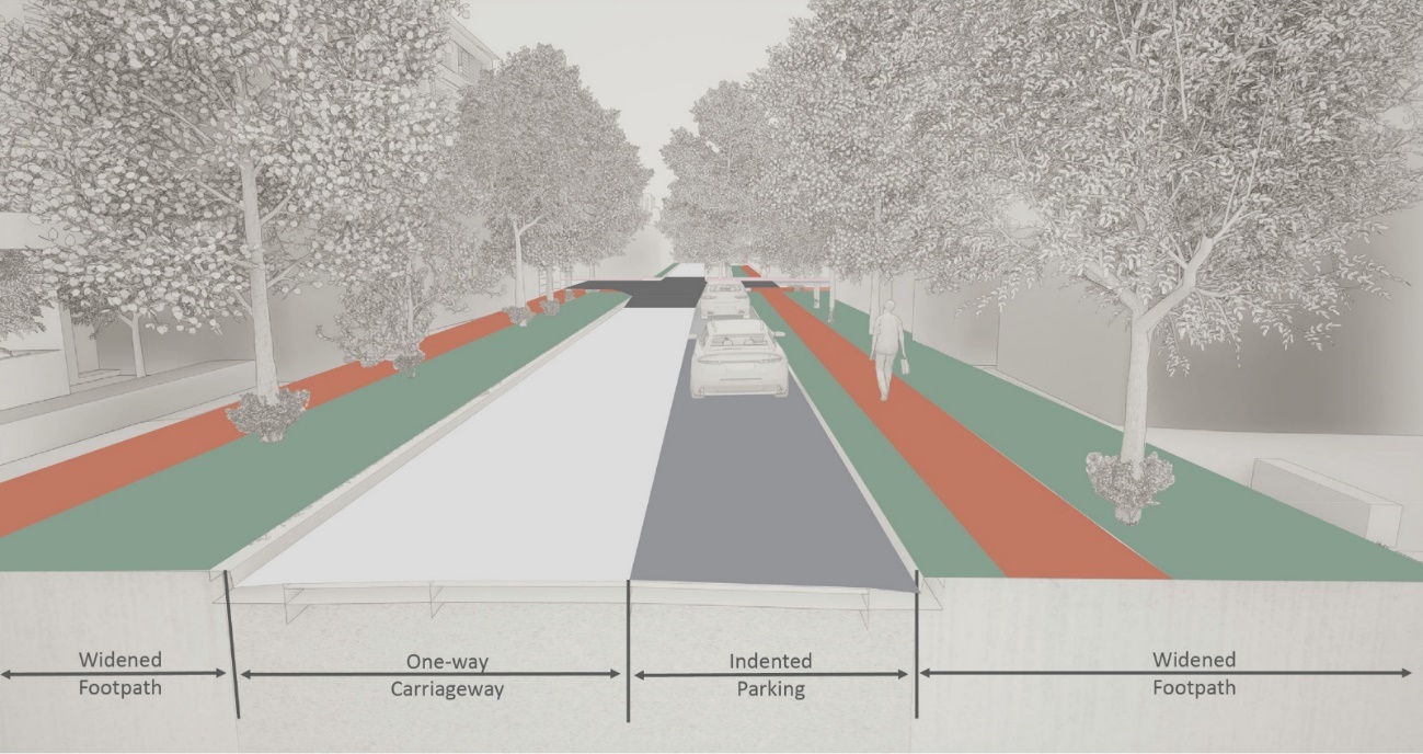
Key
|
Surface |
Meaning |
|---|---|
 |
Carriageway |
 |
Parking (Permeable Paving) |
 |
Verge planting |
 |
Continuous footpath treatment |
 |
Union Street paving |
 |
Village Street paving |
 |
Existing pavement |
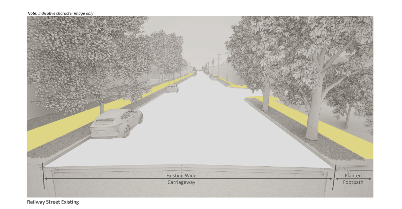
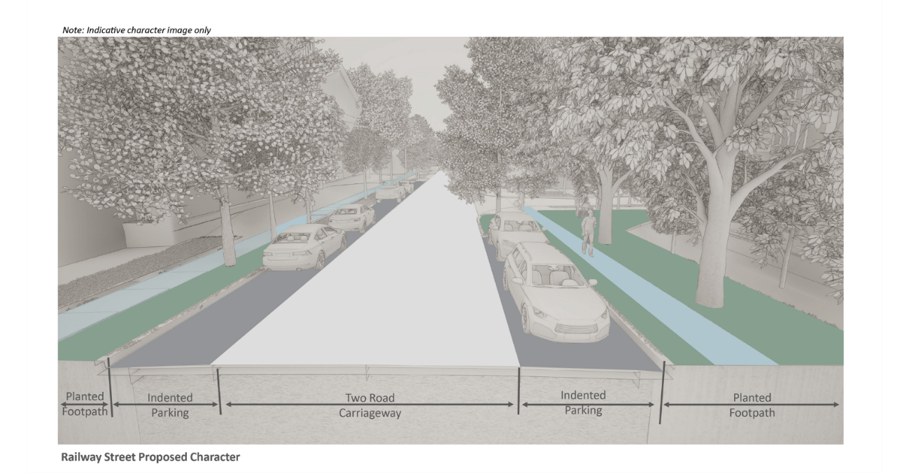
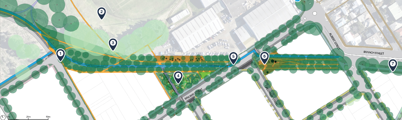
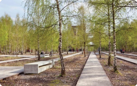
Wickham Concept Public Domain Plan: Railway Street - Green Connector
Railway Street and Bullock Island Rail Corridor New Public Domain and Traffic Plan
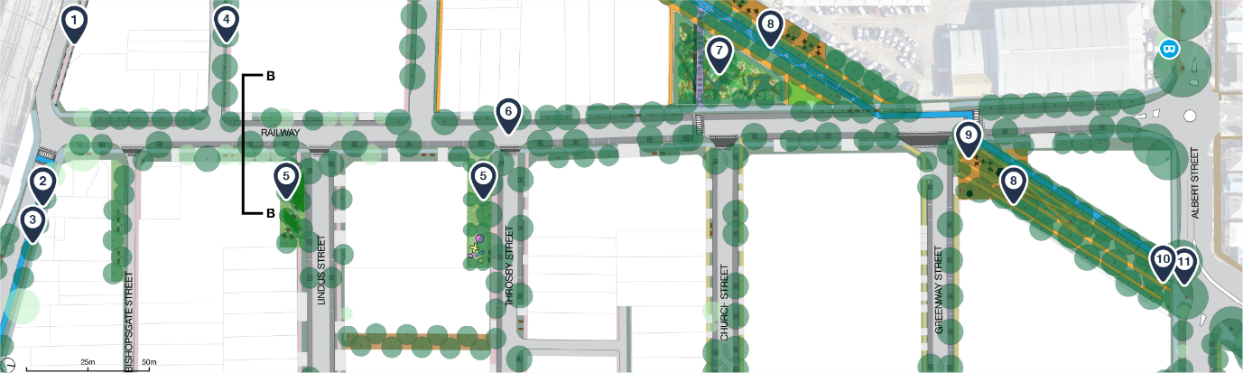
Labels
- 1. Options for either a Quietway or expanded footpath that allows for a shared path, continuing the cycle route along Station Street
- 2. Upgrades to Station Street to include new street trees to both sides of street.
- 3. Bidirectional separated cycleway on northern side Station Street
- 4. Extension of Croft Street with change to one way lane with consolidated footpath zone to northern side of street
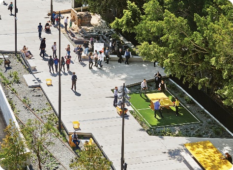
- 5. Open space/activation zones with opportunity for Community input to appropriate amenities
- 6. Temporary Stage One cycle lane between Holland Street and Albert Street. Opportunity to make permanent based on community feedback
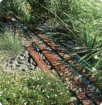
- 7. Urban wetland zone with boardwalks, plaza spaces to active building edges and integration with rail corridor.
- 8. Plaza zone with activated building frontages and opportunity for Community input to appropriate amenities
- 9. Linear Park to Bullock Isalnd Railway Corridor with combined rail interpretation and significant greening opportunities
- 10. New Welcome Nodes at key entrance points to precinct. Form of elements to be determined via Community Feedback
- 11. Expansion of Fig Tree planting along Albert and Branch Streets to connect to Wickham Park planting
Key for map
Surface treatment
|
Symbol |
Meaning |
|---|---|
 |
Carriageway |
 |
Parking (Permeable Paving) |
 |
Verge planting |
 |
Continuous footpath treatment |
 |
Village Street paving |
 |
Emerging Industries paving |
 |
Civic Streets paving |
 |
Park edge paving |
 |
Existing/unchanged paving |
 |
Private property |
 |
Driveway |
 |
Separated cycleway |
Street furniture
|
Surface |
Meaning |
|---|---|
 |
Benches |
 |
Bin |
 |
Bicycle parking racks |
 |
Bollards |
 |
Interpretation Node |
Trees and associated elements
|
Symbol |
Meaning |
|---|---|
 |
Tree grate |
 |
Passively irrigated tree pits |
 |
Existing / proposed medium tree |
 |
Existing / proposed |
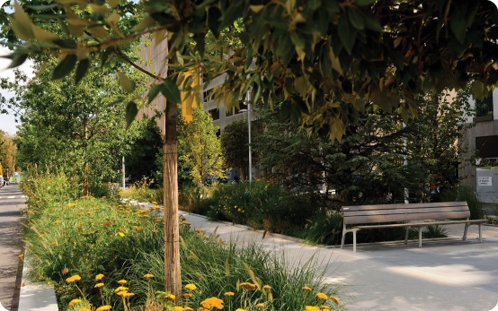
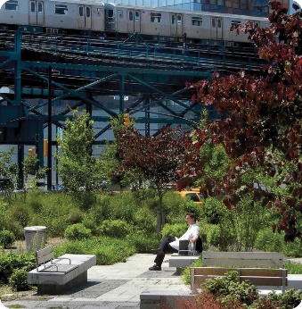
Character & Precedent/Images
Section at B-B
Key
|
Symbol |
Meaning |
|---|---|
 |
Carriageway |
 |
Parking (Permeable Paving) |
 |
Verge planting |
 |
Continuous footpath treatment |
 |
Civic streets paving |
 |
Village Street paving |
 |
Existing pavement |
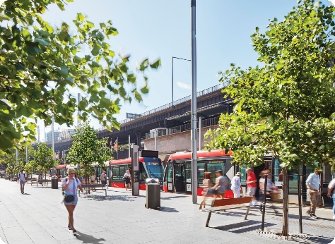
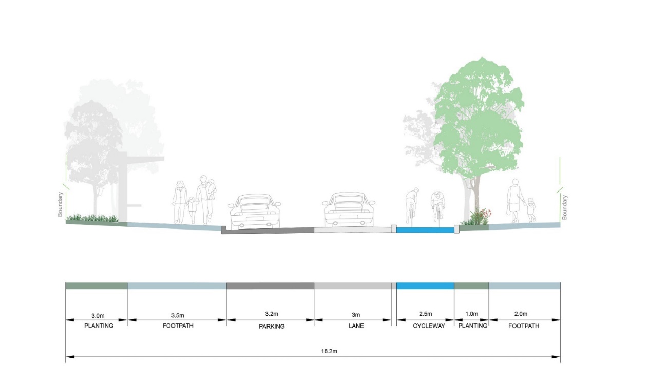
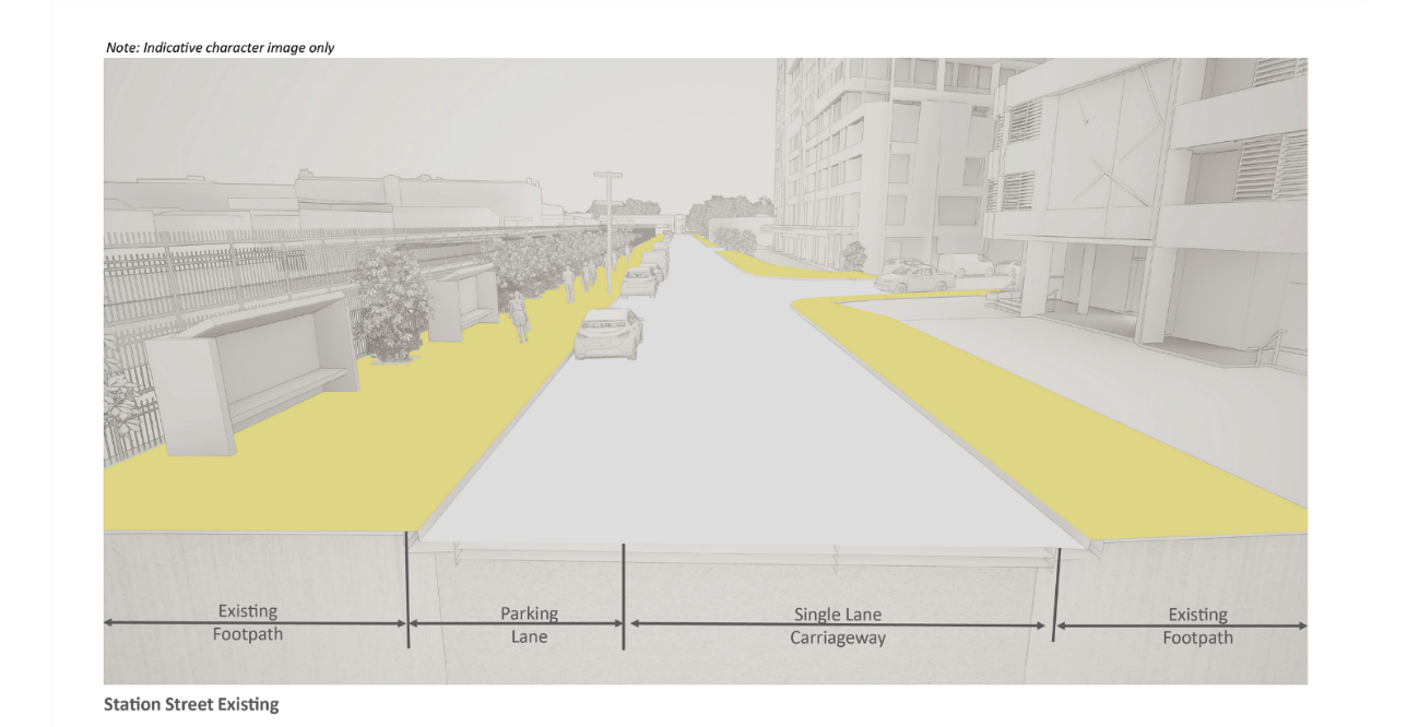
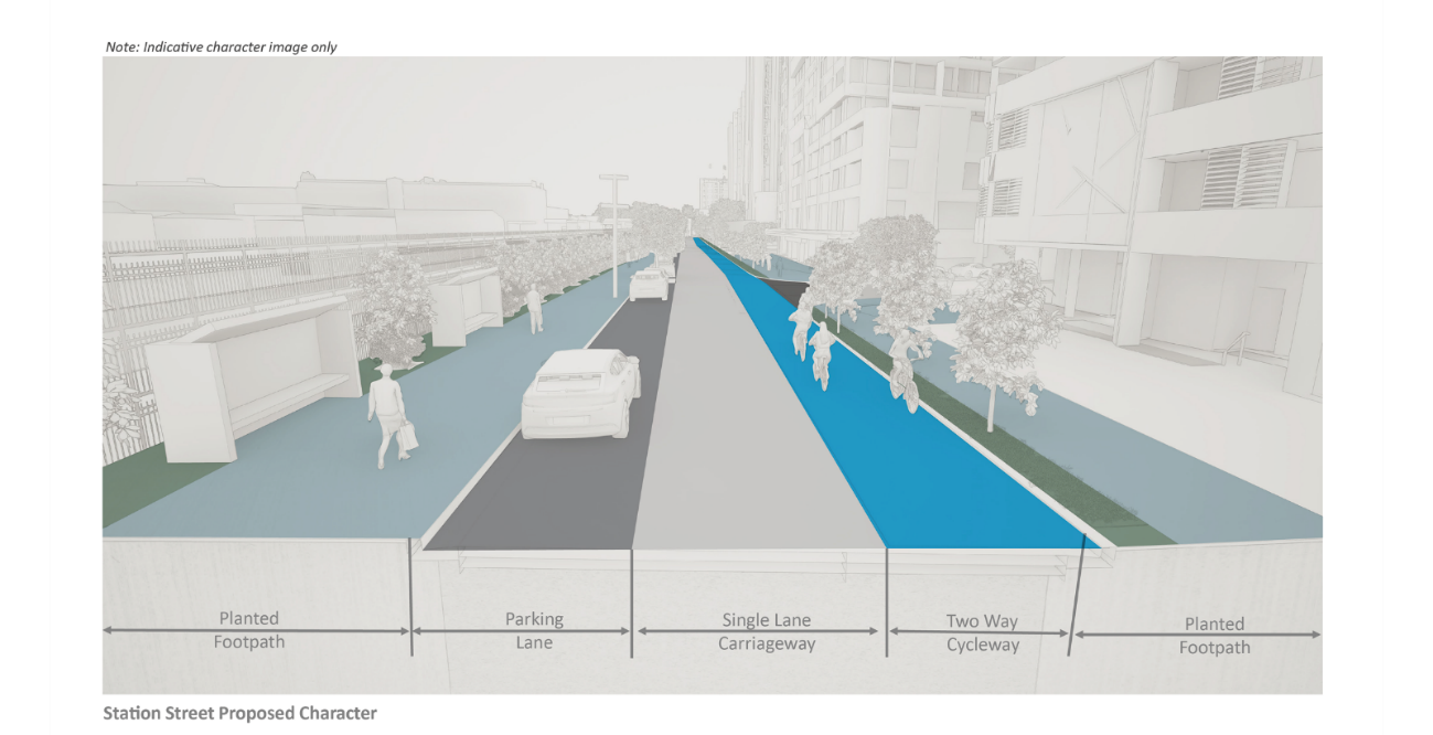
Wickham Concept Public Domain Plan: Station Street - Interchange Connector
Station Street New Public Domain and Traffic Plan
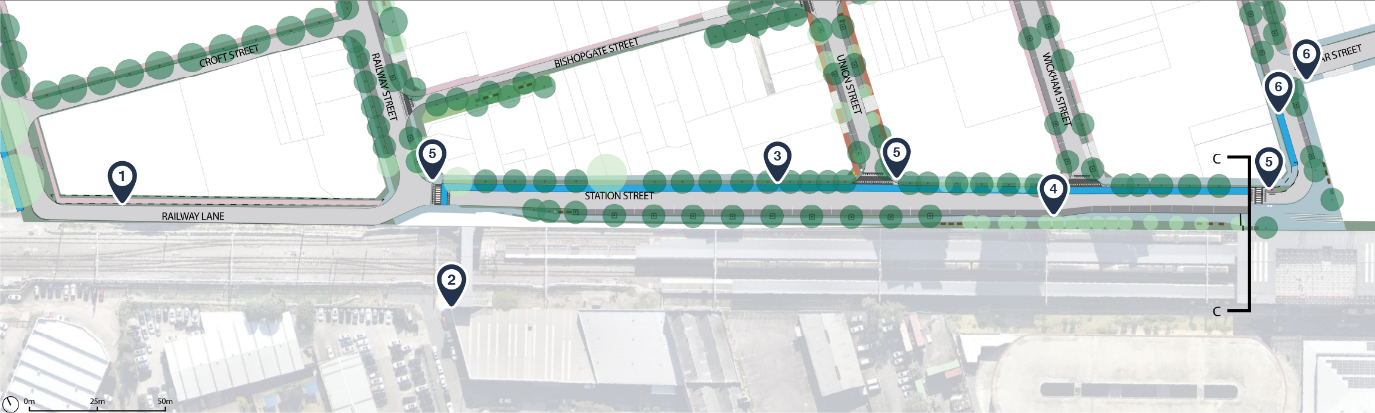
Labels
- 1. Options for either a Quietway or expanded footpath that allows for a shared path, continuing the cycle route along Railway Lane
- 2. Upgrades to Station Street to include new trees on both sides of street.
- 3. Separated, bi-directional cycleway on the northern side Station Street
- 4. Accessible parking bay for Newcastle Interchange maintained
- 5. Separated cycleway along Charles Street between Dangar Street and Station Street, connecting to Quietway in Dangar Street
- 6. New Welcome Nodes at key entrance points to precinct. Form of elements to be determined via Community Feedback
Key for map
Surface treatment
|
Symbol |
Meaning |
|---|---|
 |
Carriageway |
 |
Parking (Permeable Paving) |
 |
Verge planting |
 |
Continuous footpath treatment |
 |
Union Street paving |
 |
Village Street paving |
 |
Emerging Industries paving |
 |
Civic Streets paving |
 |
Park edge paving |
 |
Existing/unchanged paving |
 |
Private property |
 |
Driveway |
 |
Separated cycleway |
Street furniture
|
Symbol |
Meaning |
|---|---|
 |
Benches |
 |
Bin |
 |
Bicycle parking racks |
 |
Bollards |
 |
Interpretation Node |
Trees and associated elements
|
Symbol |
Meaning |
|---|---|
 |
Tree grate |
 |
Passively irrigated tree pits |
 |
Existing / proposed medium tree |
 |
Existing / proposed |
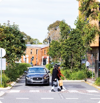
Character & Precedent/Images
Section at C-C
Key
|
Symbols |
Meaning |
 |
Carriageway |
 |
Parking (Permeable Paving) |
 |
Verge planting |
 |
Continuous footpath treatment |
 |
Civic streets paving |
 |
Cycleway |
 |
Existing pavement |
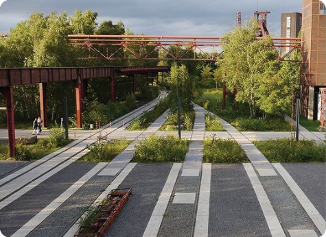
Wickham Concept Public Domain Plan: Bullock Island Railway Corridor Park
Bullock Island Rail Corridor park and public spaces
Labels
- 1. Dedicated cycleway and vehicle connection along new road to Maitland Road
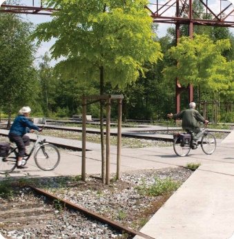
- 2. Celebration of historic railway lines by incorporation into dedicated cycleway
- 3. Connections to existing and proposed paths through Wickham Park
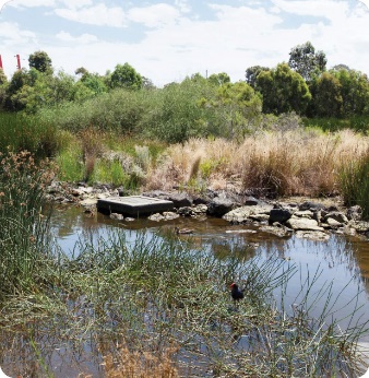
- 4. Wetland park providing flood storage and restoration of previously extant habitat
- 5. Bi-directional, separated cycling facility traversing length of former railway corridor and connected to shared paths
- 6. Public square and gathering point at intersection of Greenway Street and Railway Street
- 7. Eastwards extension of grand line of figs on Albert Street
Key for map
Surface treatment
|
Symbol |
Meaning |
|---|---|
 |
Carriageway |
 |
Parking (Permeable Paving) |
 |
Verge planting |
 |
Continuous footpath treatment |
 |
Union Street paving |
 |
Village Street paving |
 |
Emerging Industries paving |
 |
Civic Streets paving |
 |
Park edge paving |
 |
Existing/unchanged paving |
 |
Private property |
 |
Driveway |
 |
Separated cycleway |
Street Furniture
|
Symbol |
Meaning |
|---|---|
 |
Benches |
 |
Bin |
 |
Bicycle parking racks |
 |
Bollards |
 |
Interpretation Node |
Trees and associated elements
|
Symbol |
Meaning |
|---|---|
 |
Tree grate |
 |
Passively irrigated tree pits |
 |
Existing / proposed medium tree |
 |
Existing / proposed |
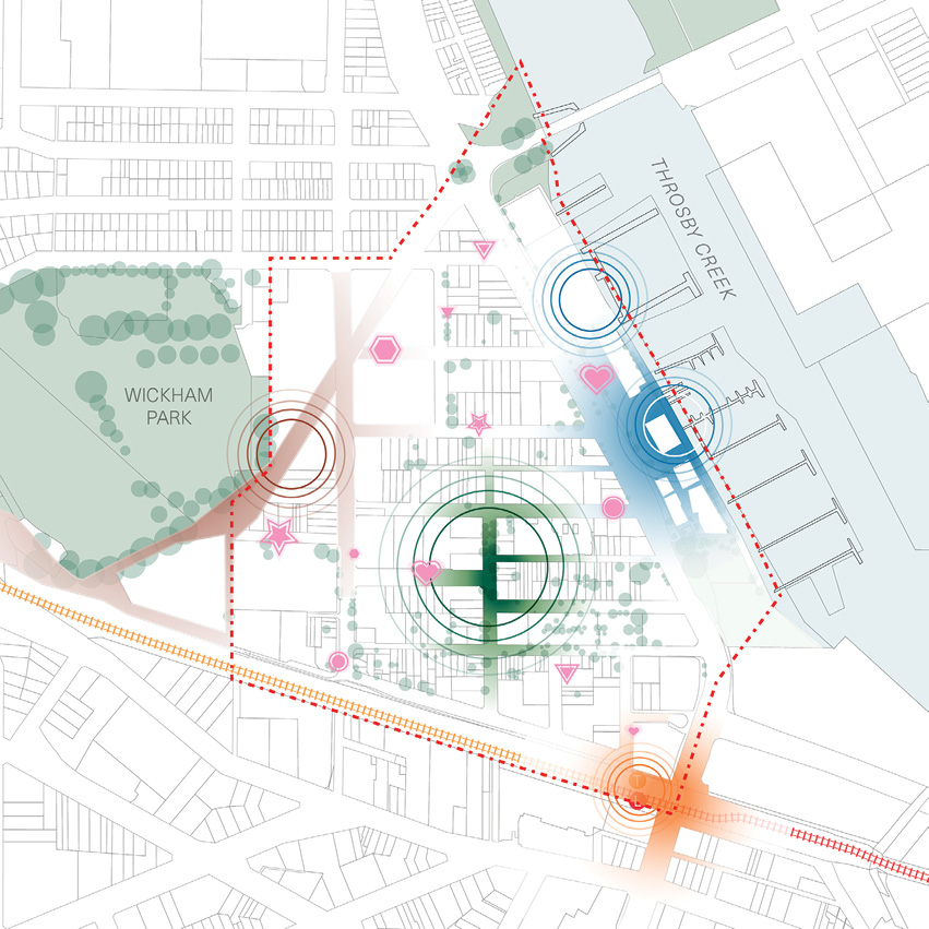
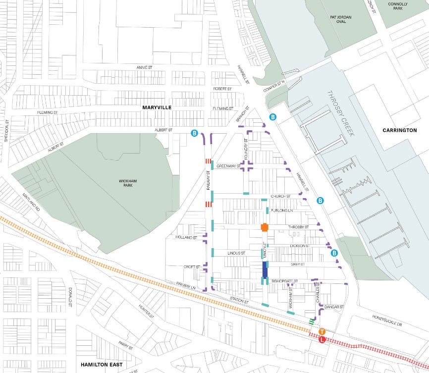
Wickham Concept Public Domain Plan: Options & Opportunities
Labels
- 1. The street art trail links together existing works of street art, mostly concentrated in the Emerging Industries, and could integrate new works
- 2. The European heritage trail links together heritage listed buildings, the Bullock Island Railway corridor, and heritage paving on Union Street
- 3. The Connecting with Country trail is a loop connecting Wickham Park to the Tree of Knowledge Park, celebrating Country, its stories, and the long history of its care in Wickham. Further input from knowledge holders and First Nations community members to guide development in detail.
Key for map
|
Symbol |
Meaning |
|---|---|
 |
Connecting with Country trail |
 |
European heritage trail |
 |
Street art trail |
 |
Public sculptures |
 |
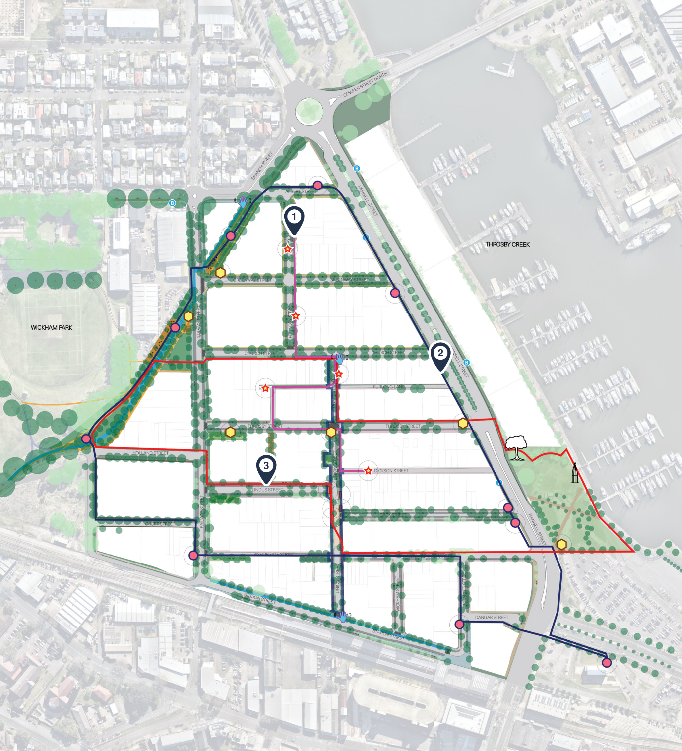
Yum Yum Tree (Tree of Knowledge) |
 |
Potential heritage panel, artefact, or artwork at existing European heritage site |
 |
Potential public art, footpath mural, or sculpture |
 |
Street art locations |
 |
Welcome node |
 |
Art bollards on Union Street |
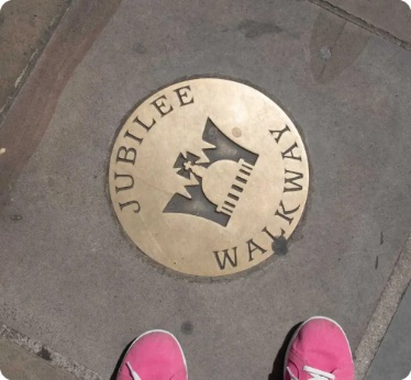
Trail Opportunities - Country; Art; Heritage + Queries for other opportunitiues/connections from public
Wickham Concept Public Domain Plan: Illustrative plan